

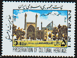
This vast downtown area linked by a series of of two-storeyed arcades, includes the Royal Mosque, the Mosque of Sheyx Lotfollah, the magnificient Portico of Qeyssariyeh, and the 15th century Timurid Palace. The area was built by Shah Abbas I the Great at the beginning of the 17th century.
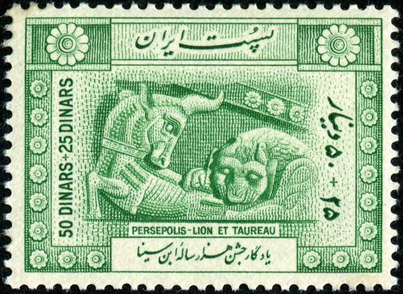
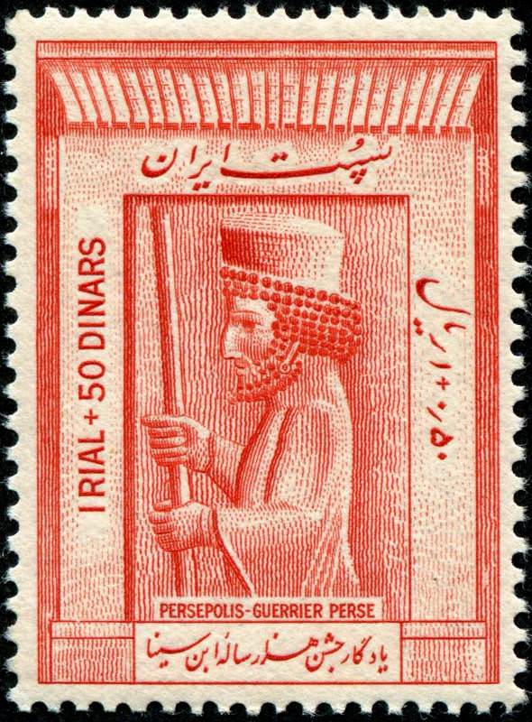
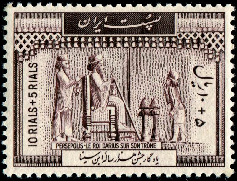
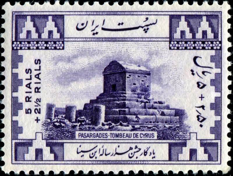
Pasargadae was the first dynastic capital of the Achaemenid Empire, founded by Cyrus II, the Great, in Pars, homeland of the Persians, in the 6th century BC.

The mausoleum of Oljaytu was constructed in 1302-12 in the city of Soltaniyeh, the capital of the Ilkhanid dynasty, which was founded by the Mongols.
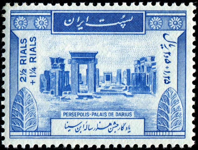
Site of the most famous royal proclamation carved by Darius I on the great cliff known as "Mountain of the Gods" which celebrates various of his victories including his defeat over Gaumata, pretender to the throne.
Site includes three monastic ensembles in the north-west of the country: St Thaddeus, St Stepanos, and the Chapel of Dzordzor. The oldest, St Thaddeus, dates back to the 7th century.
The hydraulic system created two main diversion canals on the river Karun and can be traced back to Darius the Great in the 5th century B.C. One canal is still in use providing water to the city of Shushtar via a series of tunnels that supply water to mills.
The Persian Garden comprises nine gardens from different epochs and climates. They derive from the Chahar Bagh model, which dates back to the 6th Century BC. The designated gardens are:
Links:
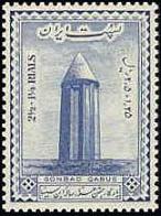
Built as a tomb for Qabus Ibn Voshmgir in 1006, the 53 m high tower is visible from great distances in the surrounding lowlands. The tower is the only remaining evidence of Jorjan, a former centre of arts and science that was destroyed during the Mongols' invasion in the 14th and 15th centuries.
Masjed-e Jame' is the oldest Friday (congregational) mosque in Iran.
The oldest of the historic monuments in Tehran the Golestan Palace (The Rose Garden Palace) belongs to a group of royal buildings that were once enclosed within the walls of Tehran's Historic Arg (citadel).
Meaning "Burnt City", Shahr-i Sokhta is located at the junction of Bronze Age trade routes crossing the Iranian plateau.
Semi-arid area in a valley with semi-nomadic agro-pastoralists.
A group of Archaeological mounds containing several layers of superimposed urban settlements from the 5th millennium BC to the 13th century AD.Cult
The Persian Qanat is an ancient underground water mangement system used for irrigation in a desert climate. The system was communally managed with the use of water clocks.
** This serial site covers 11 still functioning qanats in central and eastern Iran: Akbar Abad (29.089, 58.398); Ebrahim Abad Qanat (34.178, 50.024); Ghasem Abad (29.090, 58.398); Hasam Abad-e Moshir Qanat (31.573, 54.445); Mozd Abad Qanat (33.448, 51.171); Qanat of Baladeh (36.199, 51.805); Qanat of Gowhariz (30.056, 57.118); Qanat of the Moon (33.379, 52.375); Qanat of Vazvan (33.419, 51.181); Qanat of Zarch (31.989, 54.234); Qasabeh Gonabad (34.290, 58.654)
The Lut Desert in the southeast of Iran contains spectacular landforms shaped by wind erosion. This salt desert also is known as the hottest place on earth: temperatures of over 70 degrees Celsius have been measured. The landscape is "hyper-arid," seeing very little rain because it lies in a basin surrounded by mountains.
Eight archaeological sites situated in three geographical parts in the southeast of Fars Province: Firuzabad, Bishapur and Sarvestan. These fortified structures, palaces, and city plans date back to the earliest and latest times of the Sassanian Empire, which stretched across the region from 224 to 658 CE.
The history of these broad-leaved forests dates back 25 to 50 million years, when they covered most of this Northern Temperate region. These ancient forest areas retreated during the Quaternary glaciations and then expanded again as the climate became milder.
The remote and mountainous landscape of Hawraman/Uramanat bears testimony to the traditional culture of the Hawrami people, an agropastoral Kurdish tribe that has inhabited the region since about 3000 BC.
Last updated: July 24, 2025