Wolves and Birds and Bears, Oh My: Yellowstone and Beyond


Yellowstone and Beyond 2013 Photos


by

John and Lynn Salmon -- May 2013

ARRIVAL in BOZEMAN (Saturday, May 11)

We barely had time to turn around after our recent trip to Iceland and now we're off again to Montana and its neighbors. We're going for a mixed bag of touring with a Saw Mill River Audubon Group for a week in Yellowstone, followed by a couple of weeks of driving around on our own and getting in adventures - like Caine in Kung Fu.

After an early morning departure from White Plains Airport with just enough time for pizza during our plane change in Chicago we arrive very tired in Bozeman around 1pm. The friendly woman working at the Hertz counter recommended her favorite eating place, 
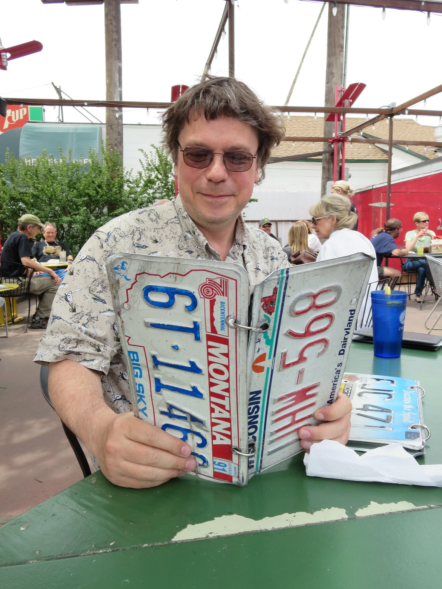
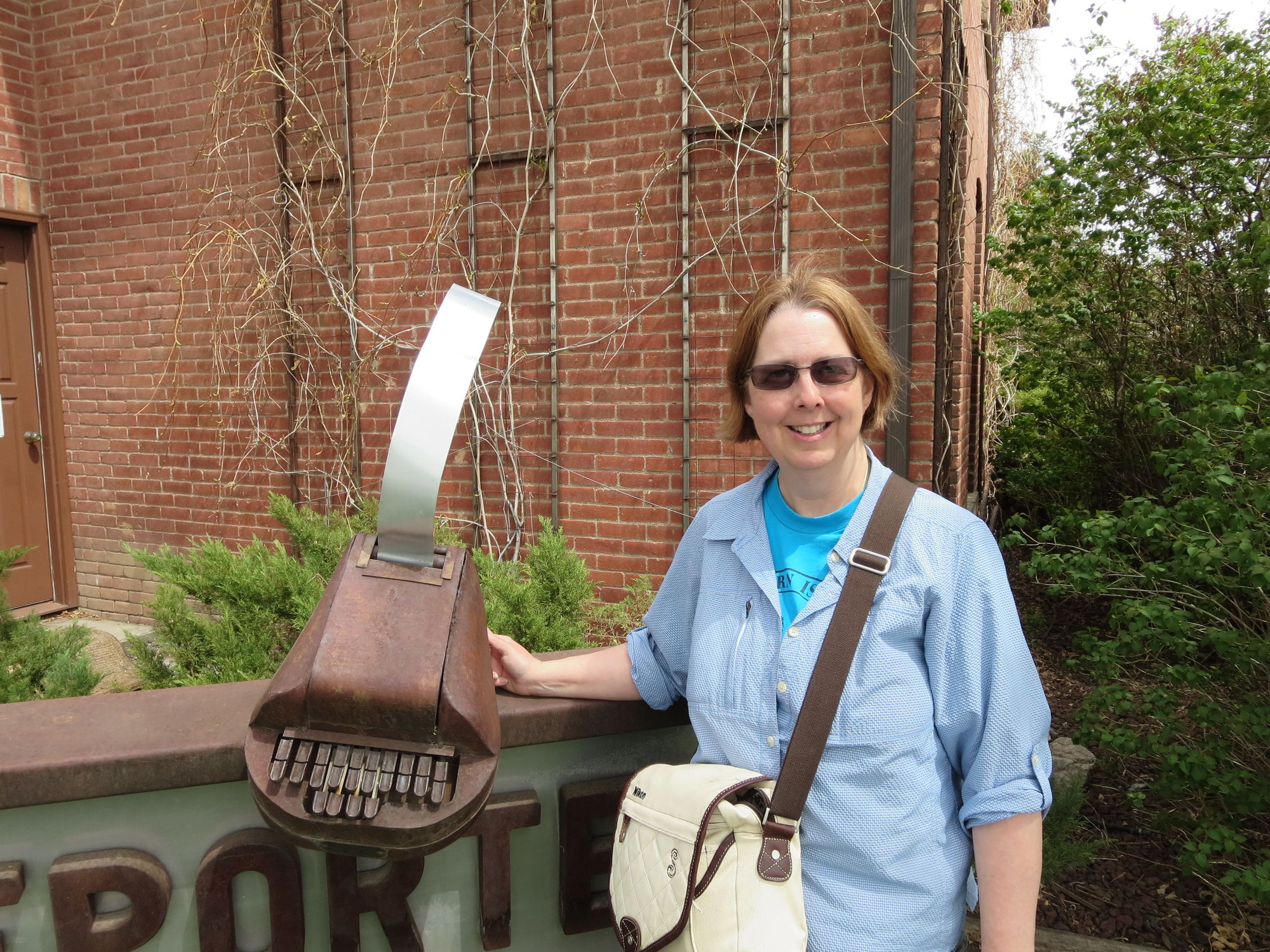
and we head into downtown Bozeman for lunch. The Western Cafe looks to be closing up as we arrive (they're only open till 2pm) so we eat next door at The Garage. The place is absolutely packed with diners. It has a comfortable outdoor patio and cute menus sandwiched between automobile license plates. The burgers weren't bad either.

After lunch, we find a geocache, our first one in Montana, then head to our hotel for a nap. 
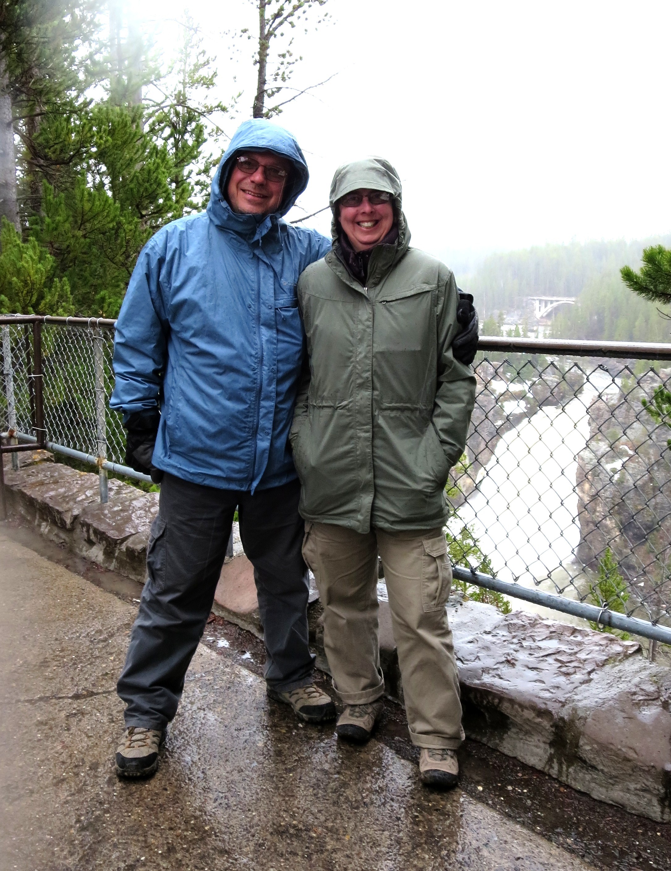
Travel logistics dictated that we arrive a day before our Audubon trip started, and we're happy to take it easy for a day. Later that evening, we take a walk around the area near our hotel, get some food, 
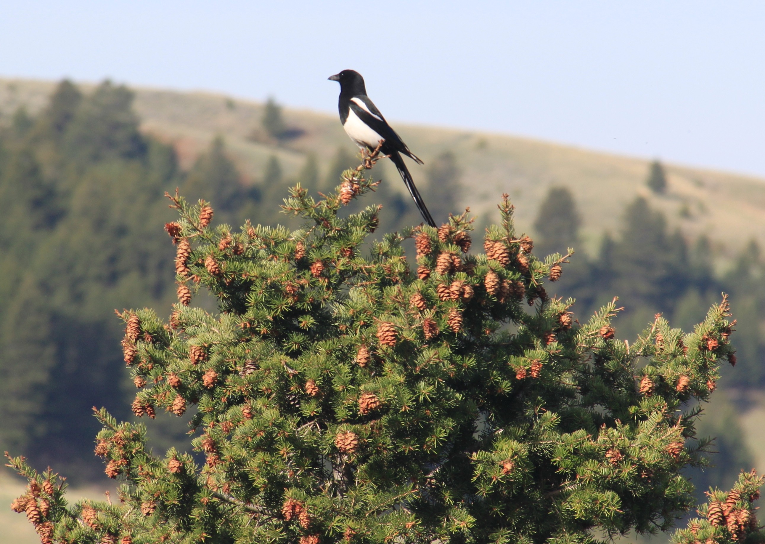
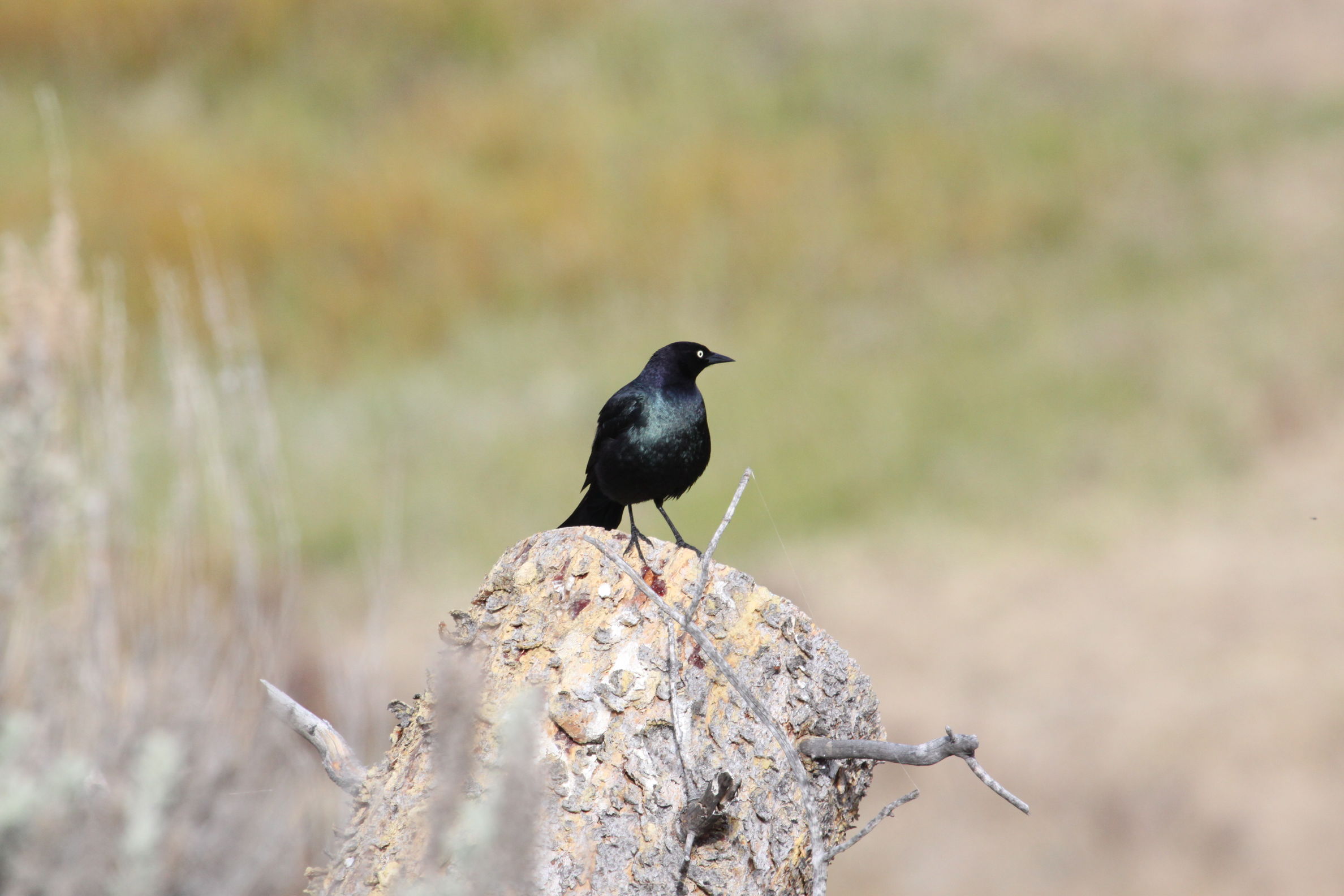
find a couple more geocaches, and see 
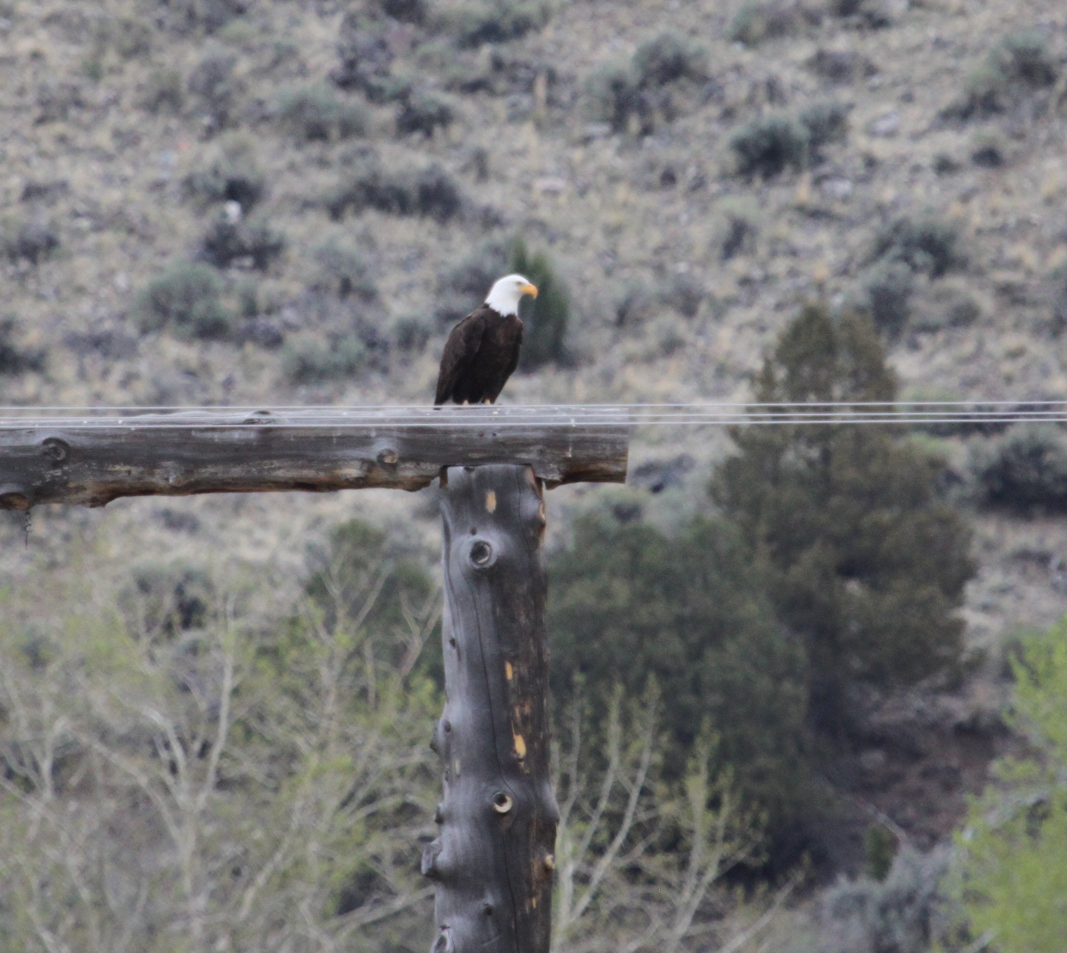
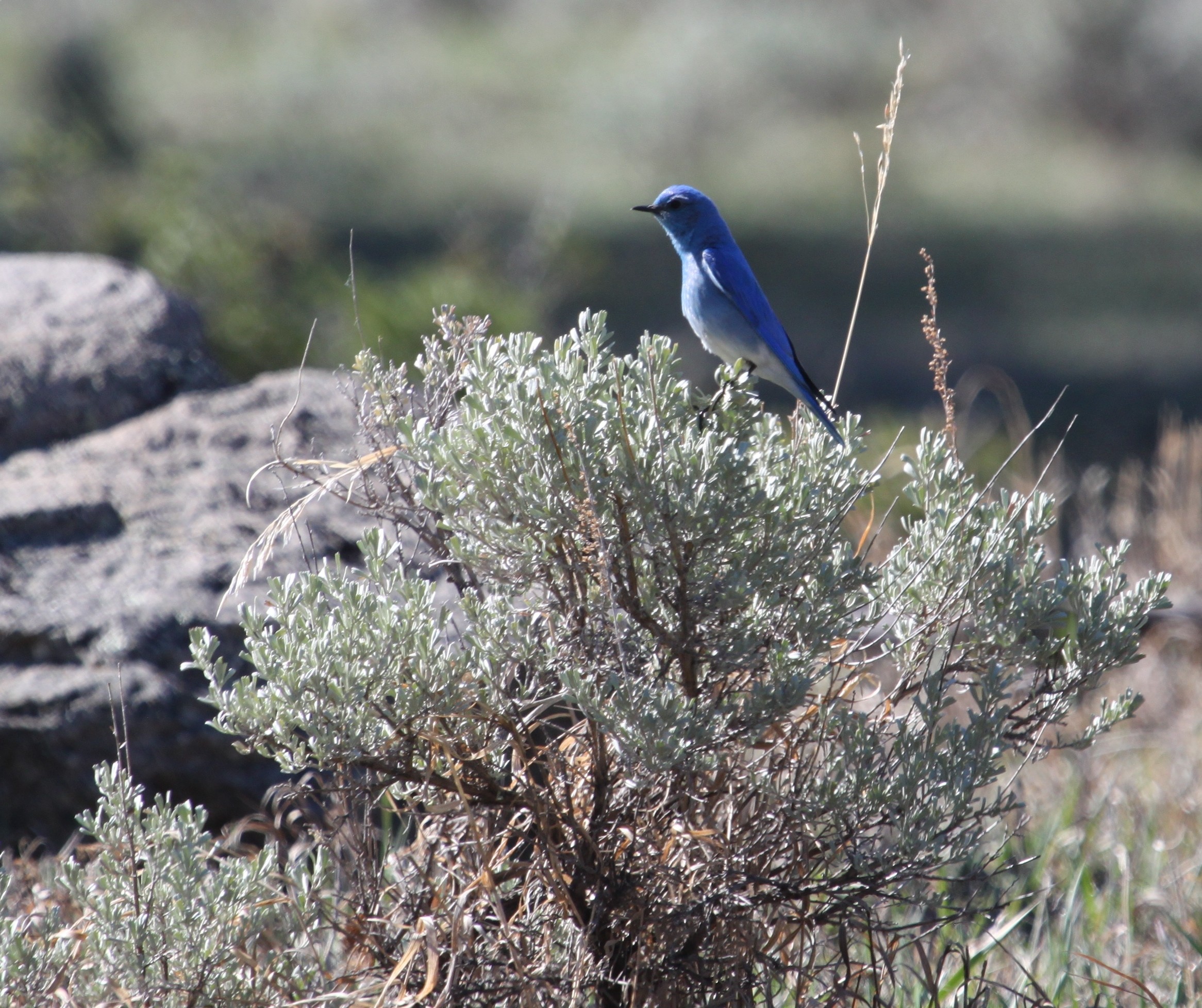
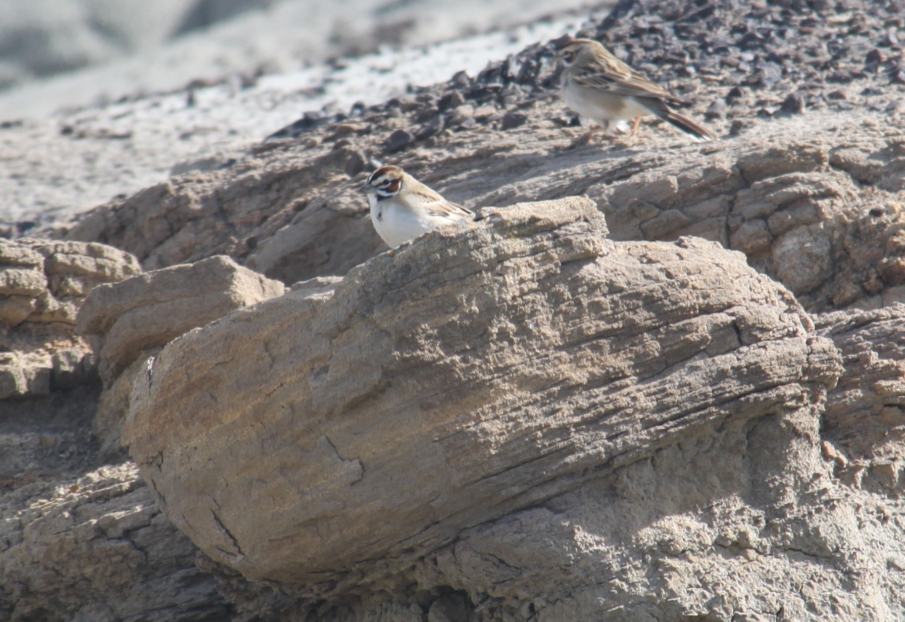
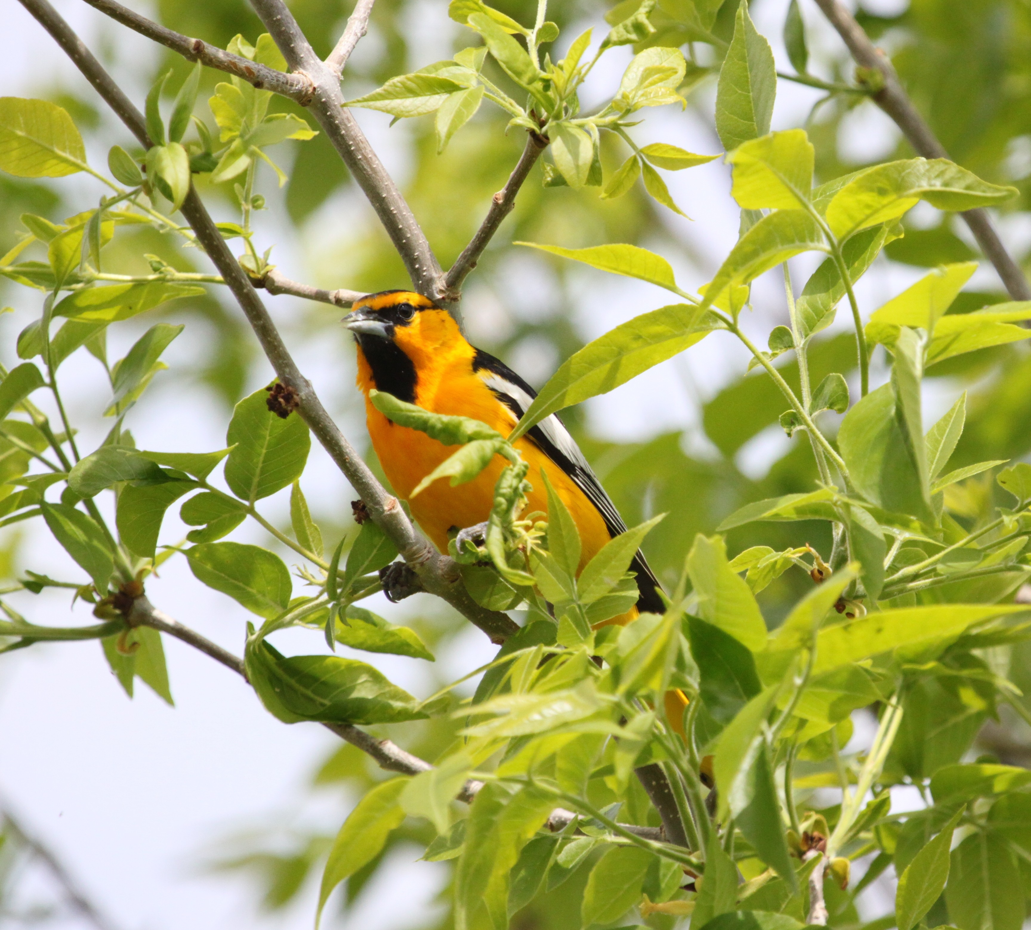
our first new bird of the trip, a Black-billed Magpie, Pica hudsonia. We see plenty more magpies during the rest of the trip, and ultimately add 63 new species to our bird list.

BOZEMAN (Sunday, May 12)

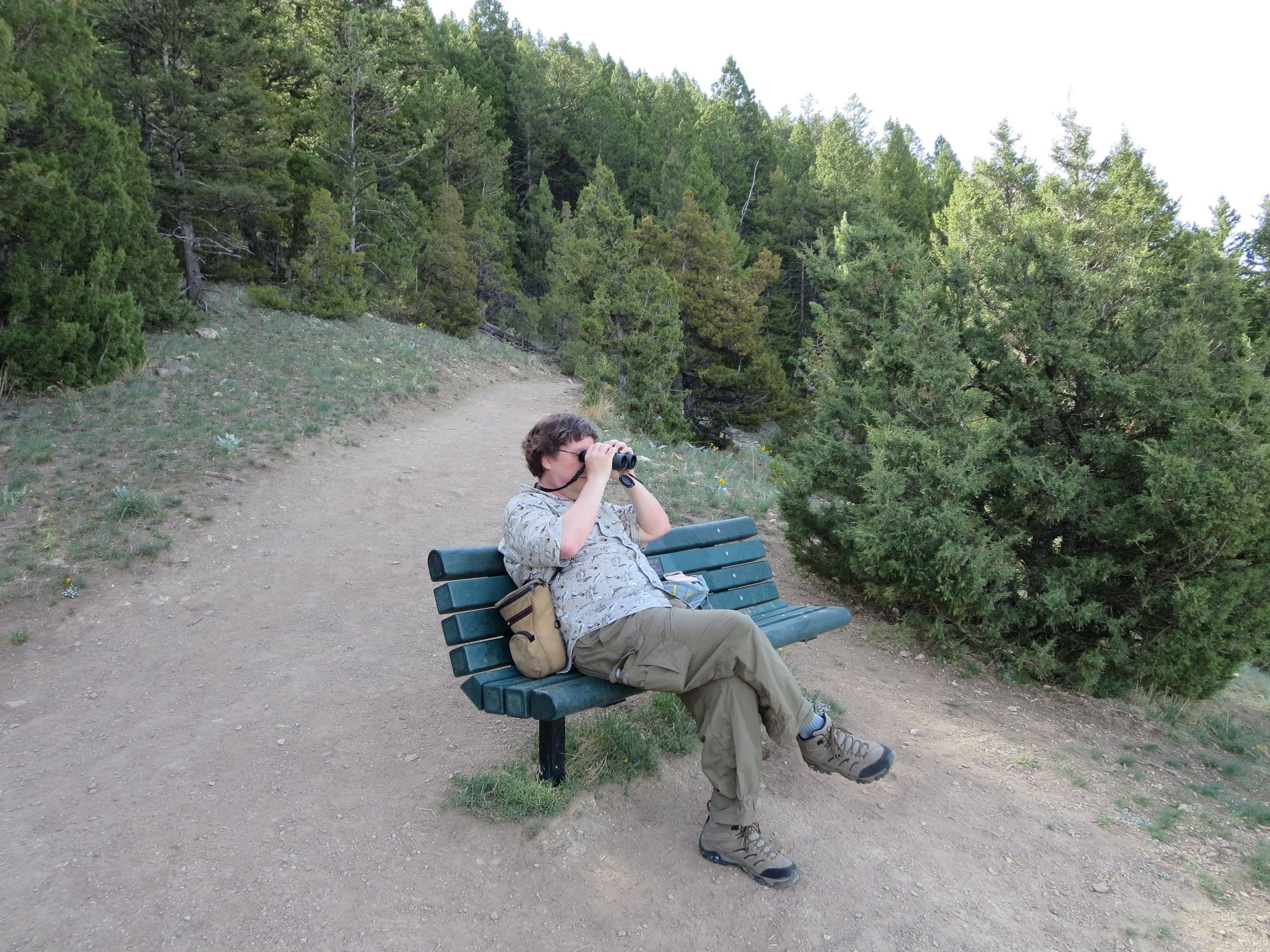
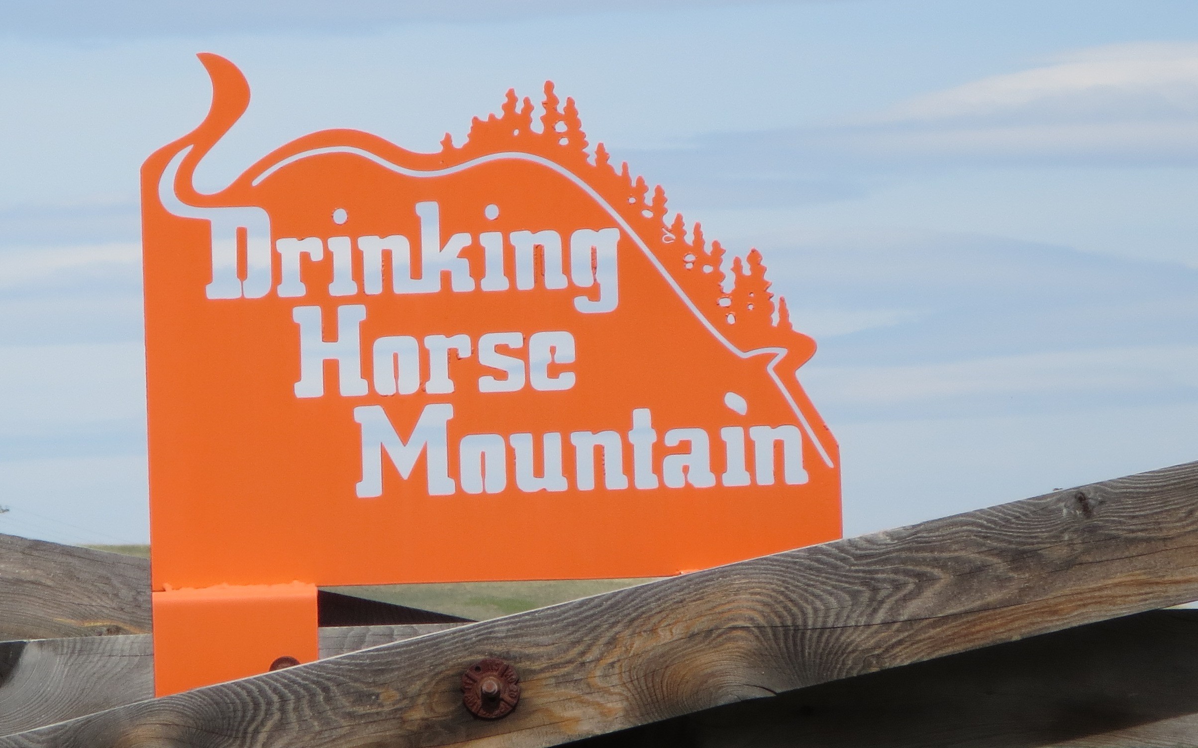
We woke up early feeling refreshed and decided to do a 2.4 mile loop hike on Drinking Horse Mountain Trail (trail map) located only 5 miles from downtown Bozeman. 
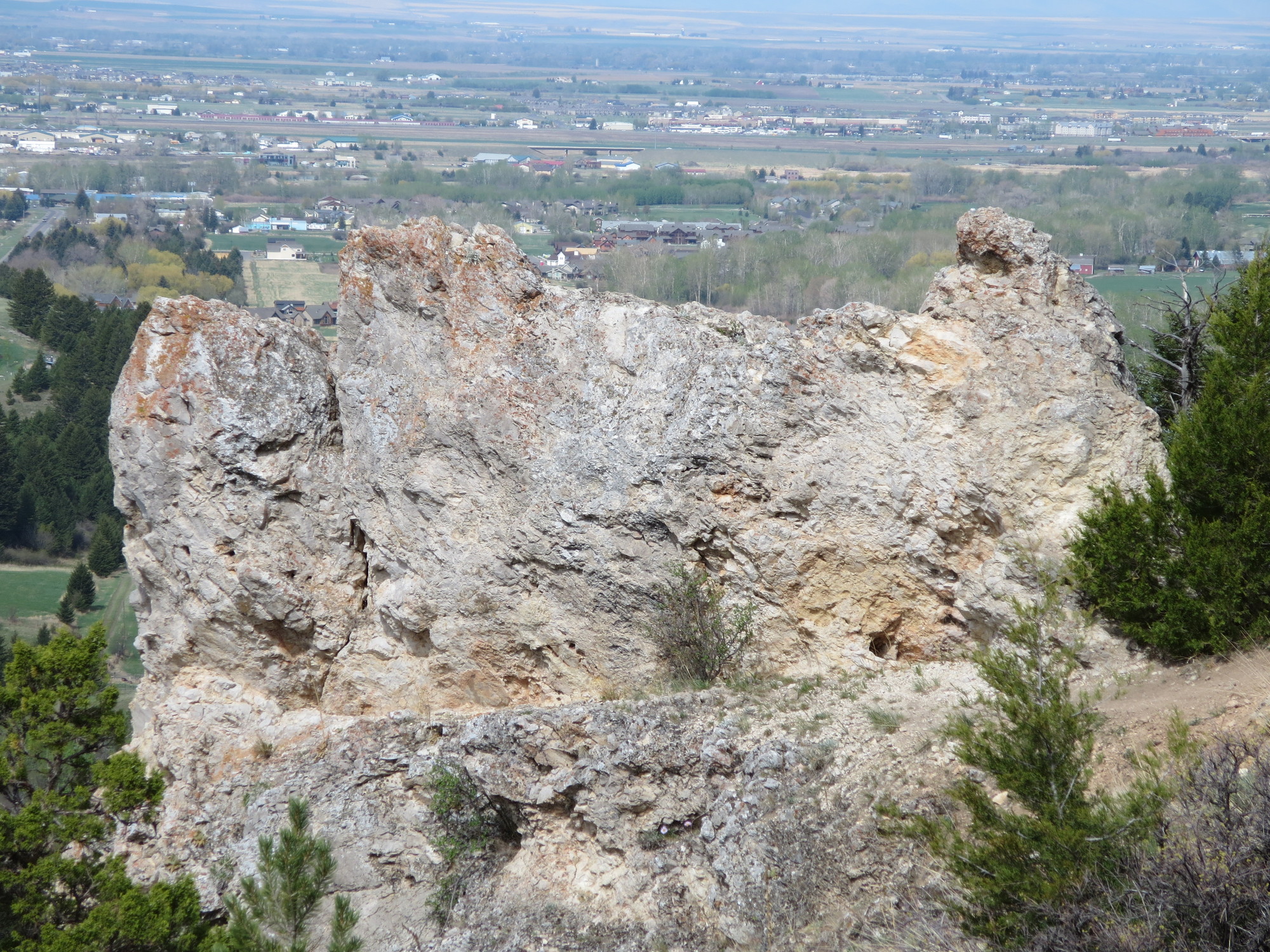
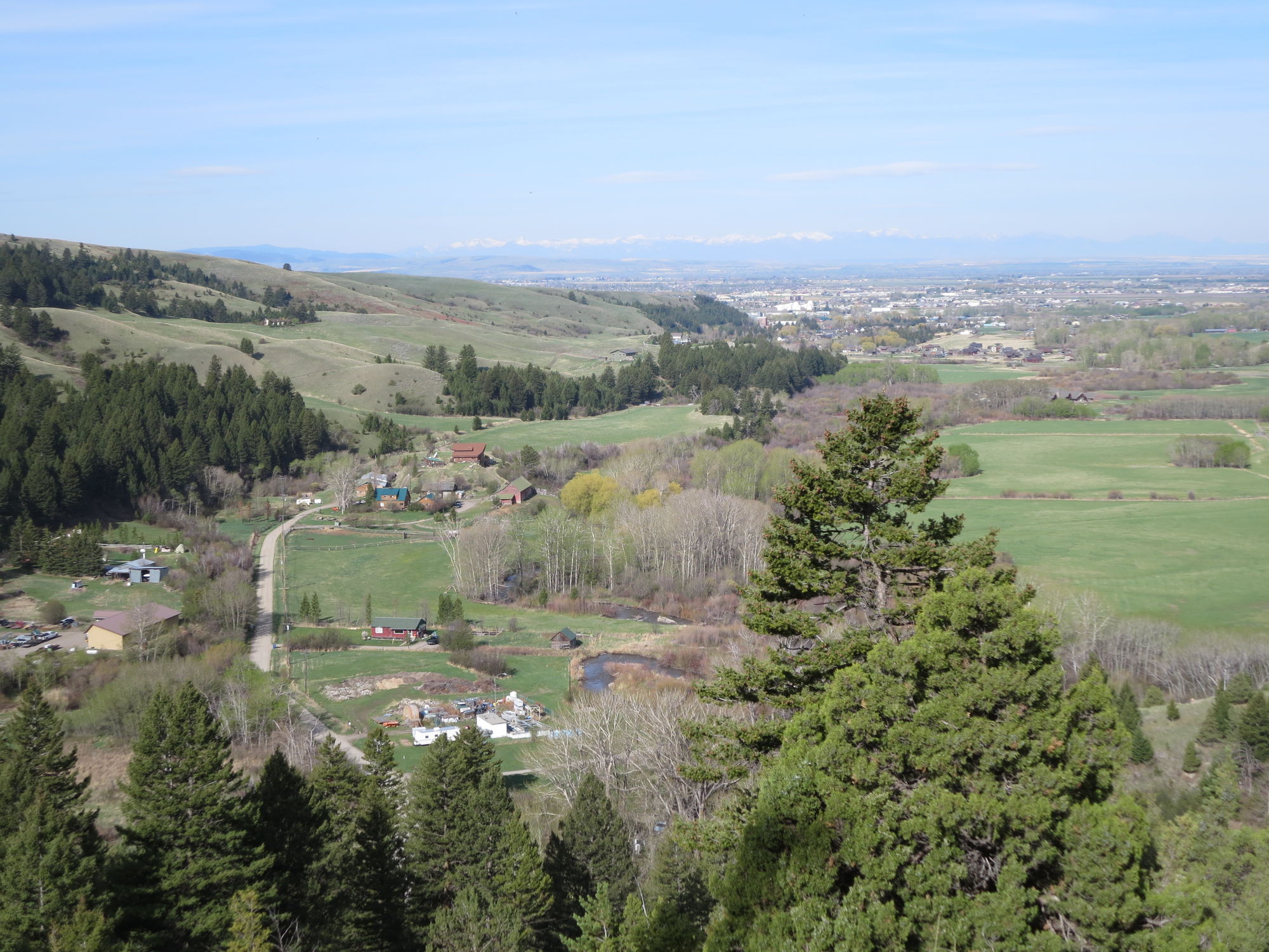
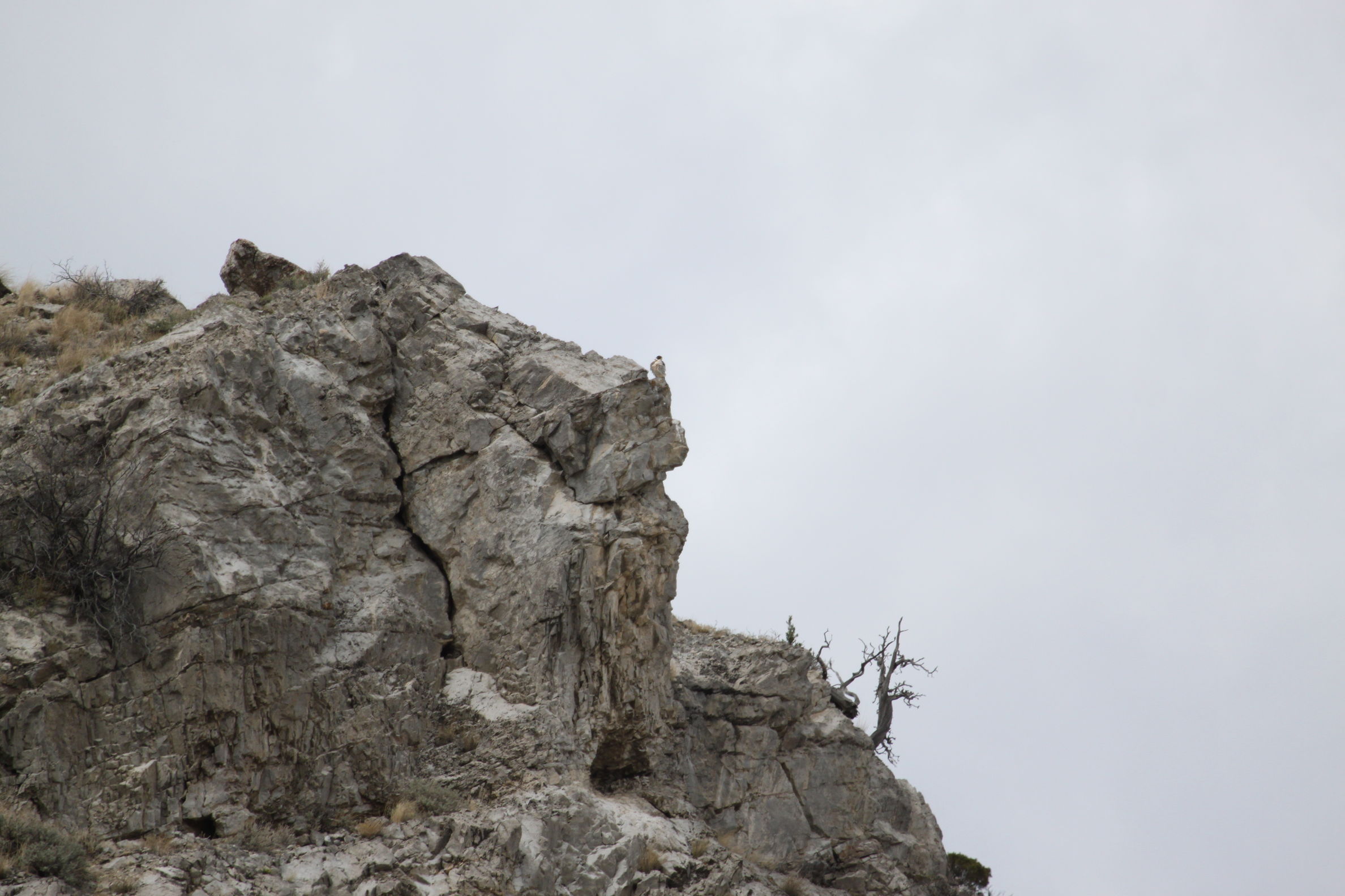
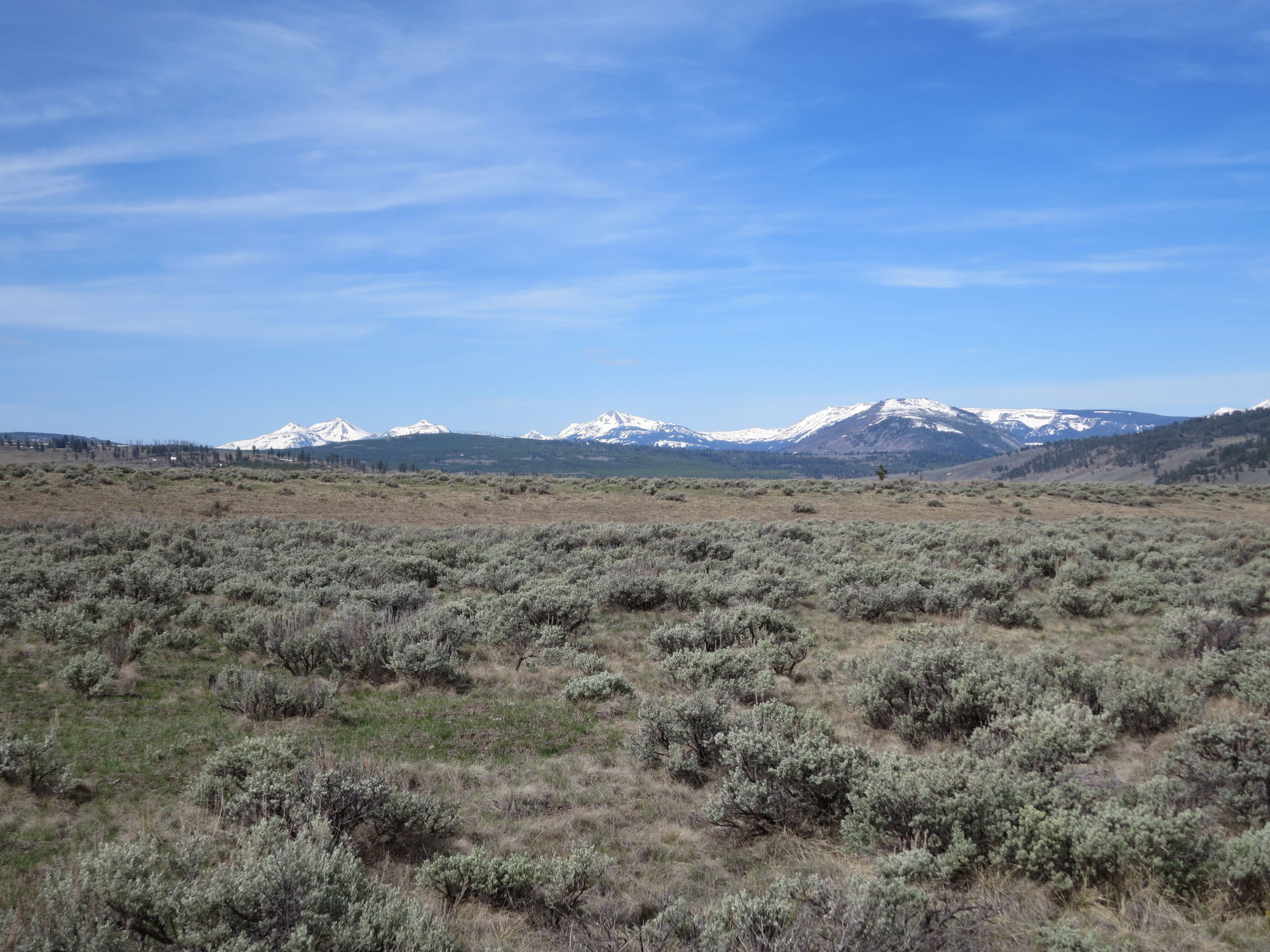
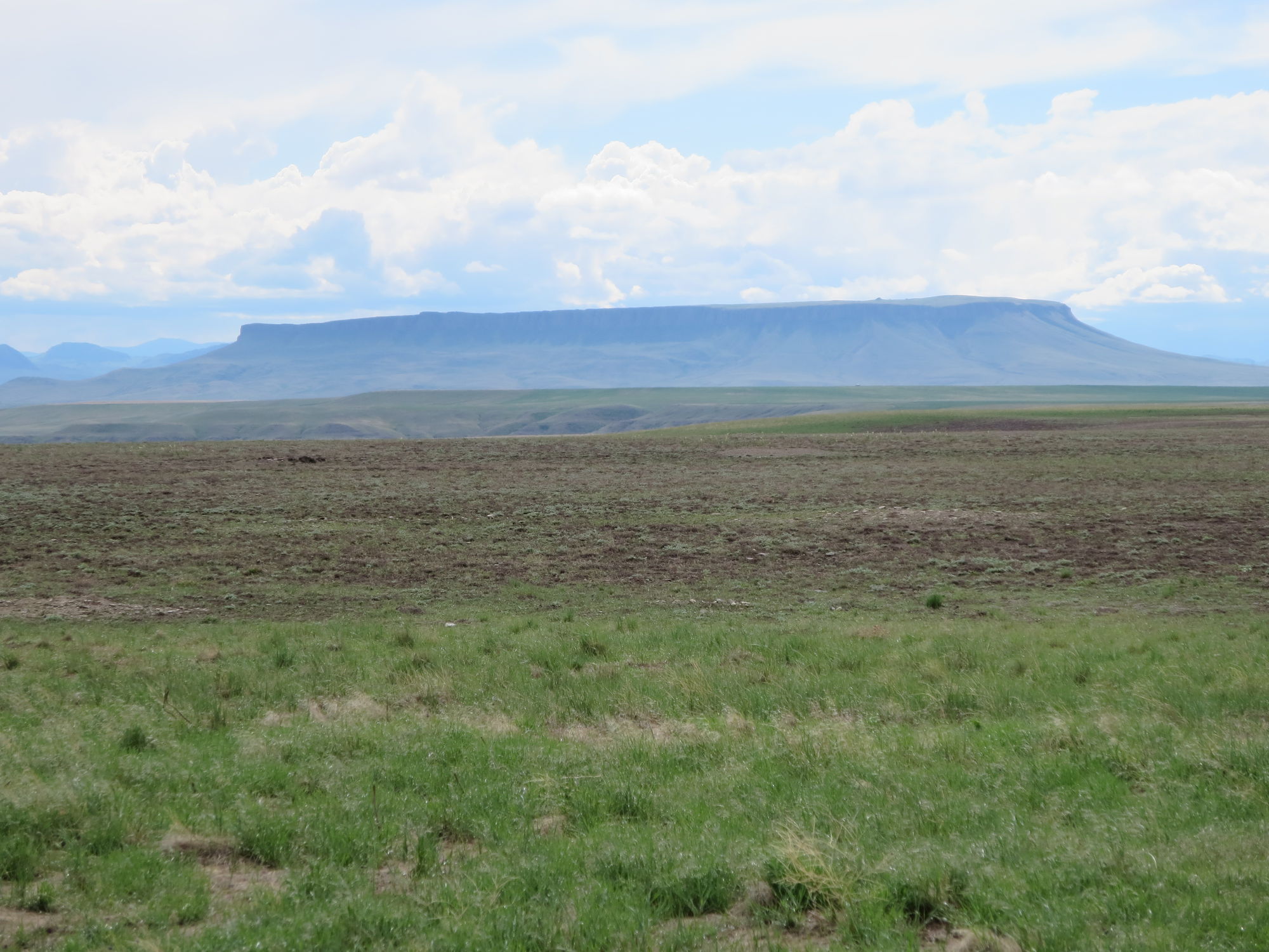
The walk begins under the shade of cottonwood and dogwood trees 
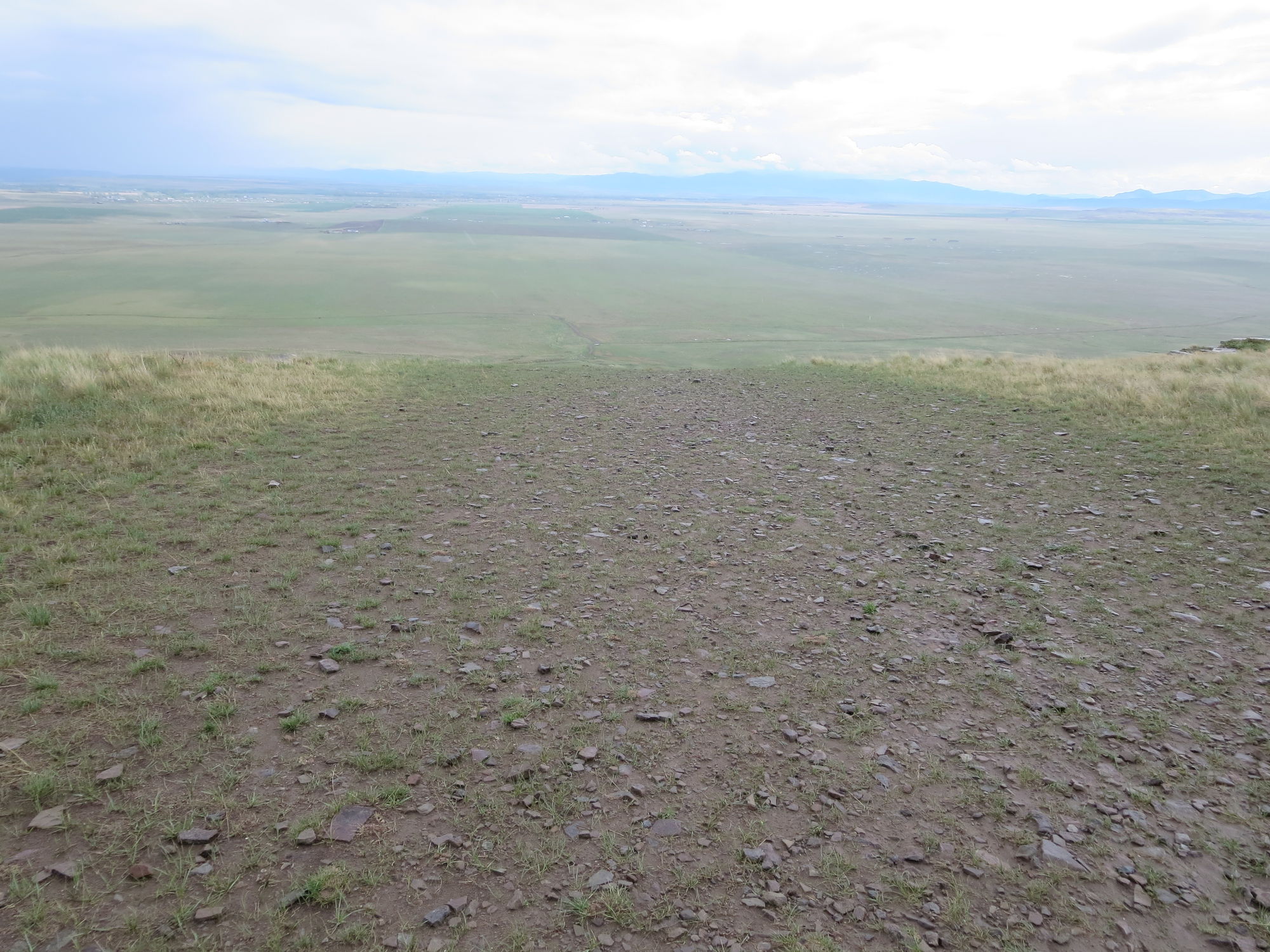
along Bridger Creek and heads up to rocky outcrops with good views of the 
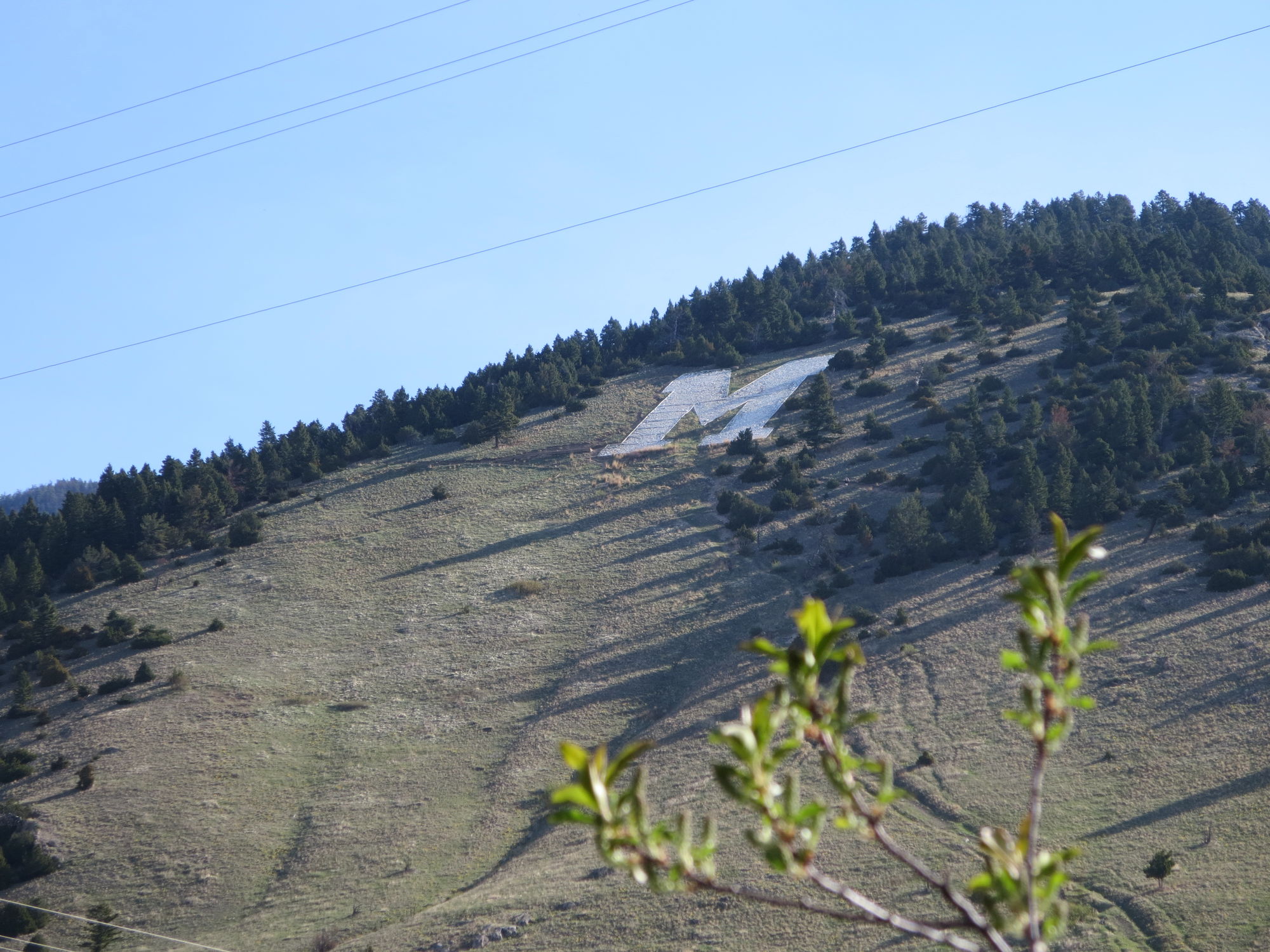
surrounding Gallatin Valley. We can see the big "M" for Montana State University on the side of the neighboring mountain. The Bozeman Fish Technology Center and Hatchery is in the same area, but was not open on Sunday.

There were heaps of other people out enjoying the trail, most of them with a dog or two. The weather was perfect, and it was also mother's day, which may have increased the numbers. We met a nice family near the picnic table at the summit who invited us to sit.
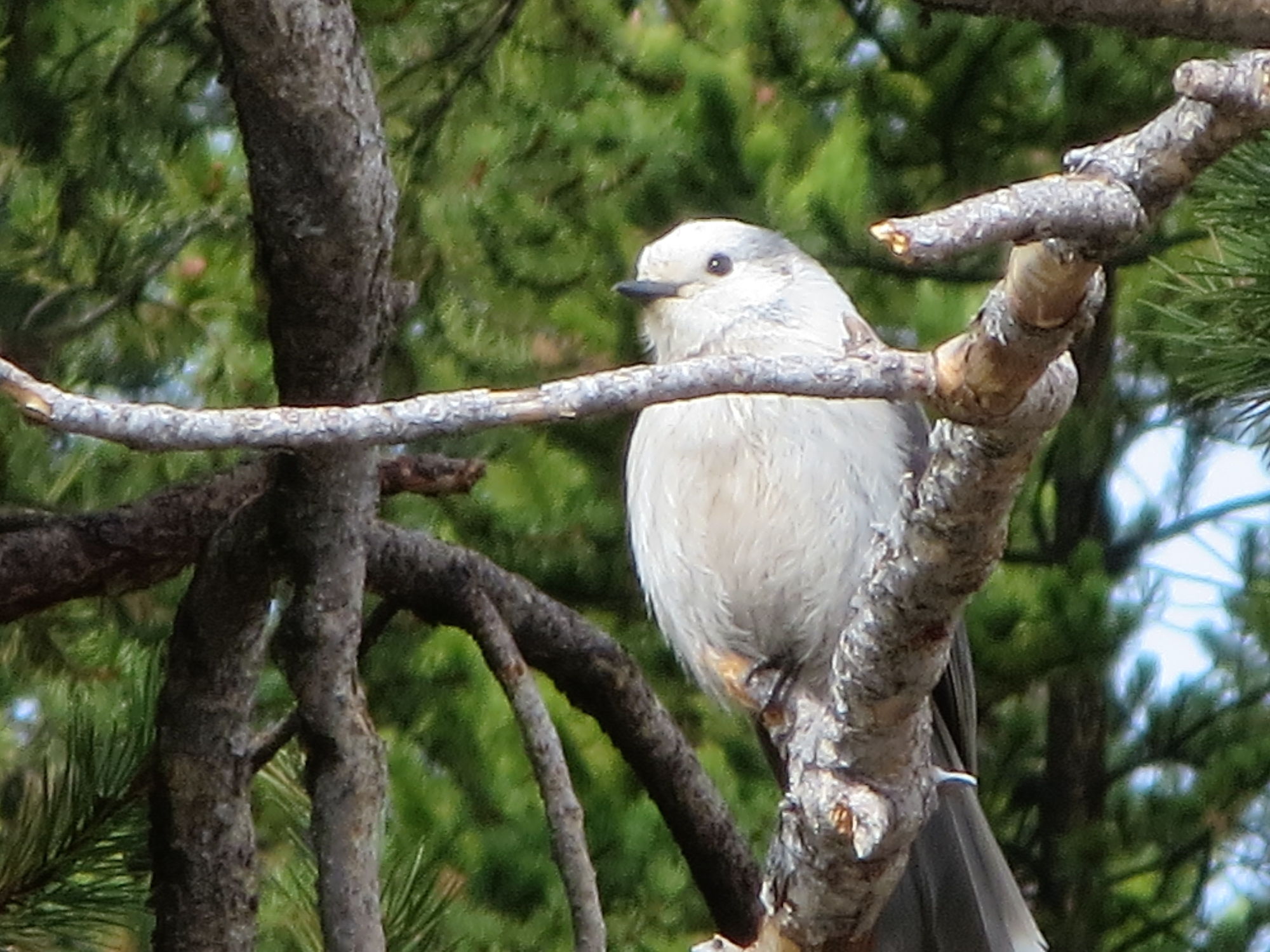
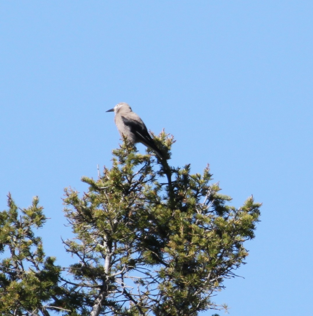
 They identified a bird singing on an overhead branch as a Townsend's Solitaire, Myadestes townsendi, another new bird for our list. We also saw a lot more black-billed magpies, some chickadees, and plenty of robins. The Thirsty Horses geocache was a few steps away from the summit, and I made a quick detour for it before we continued down and around the loop.

Today, we stopped at the Western Cafe for lunch and then headed back to the Bozeman Airport for the start of the trip we signed up for last August. The trip offered by the Saw Mill River Audubon is called, 
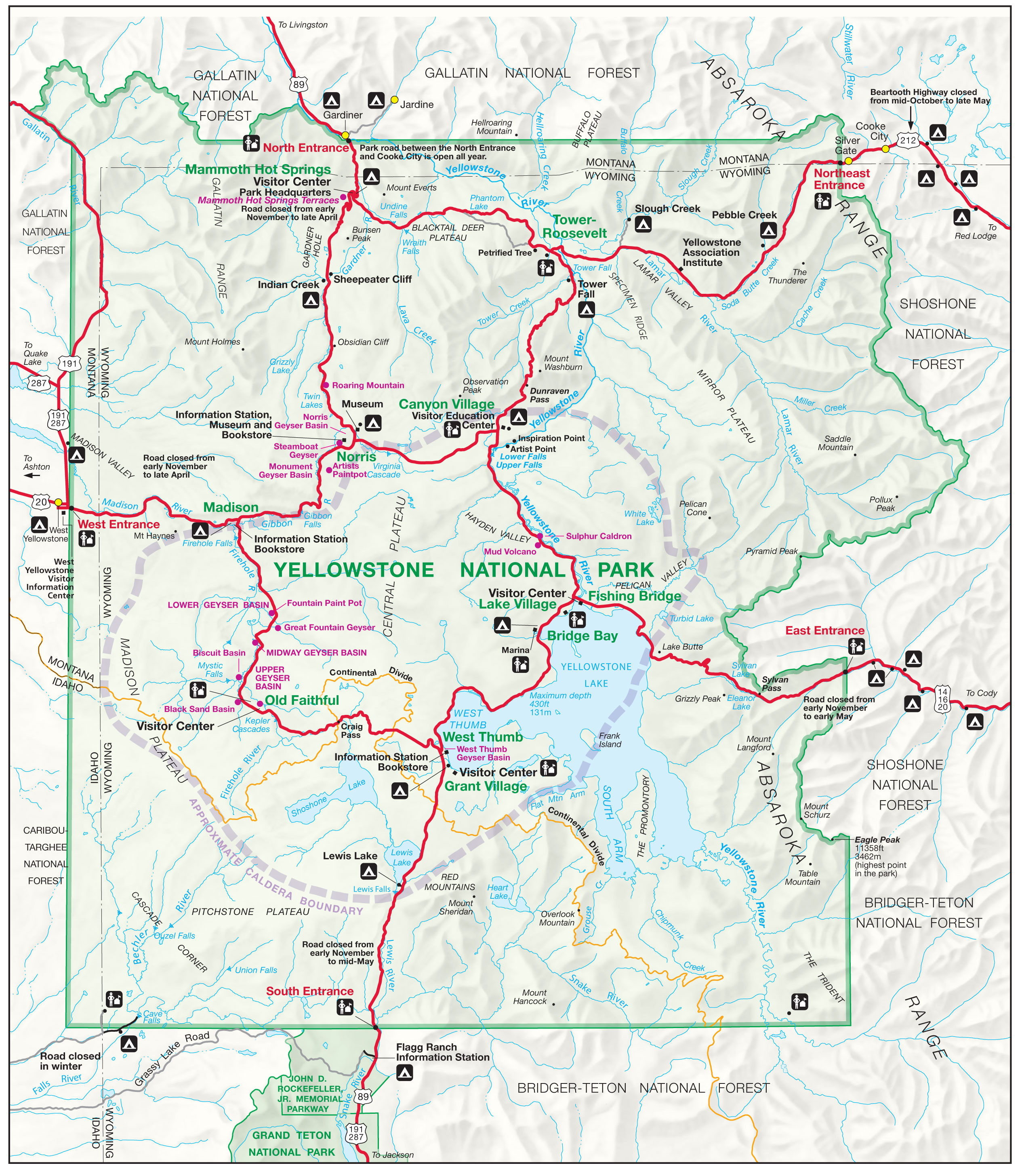
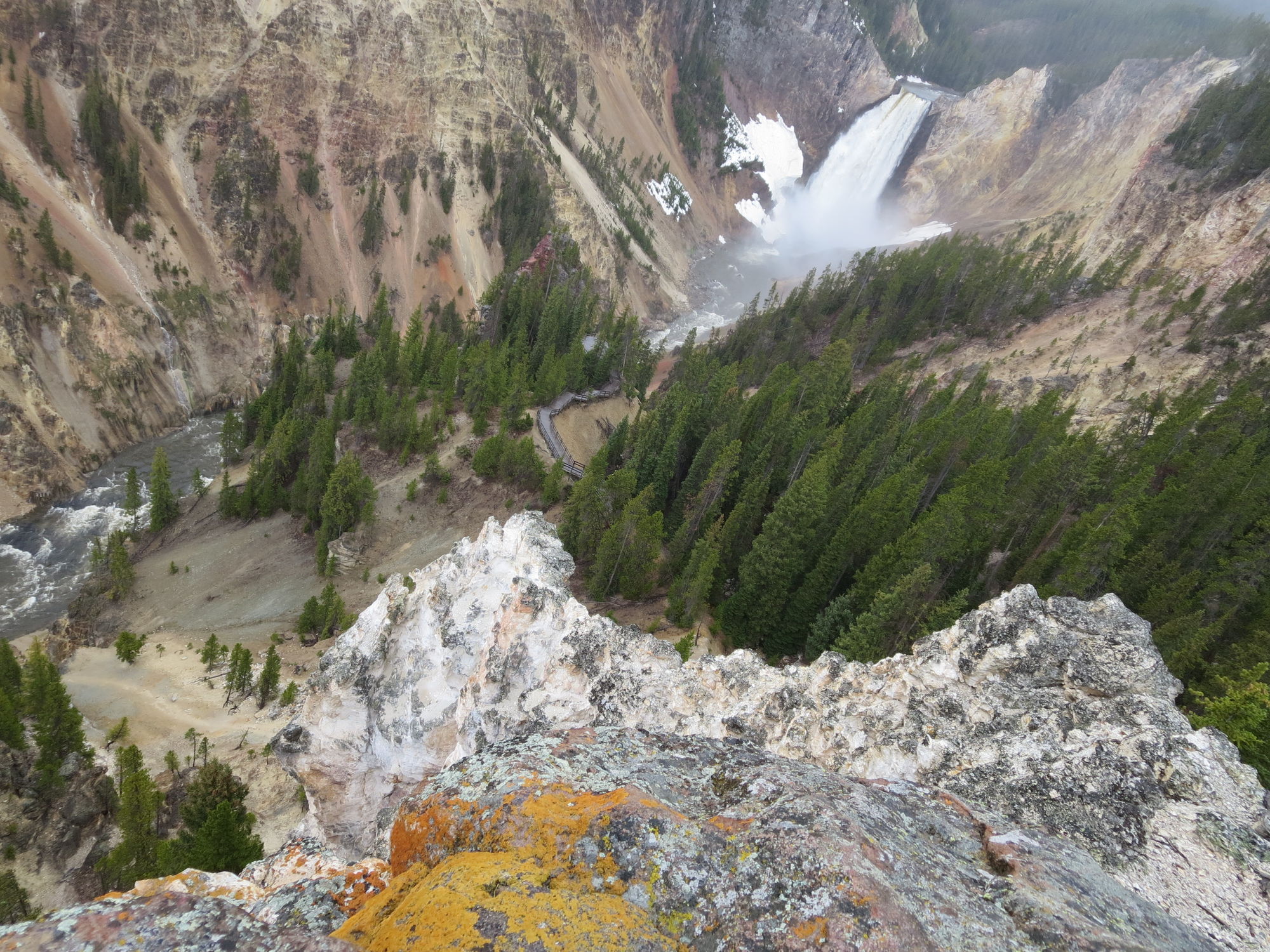
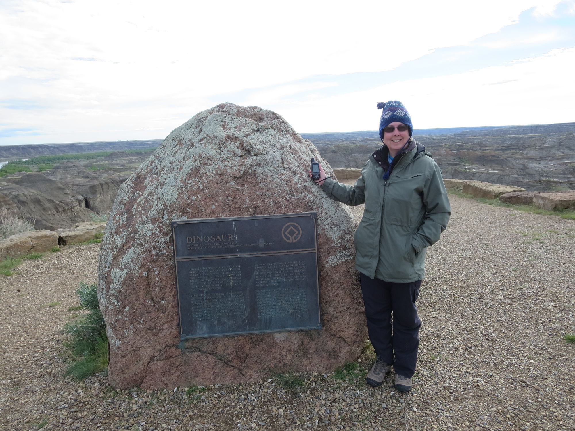
"Yellowstone Wolves & More." For some time we have wanted to go to Yellowstone, a World Heritage Site, visit our friend Tom who lives in Montana, and the trip dates included our 30th wedding anniversary, so how could we say no.

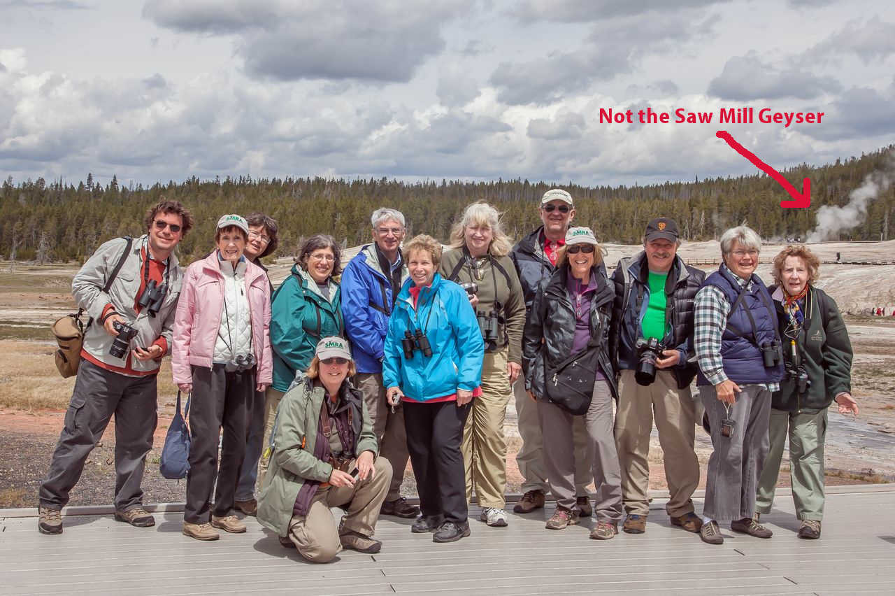
At the airport, we met our group of 11 other people with varying ties to the Saw Mill River Audubon and were joined for the afternoon by local guide, John Parker, from the Sacajawea Audubon and headed off 30 min north of BZN in 3 rental cars for some afternoon birding.

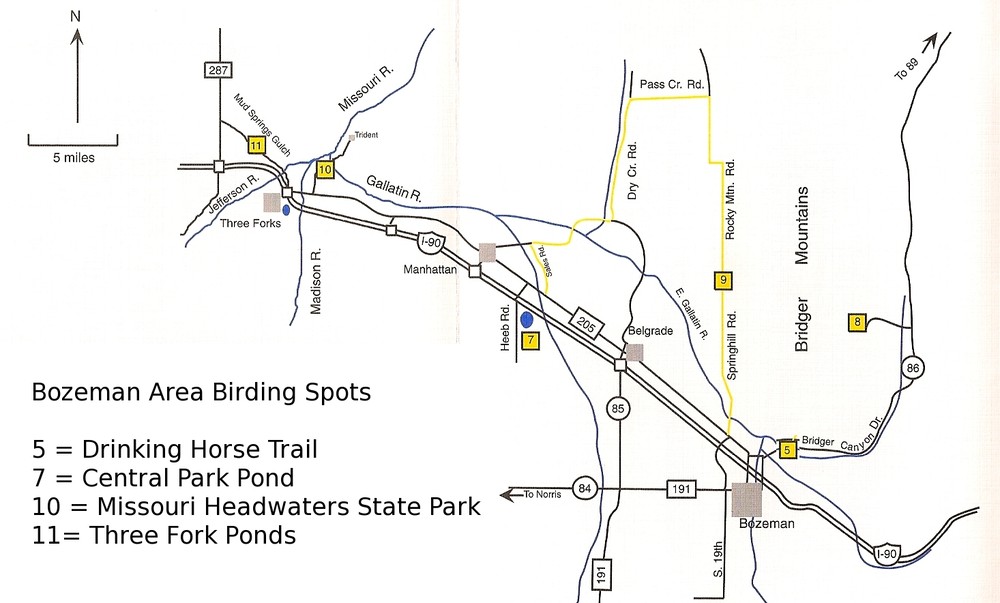
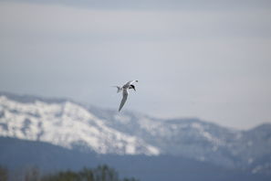
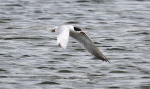
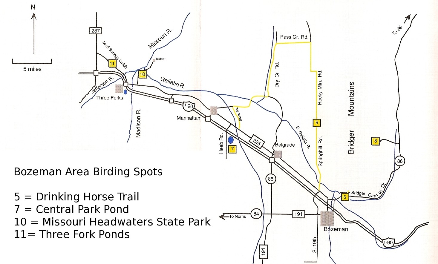
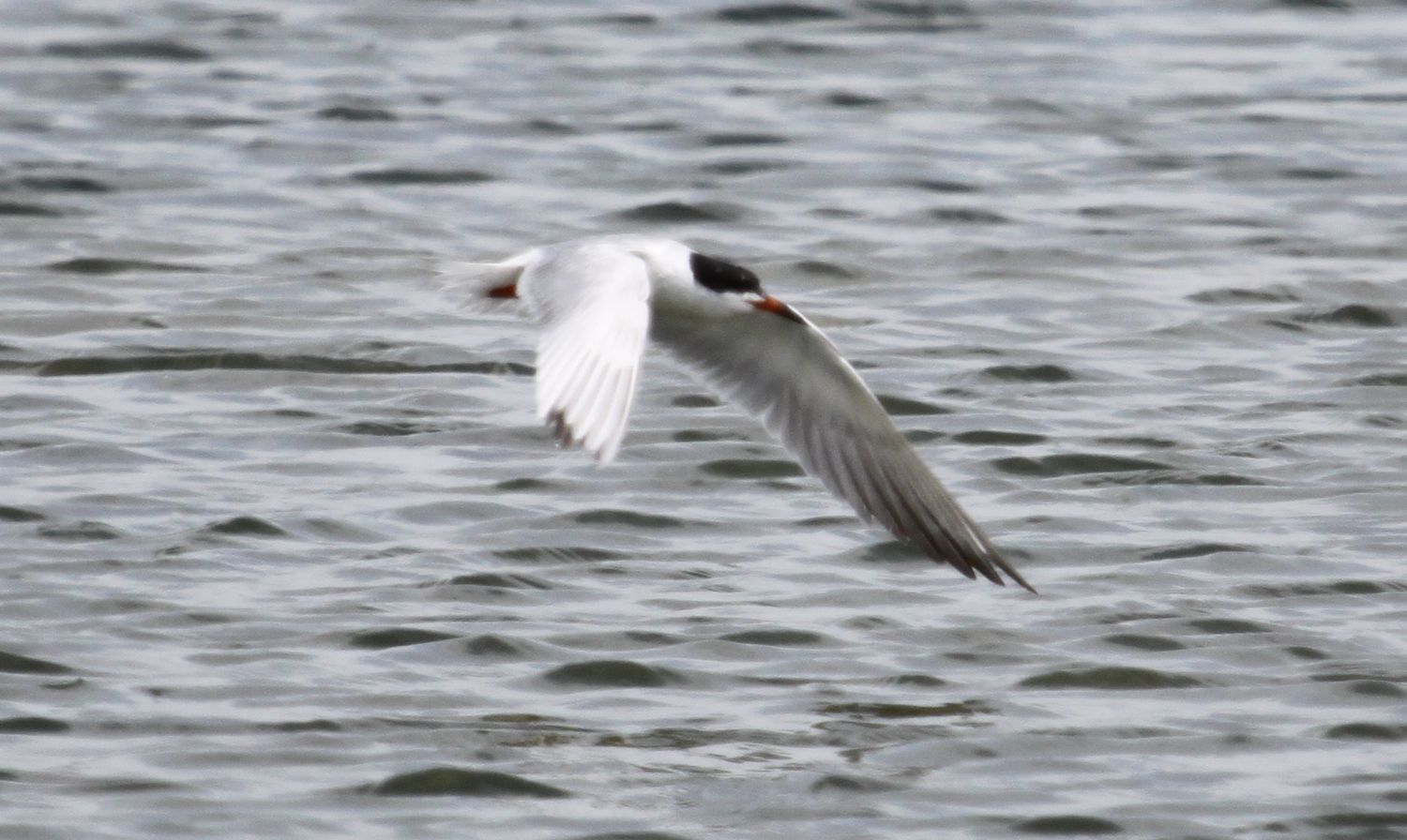
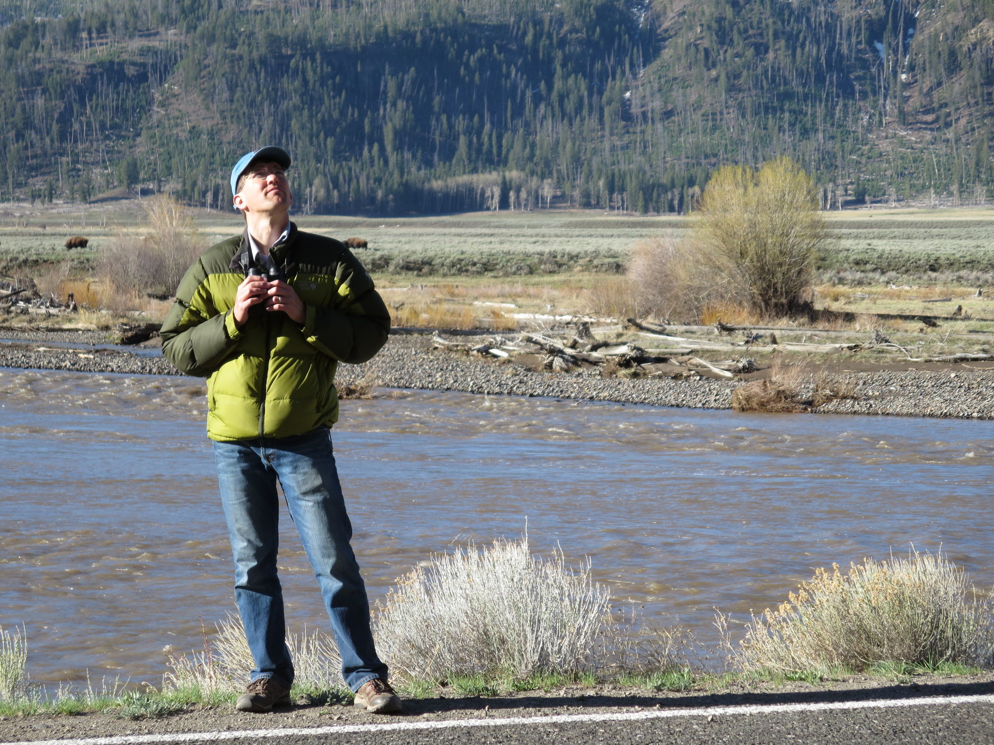
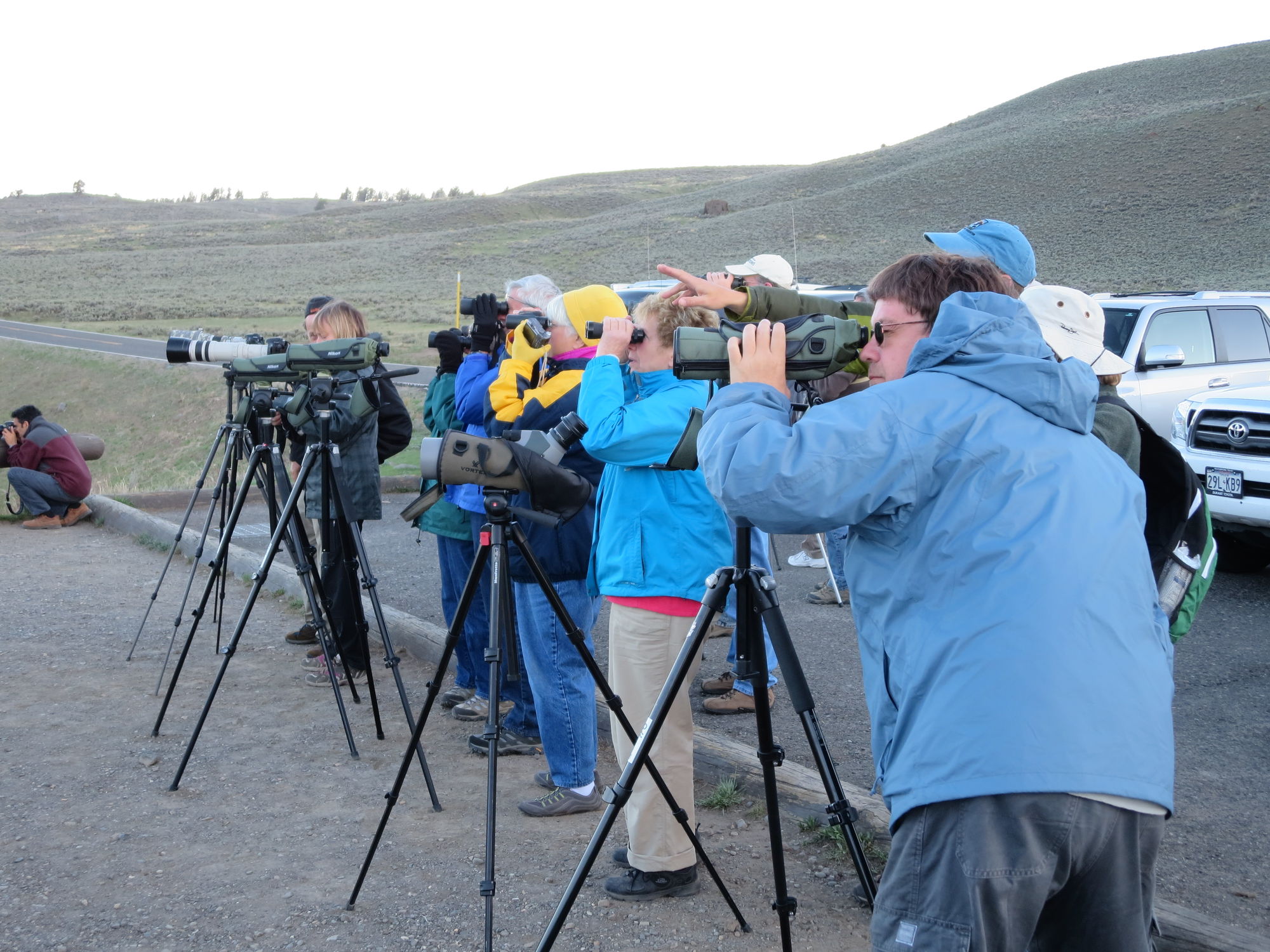
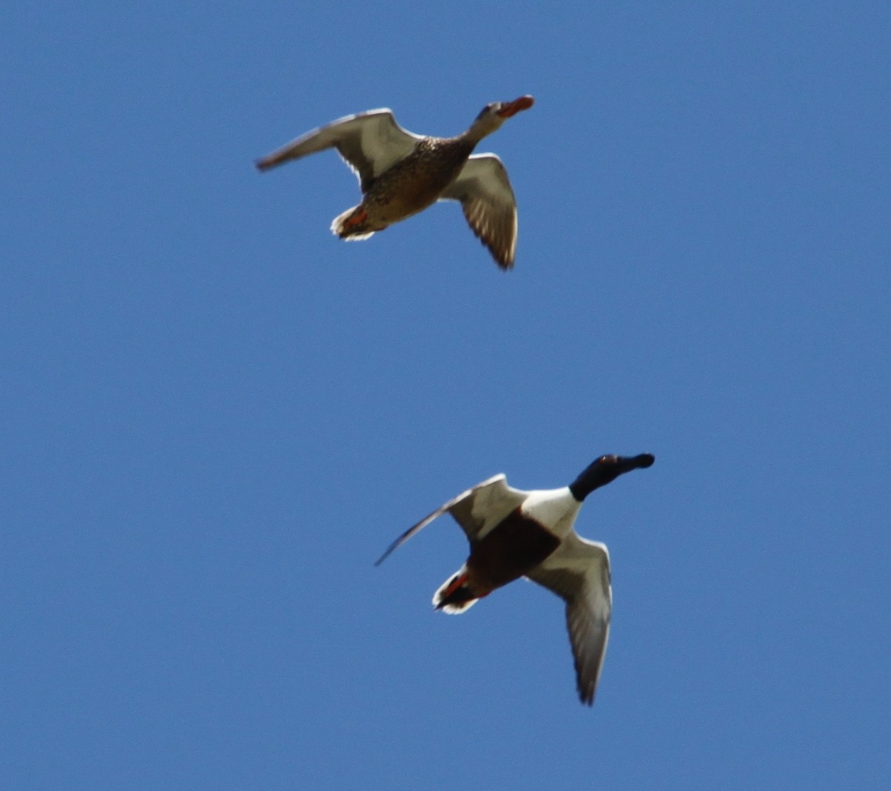
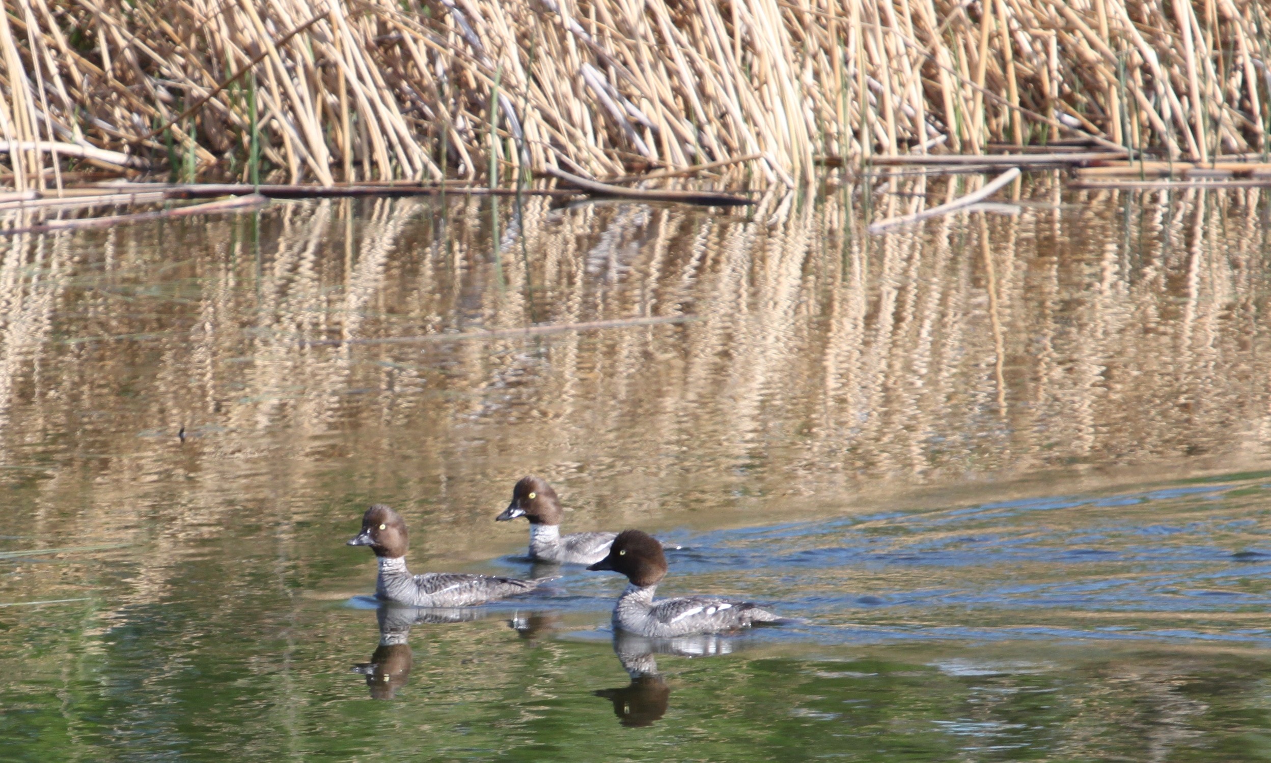
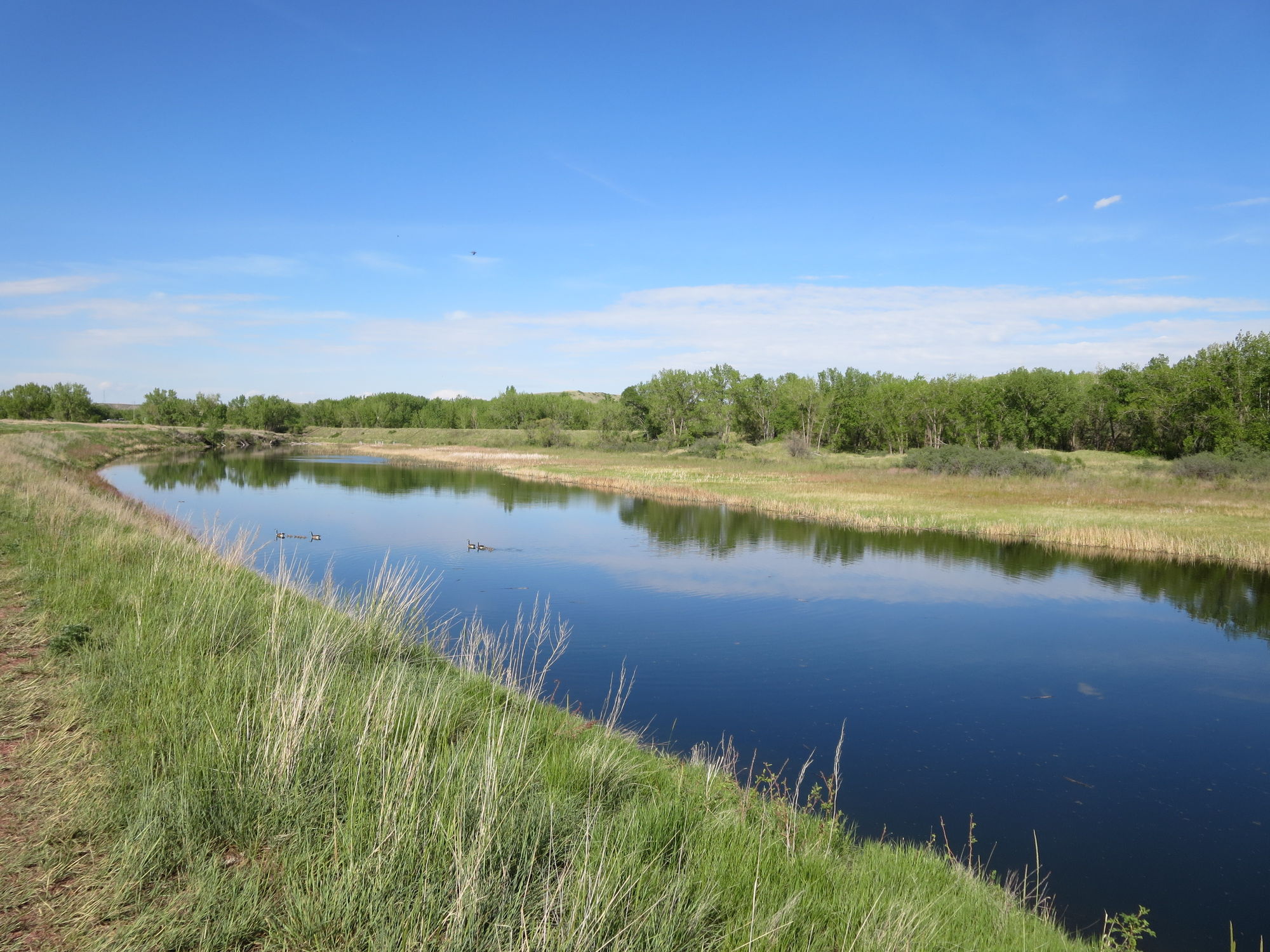
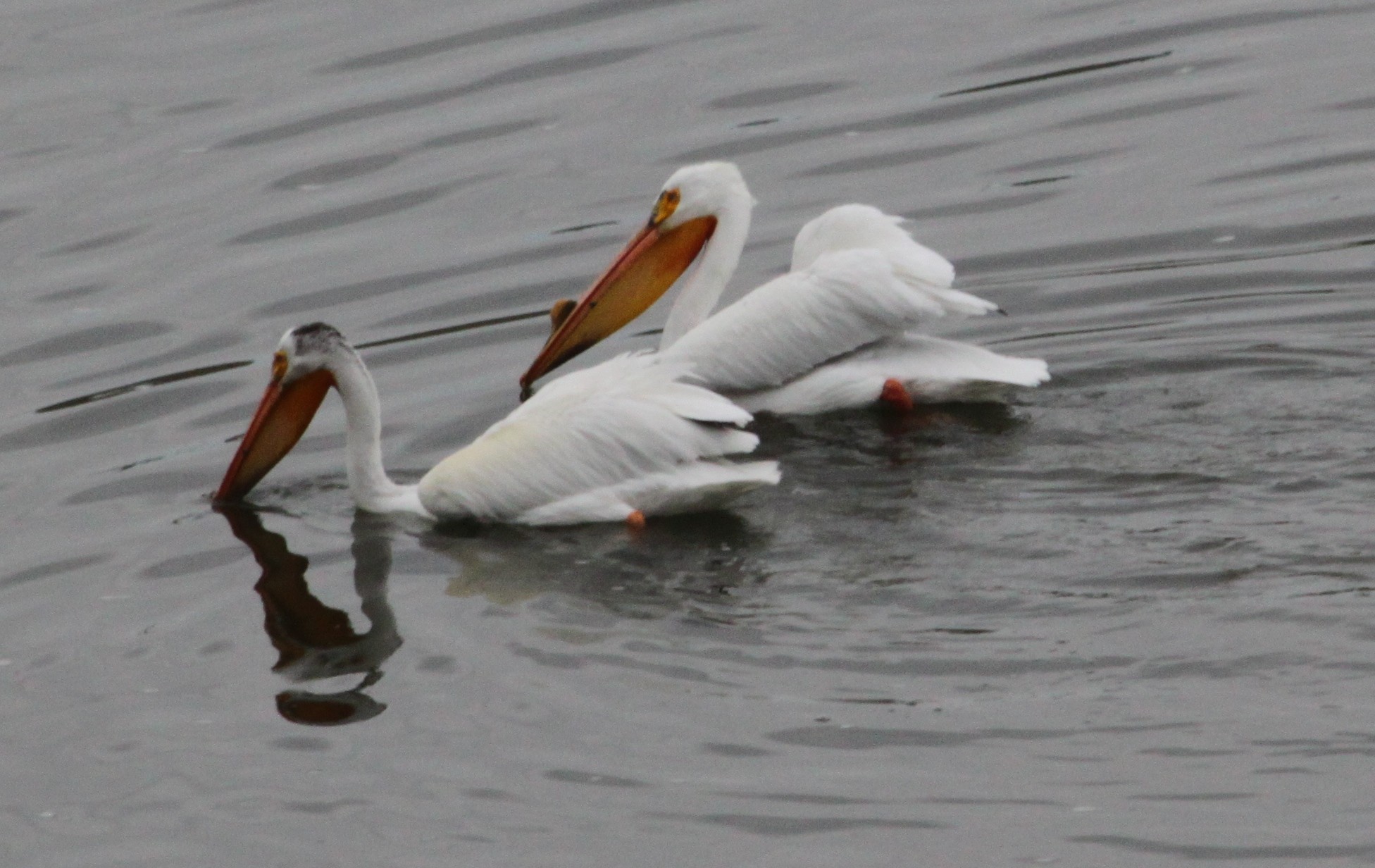
Our first stop was at the Central Park Pond near Manhattan, MT, an amusingly named spot for this group of New Yorkers. The binoculars were out and within minutes we 
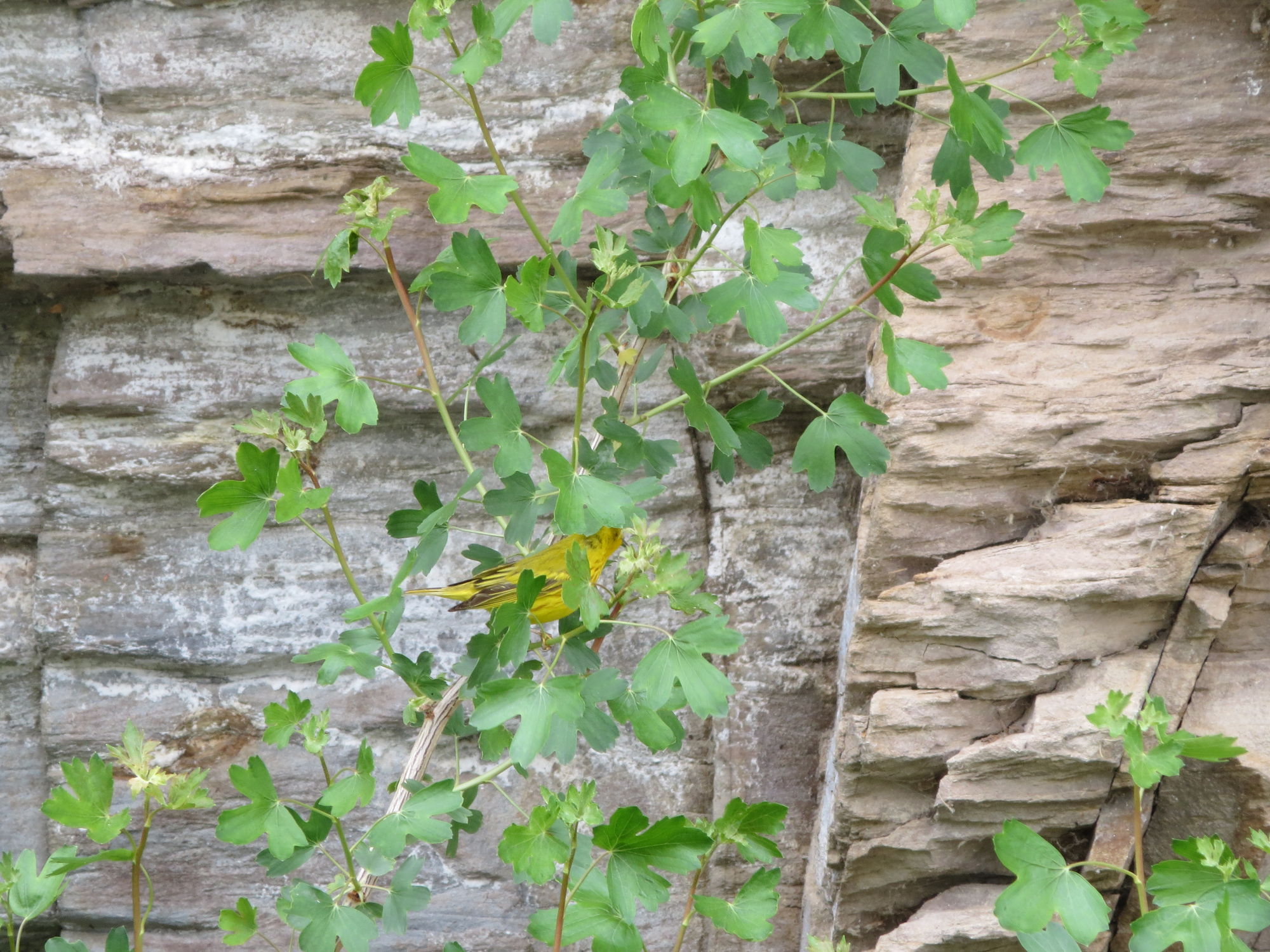
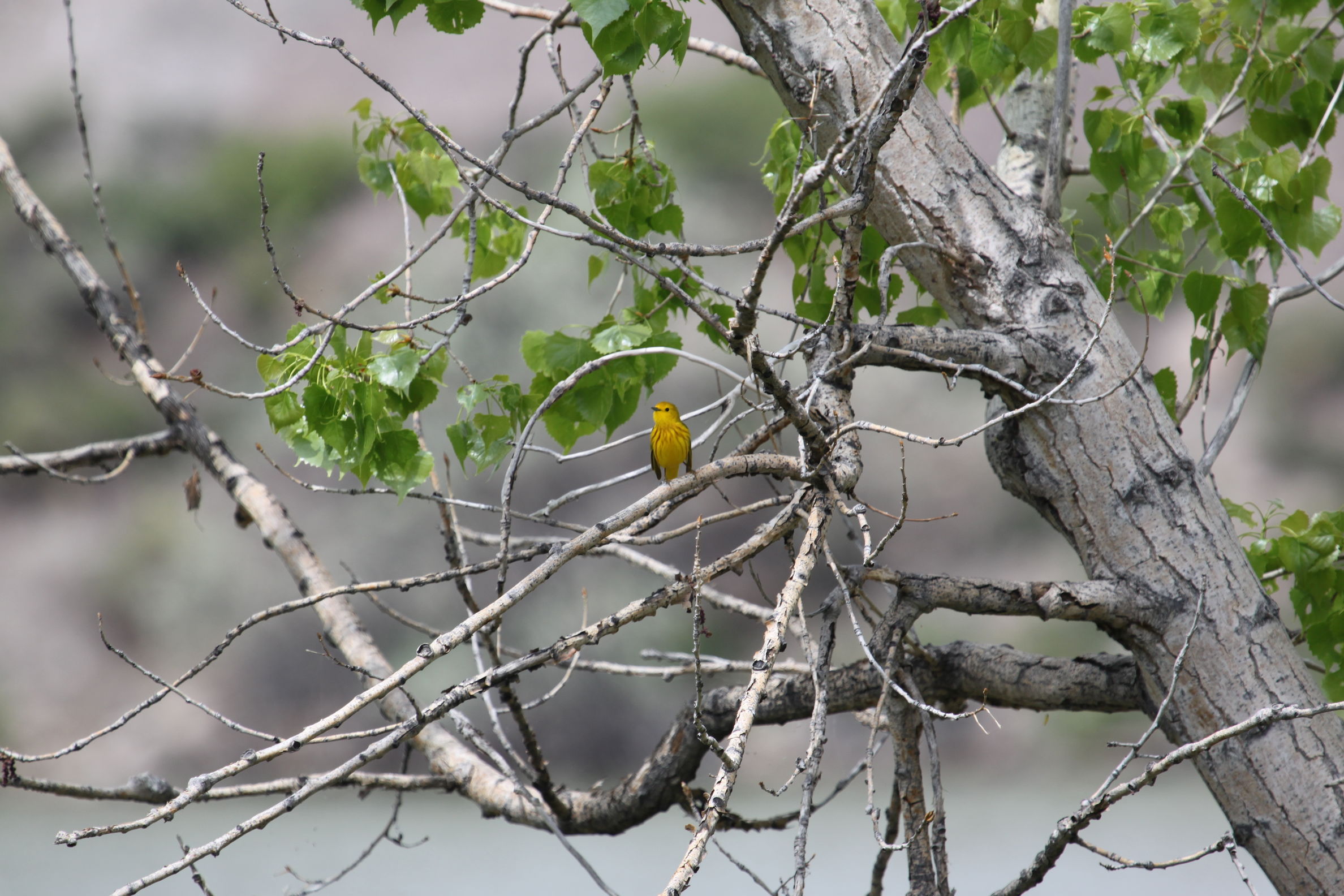
had seen Forster's terns, yellow-headed blackbirds, mallards, Canada geese, American white pelicans, cinnamon teals, scaups, shovelers, yellow rumped warblers, prairie falcons, a red tail hawk, and swallows galore. Many of these were new birds for us, not hard to accomplish since we are pretty amateur birders. We also got much clearer looks at many other species that we have seen on previous occasions.

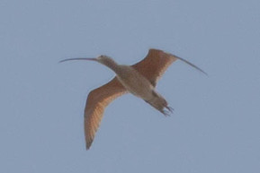
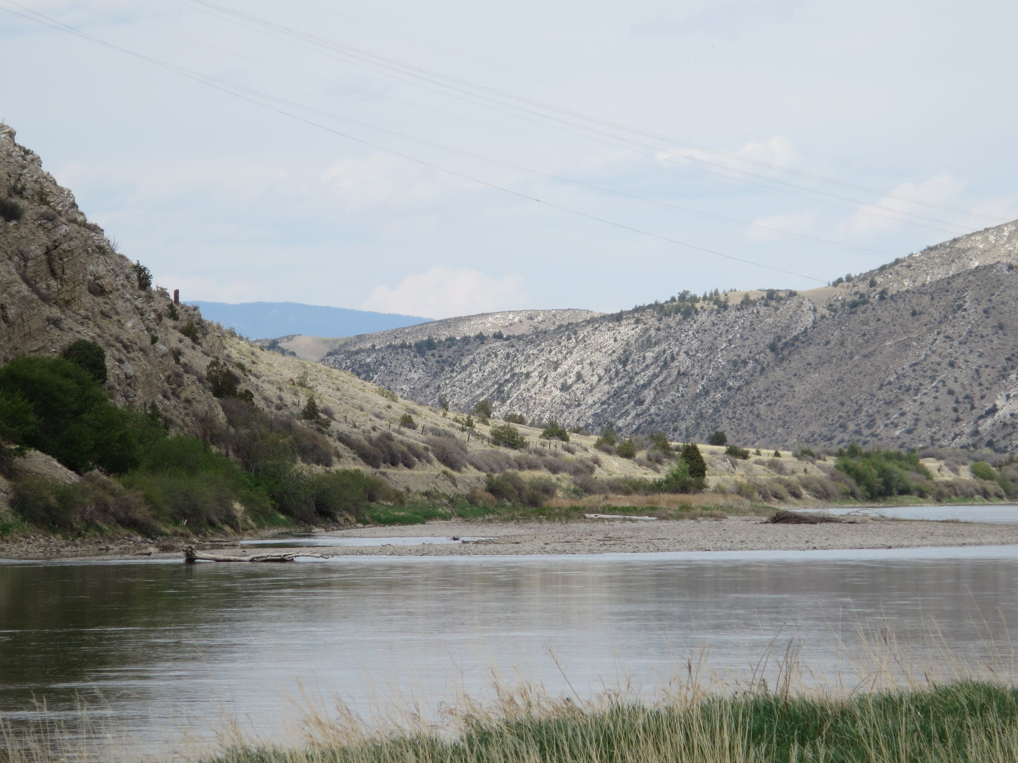
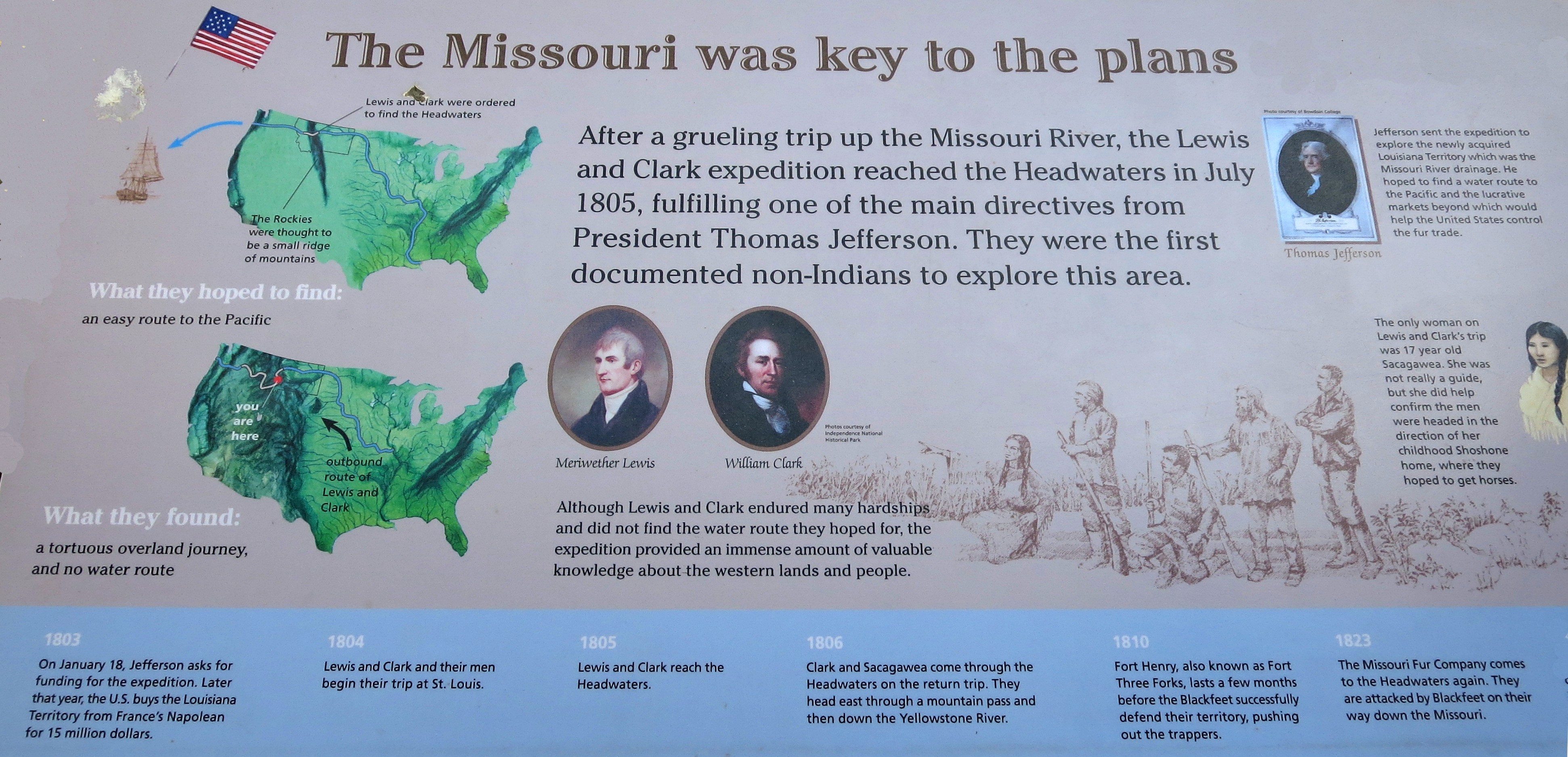
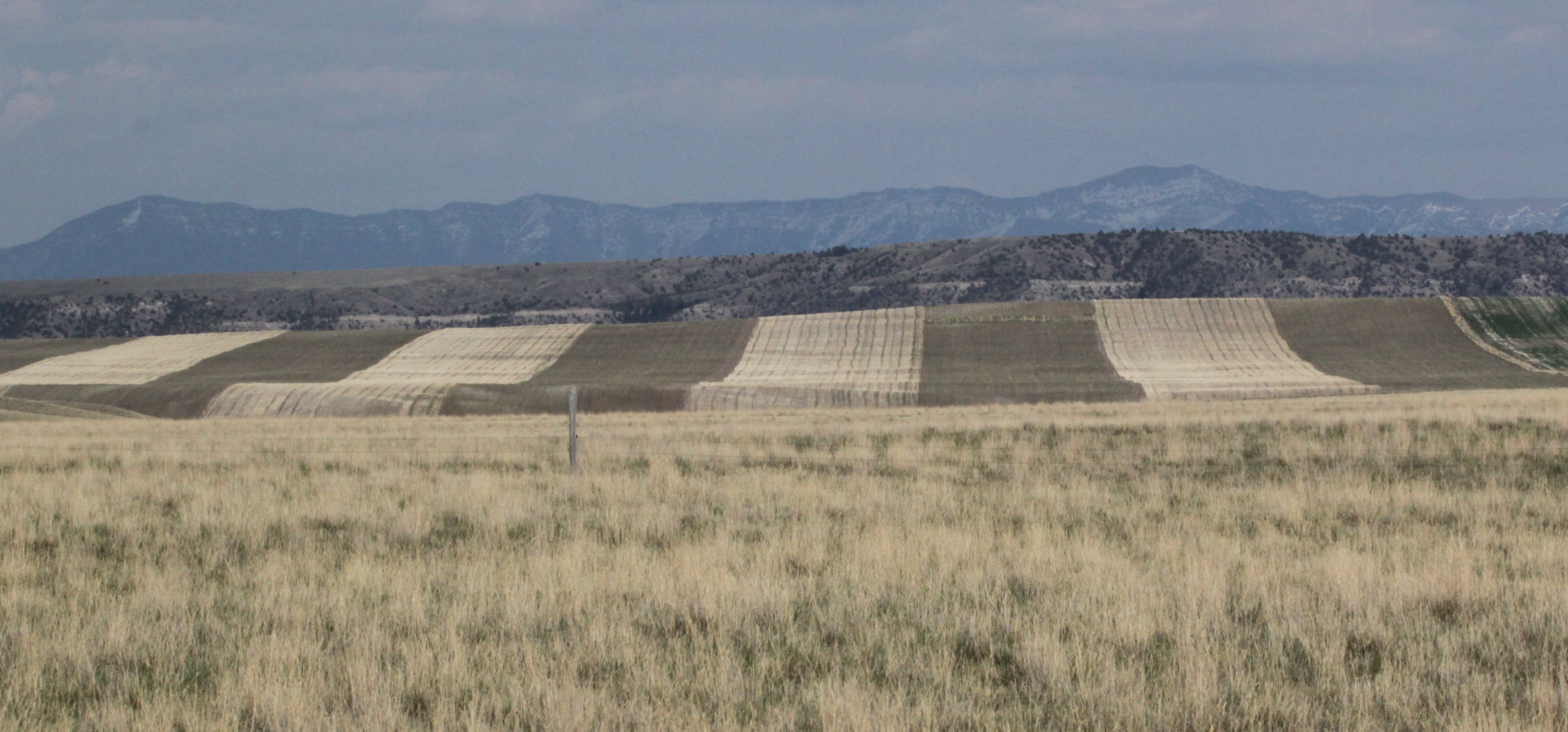
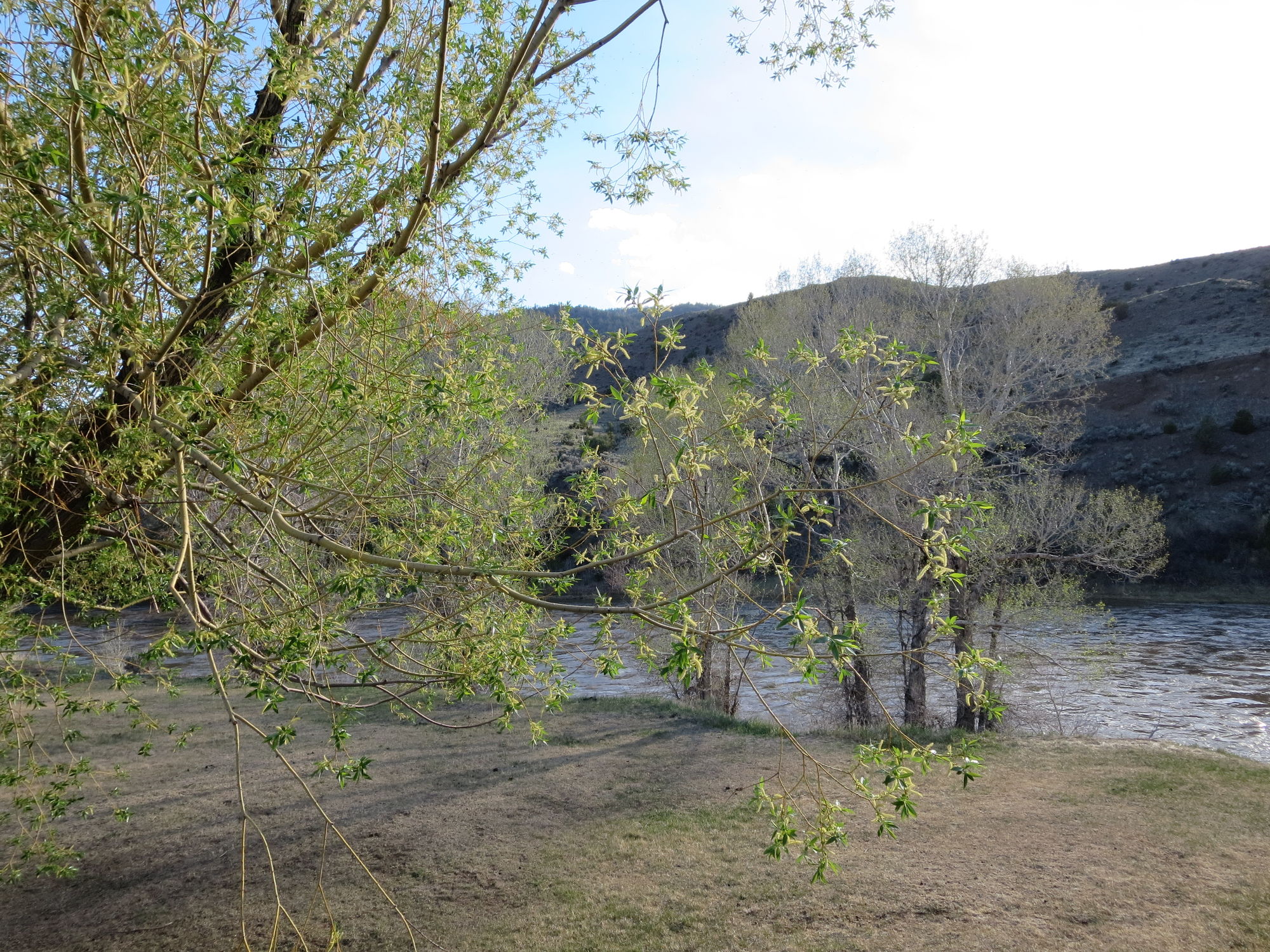
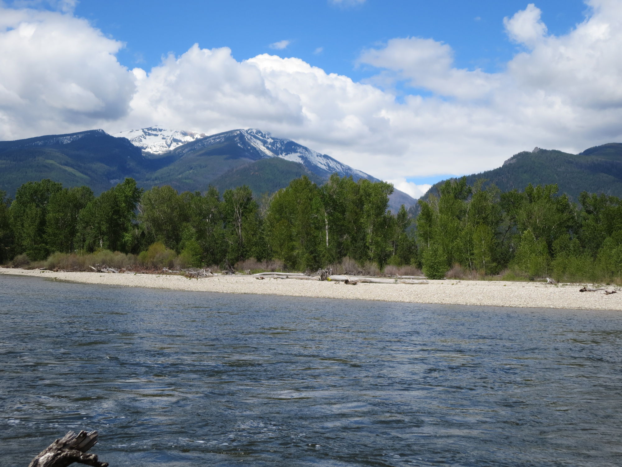
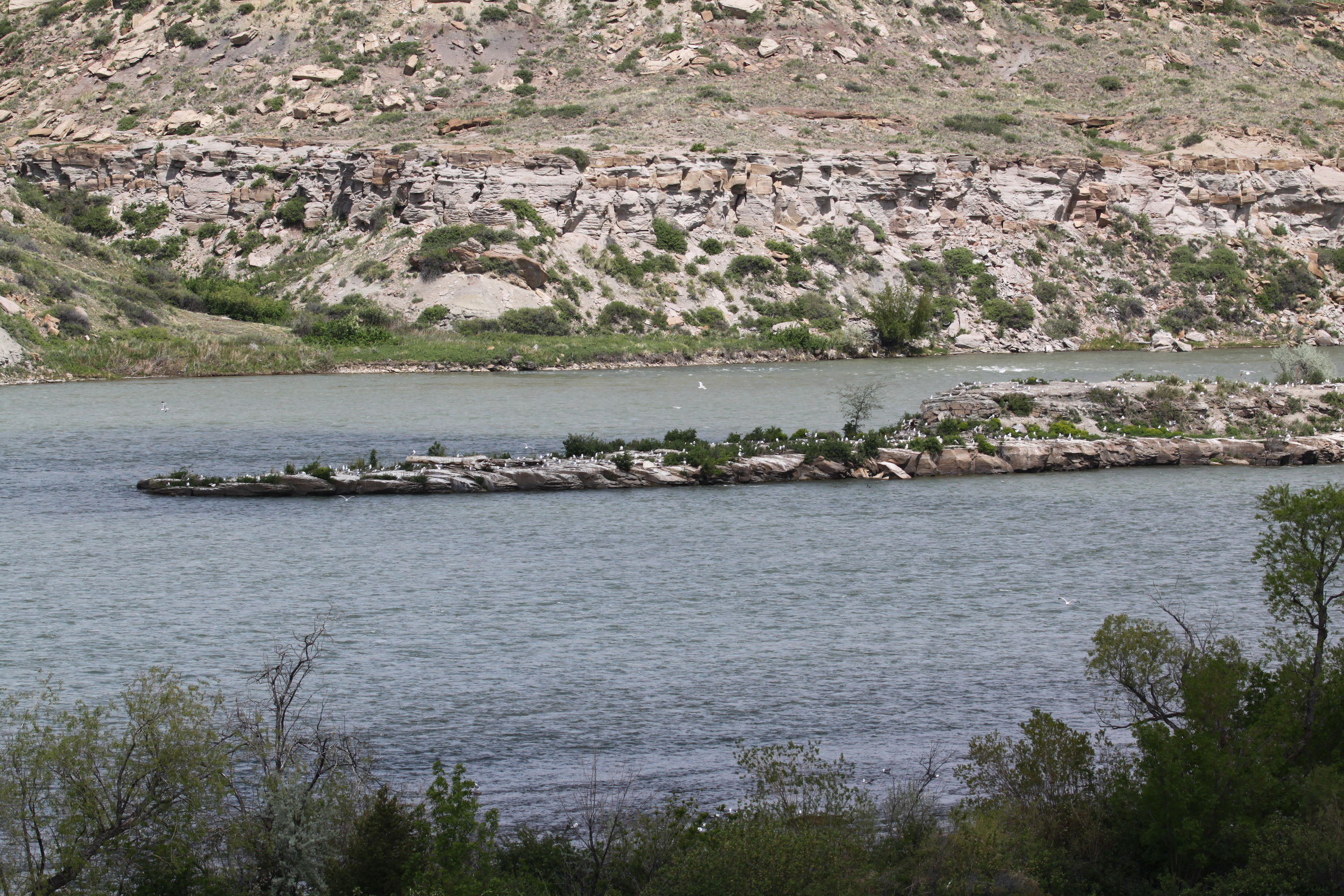
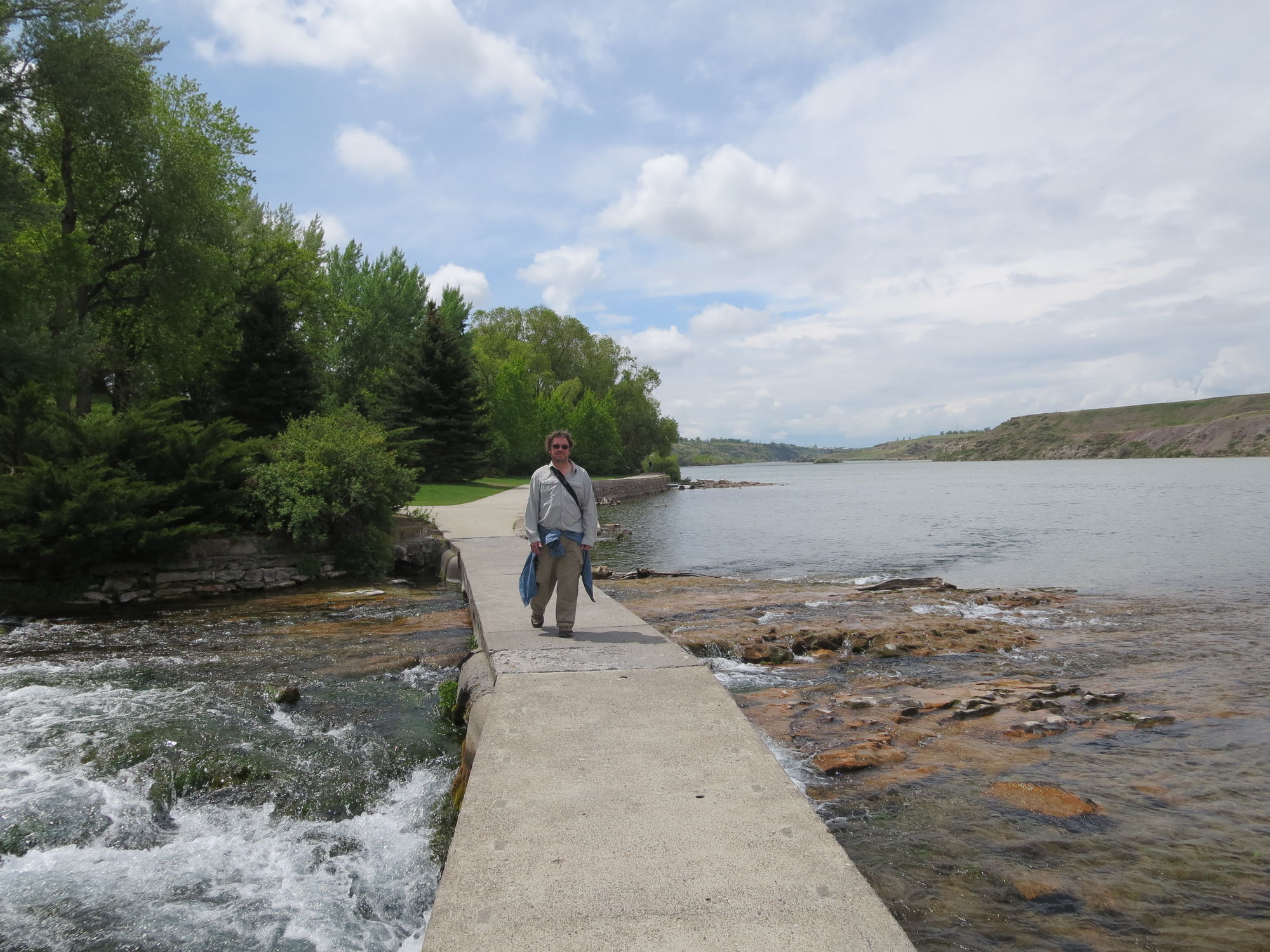
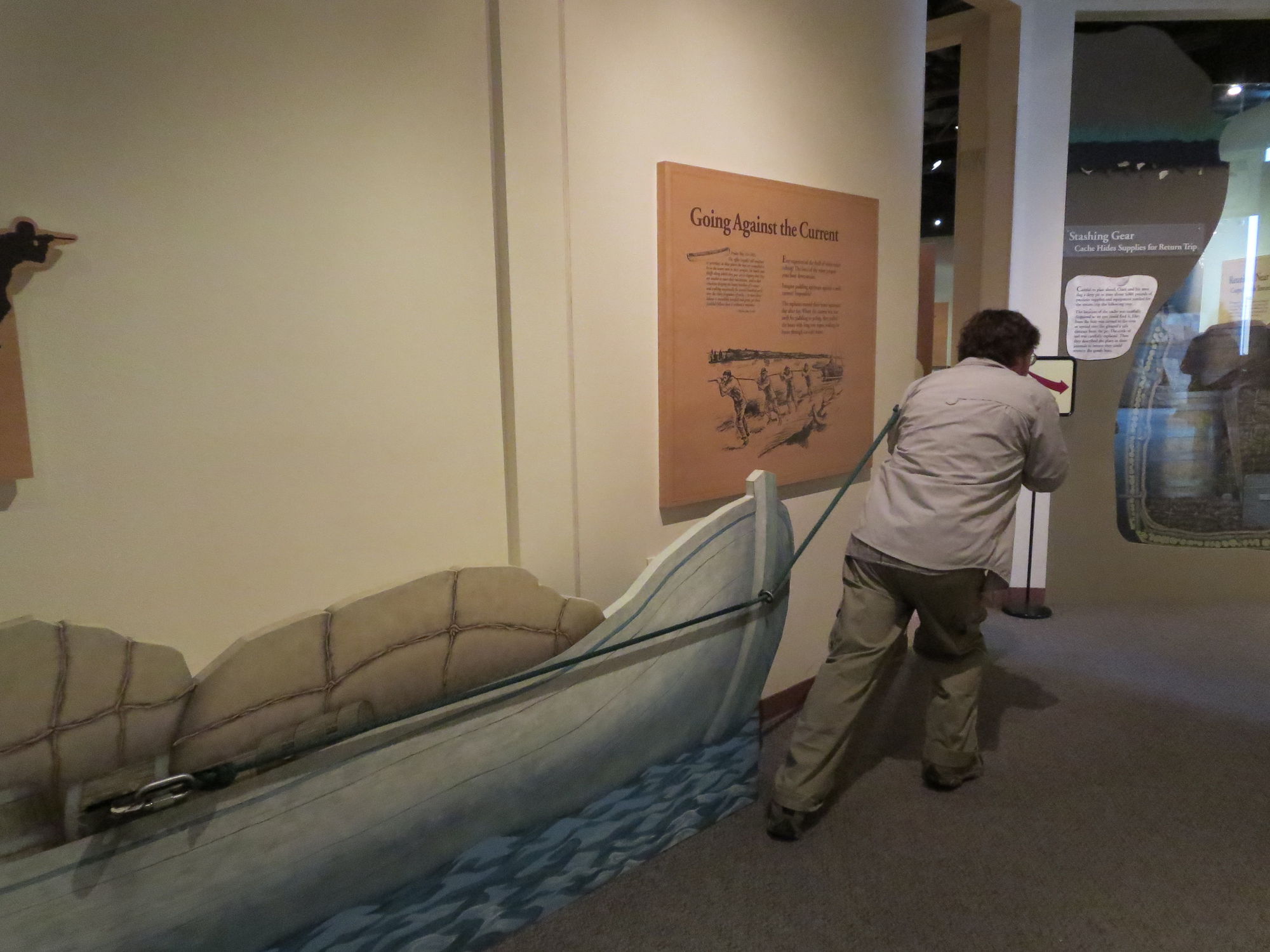
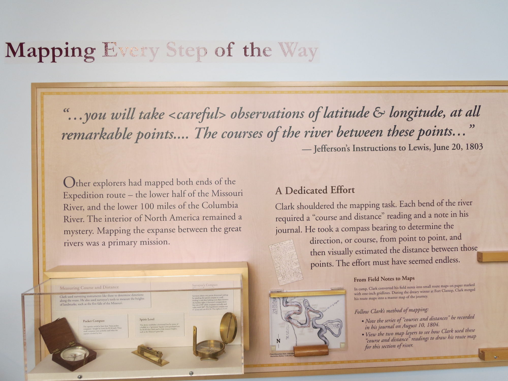
Our next stop was at Missouri River Headwaters State Park. This is where the Gallatin, Madison, and Jefferson rivers meet to form the Missouri River. In addition to some more birding we learn a little bit of history. 
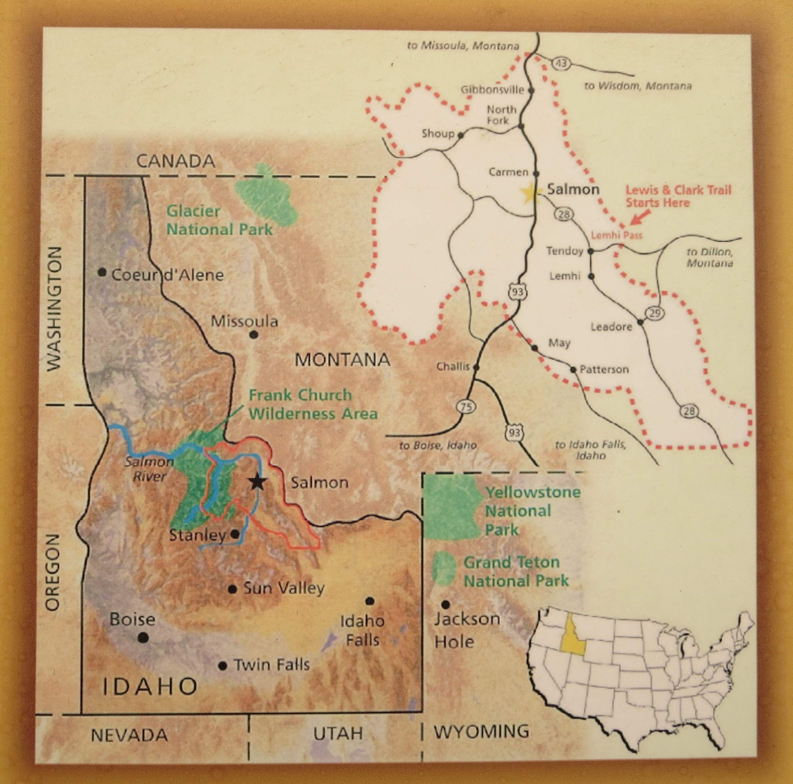
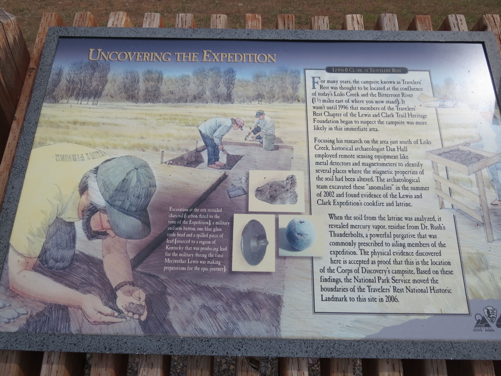
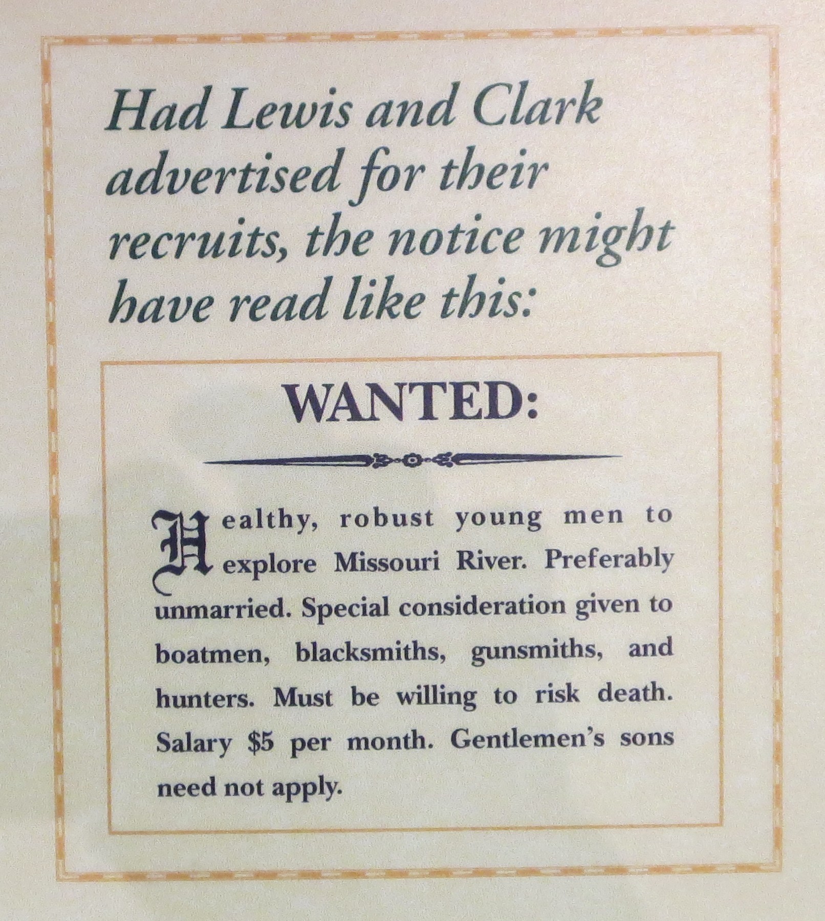
By comparison, our journey here was much easier than the tortuous overland journey made by Lewis and Clark who reached the headwaters in July, 1805.
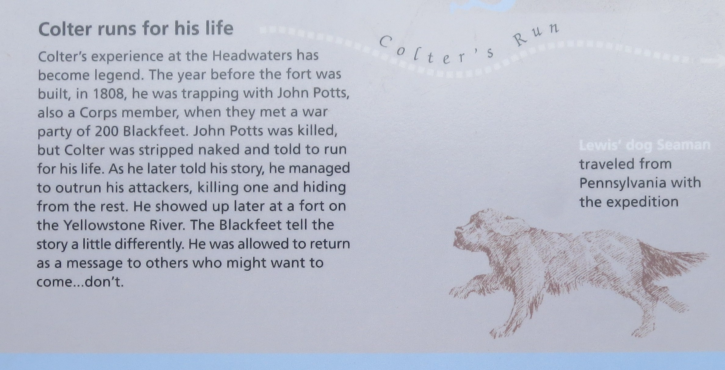
 We learned that Lewis' dog, named Seaman, accompanied the expedition from Pennsylvania. It was also at the headwaters that John Colter made his legendary naked run to escape a Blackfeet war party.

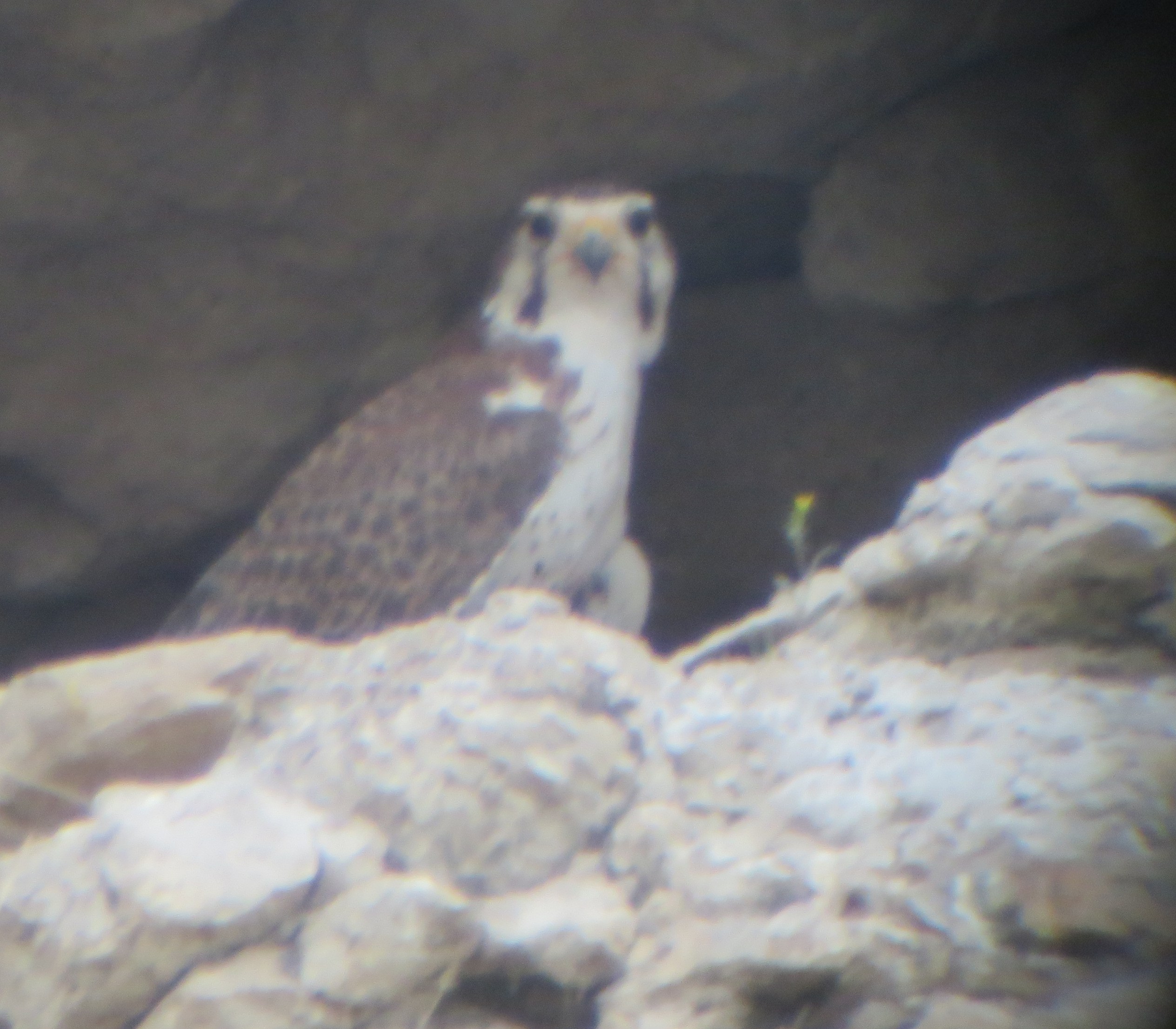
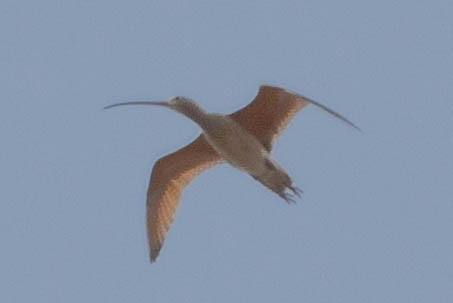
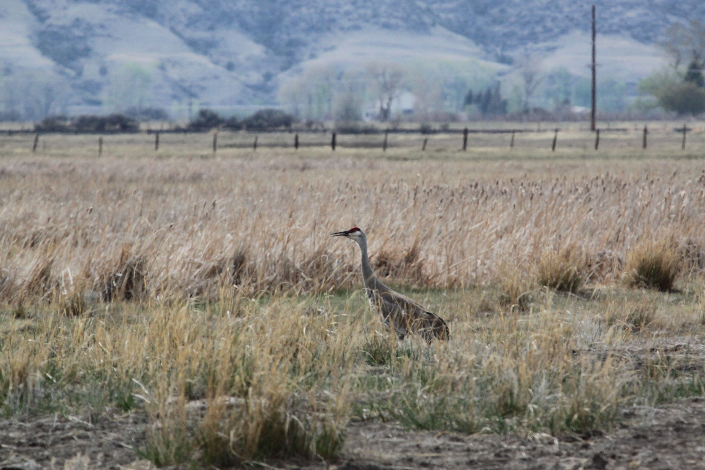
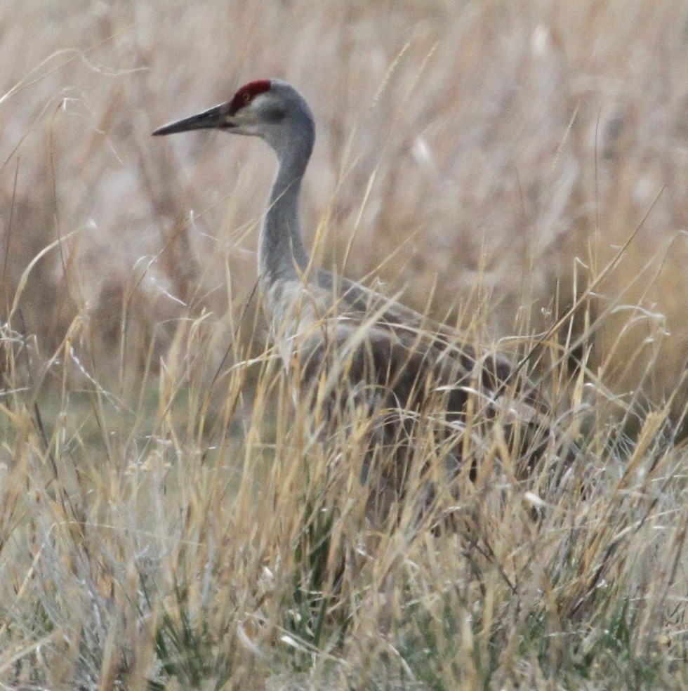
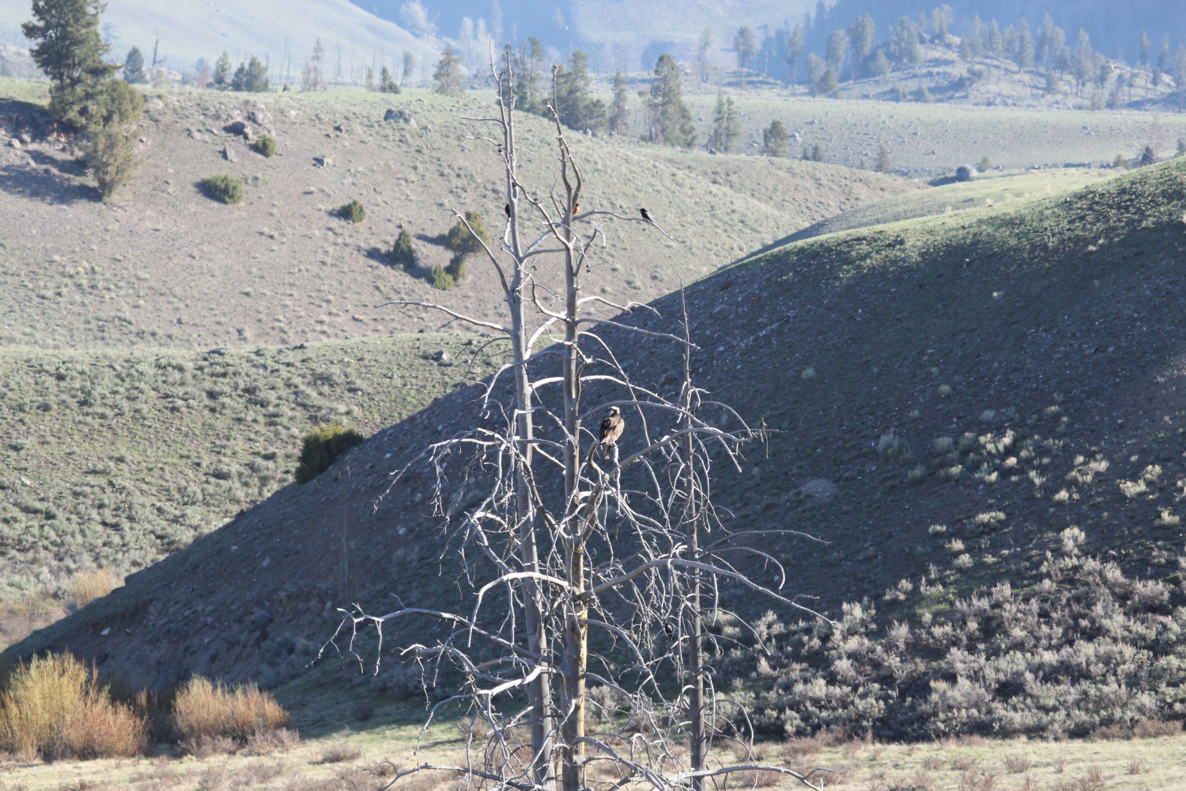
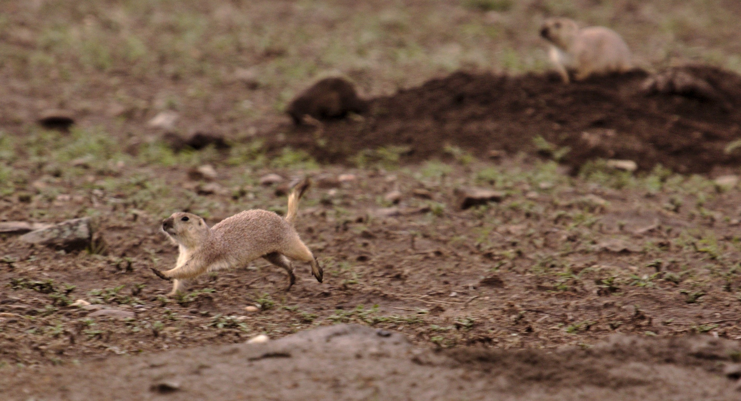
While we enjoyed looking at the large Sandhill cranes the most, another high point was seeing a burrowing owl in a field. The owl was something we would never spot on our own without an expert to point it out to us.

Our day continued late into the evening as we covered a lot of ground, saw more birds, had dinner in Livingston, and eventually reached the Yellowstone River Lodge in Gardiner where we practically fell into bed.
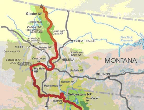
 (See trip map)


YELLOWSTONE: LAMAR VALLEY (Monday, May 13)

A morning wildlife drive begins our visit to Yellowstone National Park. Yellowstone is America's first national park and a world heritage site.

We got and early start and all piled into a perfectly sized mini bus that was designed to hold a group of 14 with a guide from the Yellowstone Association Institute. We got to know our guide, George, over the next few days, and must say that he is the best guide we have ever had on one of these types of outings.

Heading first to the Lamar Valley, we had already spotted bison, elk, pronghorns, mule deer, a coyote, and a host of birds before lunch. We also saw a group of three black bears, mama with two cubs, in our first "bear jam." We are pleased to be visiting Yellowstone a couple weeks before Memorial Day and the onset of summer crowds. There are other people in the park at this time of year, but for the most part, the roads are clear and the our group of 14 dominates any roadside collection of people gathered for an animal sighting. While our main focus today is on big mammals in the park, we also stop and enjoy many bird sightings. Any collection of people with binoculars and scopes stopped along the road prompts other visitors to stop and see what they are looking at. We frequently find ourselves saying, "Just birds" sometimes disappointing those hoping for a bear or a moose.

We have our own private bear encounter at a picnic table where we stop for lunch. A mama black bear and cub were napping in the shade at the site as we pulled up. John and I were first out, and our initial reaction was to turn around and get back on the bus. Others blocking the way thought we were joking about seeing a bear. Fortunately, the black bears were neither interested in nor disturbed by our presence. They got up and slowly ambled away giving the picnic spot to us.

There are ample signs warning that Yellowstone is Bear Country posted around the park, including a sign in every toilet. Most of the warnings have to do with avoiding attracting bears with food and properly disposing of garbage. But a group of people showing up with a picnic cooler full of food was much more interesting to the ravens at this spot, than this pair of bears.

Near the end of our first day's drive we learned of a dead bison carcass that was conveniently located near the road in the Lamar Valley. The best times to view predators feeding are sunset and sunrise. After a short debate, the group opted to begin our second day at 5am for optimal wildlife viewing. It was a joy having a guide not only willing, but enthusiastic about the prospect of getting up at 3am to meet us in the park. I marked the GPS coordinates of the carcass: N44 54.440 W110 15.088.

YELLOWSTONE: LAMAR VALLEY (Tuesday, May 14)

The early morning outing was well worth the effort and we were rewarded not only by finding wolves and coyotes, but by witnessing an amazing interaction between them at the carcass site. We joined a handful of other early risers collected by the side of the road. Scopes are mounted. Cameras with big lenses are fixed on tripods. It's possible to watch the action unaided by optics, but binoculars help. The scene begins with with a lone wolf feeding on the dead bison carcass. A handful of live bison stand around, seeming to mourn the loss of their comrade. A group of three coyotes are lying nearby, looking much like contented dogs napping after a big meal.

Suddenly, the coyotes are all in motion at once and decide to take on the lone wolf. They have him surrounded, each taking turns zipping in for a bite at his flanks. As the wolf spins around to face one attacker another comes in behind as the coyote closest to the wolf's mouth jumps out of the way in the nick of time. The coyotes are quicker and seem to have the upper hand. Close examination of our photos after the fact show the wolf has his tail between his legs during much of the conflict. There comes a momentary stand-off between wolf and coyotes as the mourning bison stand by and watch. The wolf finds time for another bite of bison as the coyotes take a break.

The truce is short-lived and soon the coyotes are on the attack again. They keep it up until the lone wolf slinks off with tail between its legs. After vanquishing the wolf, the coyotes come together and high-five one another and generally yip it up. Our guide, George, captured a movie of the wolf being harassed by coyotes: watch it on You tube.

On the way out of the park one afternoon we spotted a group of bighorn sheep grazing along the side of the road. We were in two SUVs, our mode of transport between our lodge in Gardiner and the park entrance where the whole group shifted to one mini-bus driven by George while in the park. The sheep were very close and most of us got out of the cars to get good close-up photos. The sheep began eyeing us suspiciously and then decided to move in our direction ready to head-butt their share of tourists for the day. Fortunately, we all were quick on our toes and made it back into the cars.


MAMMOTH HOT SPRINGS (Tuesday, May 14)

After a very successful morning of wildlife viewing in the Lamar Valley, we changed gears and visited the Mammoth Hot Springs area in the afternoon. Yellowstone has the largest collection of hydrothermal features on the planet and seeing the hot springs, geysers, mudpots and fumaroles was high on our "to do" list.

We started near Liberty Cap and walked around the Palette Spring and Lower Terraces. Eventually, we climbed up around the main terrace and trekked over to Canary Spring. A portion of the trail had been removed due to hot spring activity which caused us to do some backtracking. While taking in the beautiful scenery, we gathered information about two earthcaches, GC14ZQZ and GC2F3T9.

On approach from parking near the Lower Terraces, the first thing one notices is Liberty Cap, a dormant hot spring cone. It was named by the Hayden Survey in 1871 for its resemblance to the knit caps worn during the French Revolution.

In striking contrast to the dull brown, lumpy upside-down ice cream cone that is Liberty Cap are the brilliantly colored active springs in the lower terraces. These resemble a beautiful frosted stair-stepped cake. The decorator drizzled white icing and colored glazes at the top that ran down and dripped over the sides. The icing is still wet in spots and steam rises from the surface.

The terraces at Mammoth Hot Springs are composed of travertine limestone formed by the precipitation of carbonate minerals dissolved in ground water. Water continues to percolate up through the limestone dissolving calcium carbonate and adding more layers of white calcite. Colorful cyanobacteria and algae live in the waters and contribute to the changing hues (blues, yellows, reds) that are seen in the terraces. Colorless and yellow thermophiles grow in the hottest water (up to 163o F); orange brown and green thermophiles thrive in the cooler waters and colors change with the seasons.

More of our Mammoth Hot Springs and other Geothermal photos


BIRDS and FLOWERS and DINOS, OH MY! (Wednesday, May 15)

An optional morning walk was spent at Black Tail Pond and Plateau looking for woodpeckers and other small wildlife. One problem with tromping around in the woods with 11 other people is that the group makes a lot of noise. And, by the time one person says, "Hey look there's a ...." the .... has probably ducked for cover. I did catch a glimpse of a pika, just before it slipped out of sight, and a yellow-bellied marmot was sunning on a rock for all to see. Red-naped sapsucker, white-faced ibis, and a couple other birds were also added to our bird list.

There were great views of Bunsen Peak and Antler Peak - both still covered with snow despite the warm temperatures we've been experiencing. Bunsen peak was indeed named for German chemist Robert Bunsen, the inventor of the Bunsen Burner and responsible for early work on volcanic geyser theories

After lunching back at our lodge, we headed to Mount Ellis trail, located about 15 min SE of downtown Bozeman (N45 35.804 W110 57.681). We were perhaps a week too early for what promises to be a spectacular spread of wildflowers on the slopes of Mount Ellis. We were still treated to the colors of the early bloomers.

Our next stop was Bozeman where we visited the excellent Museum of the Rockies at Montana State University. It is a world-class museum with a variety of exhibits. We arrived 45 minutes before closing, and only had time to take in the Siebel Dinosaur Complex. The museum had heaps of dinosaur fossils inside, and we dig that sort of thing. I mostly ran through trying to take in as much as possible in the short time available.


GRIZZLY BEAR (Thursday, May 16)

Another great morning spent with George in the park. We were looking at geothermal features, but lucked into a grizzly bear sighting across the road from Roaring Mountain. The bear was some distance away, and clearly intended to keep it that way.


OLD FAITHFUL and GEOTHERMAL FEATURES (Thursday, May 16)

Our day spent visiting some of the many geothermal features in Yellowstone was a very rushed affair. Not surprising, since the majority of the world's active geysers are here (visit link). Four other locations in the world with large concentrations of hydrothermal features are: Russia, Chile, New Zealand, and Iceland. We had the good fortune to visit Iceland for a curling bonspiel the week before this trip and we saw the original Geysir while there. Iceland was fantastic, but the Yellowstone geysers really kick Iceland's butt.

Coming in the north entrance and heading south we passed a sign marking the 45th parallel -- the half way point between the equator and the north pole. A quick check of the GPS showed the sign was placed 0.2 miles north of where the 45th parallel is located. The sign is at N45 00.195 W110 41.542. We continued south passing through the Norris Geyser Basin and the Obsidian Cliffs. A brief stop at Roaring Mountain netted our lucky grizzly bear sighting mentioned above. Roaring Mountain was so named for the roar of steam escaping in its fumaroles which can sometimes be heard a few miles away. We continued to dash in and dash out with some quick looks at other springs and fumaroles as we made our way to the Upper Geyser Basin, home of Old Faithful.

Old Faithful was the first geyser in the park to receive a name in 1870. It is one of the most frequent erupters in the park with an average of 90 minutes between blasts (44 - 125 minutes). The park rangers post eruption prediction times for some of the main geysers, including Old Faithful, but our timing here was perfect. We planned to find out when the next eruption was scheduled and then go from there, but as we were walking toward the Old Faithful viewing area, it erupted before our eyes. The time was 12:15pm.

Let's take a time out for a calculus lesson. Harry M. Woodward first described a mathematical relationship between the duration and intervals of the eruptions in 1938 -- see this article from Northwest Science.

As the eruption began, we rushed to get a quick photo, remembering our Iceland experience where the geyser's eruption lasted only a few seconds. But, Old Faithful kept pumping out water for a good 5 minutes or more. We even had time to walk up, take seats and relax a bit to enjoy the show. And what a show we had. No sooner had Old Faithful finished, when several of the other geysers in the basin started erupting in turn. We definitely saw Beehive Geyser erupt. The group got excited when we heard that Sawmill Geyser was going. Being from the Saw Mill River Audubon, we tried to get a group photo with it in the distance, but it turned out to be one of the other geysers in that photo.

The next scheduled eruption time for Old Faithful was now 1:38pm. The group agreed to meet back for a second viewing around that time. While others went to look at the visitor's center or the Old Faithful Lodge, John and I took a loop walk through the geyser basin. We made our way to the the actual Sawmill Geyser among others. The only downside was that we didn't have near enough time here. As we were heading back toward the Old Faithful viewing area 90 minutes later, it erupted again, right on schedule. We were hoping it would be late, to give us more time.

We left Old Faithful and returned north to visit hot springs and mudpots including the aptly named Fountain Paint Pot. It definitely looks like something you would find on a giant artist's easel. The same area is also home to the Red Spouter, three thermal features in one! It is a hot spring in springtime; a mudpot in late summer, and a fumarole as it dries out in the fall. Red Spouter originated from the 1959 Hebgen Lake Earthquake measuring 7.3 on the Richter Scale. This is the most powerful quake to strike the area in recorded history.

  • A hot spring is a spring of water heated by geothermal energy. Unlike a geyser, a hot spring's underground channel system is unrestricted so the water circulates and releases heat through evaporation. A geyser, by contrast, has constrictions in the plumbing that cause pressure to build up until it reaches a point where it must erupt to release the built up pressure.
  • A mudpot is a mix of heat, hydrogen sulfide gas, water, rhyolite (volcanic rock), thermophiles (heat-loving microorganisms), and a pinch of minerals. The thermophiles convert the gas to sulfuric acid which breaks down the rock into mud and clay that bubble and plop with the escaping gases.
  • A fumarole is a system that contains very little water. It is an opening in Earth's crust which emits steam and gases.

One other really cool thermal feature we saw was Dragon's Mouth Spring. The opening, which could be said to look like a dragon's mouth, made a really cool "roaring" sound from water crashing around inside hidden caverns. The water at the entrance was also lashing back and forth reminiscent of a dragon's tongue, complete with escaping steam. An attempt to take a movie to capture the nifty sound failed since the microphone on the camera wasn't up to the task.


OUR 30th ANNIVERSARY (Friday, May 17)

A power outage at our lodge struck just as we finished dinner the night before. We went to bed early and were pleased to be awoken when the lights came back on at 2:48am. Today is our 30th wedding anniversary, and it's good to be starting on a positive note.

It was wet and rainy most of the day. It sprinkled a bit yesterday, but otherwise we've had great luck with primarily sunny days. A high near 80oF the first day of the trip was a bit warm, but things cooled to more reasonable temperatures for the rest of the week.

The rain didn't dampen the spirits of the river otters we discovered frolicking in a stream as we headed toward the Canyon District of Yellowstone. You be the judge of who makes a cuter couple, them or us.

The Grand Canyon of the Yellowstone River slices through an ancient hydrothermal basin. About 600,000 years ago, the basin developed after a huge volcanic eruption filled the Yellowstone Caldera with lava and ash. Hot steam and gases weakened and altered the rhyolite and over the years, glaciers and the river have carved a spectacular canyon with idyllic water falls. Hot springs have weakened the rock downstream of the falls and geysers sometimes spout into the river, which continue to deepen the gorge.

We took in the view of the canyon and falls from Lookout Point. There was a large osprey nest, with an osprey, perched on the huge, hand-shaped rock outcropping sticking up in the center of the canyon.

We got excellent looks at some Harlequin ducks at Le Hardy Rapids. They have such a cool name in Latin, Histrionicus histrionicus. The ducks seemed unconcerned about water splashing rapidly all around them, in fact, many seemed to be sleeping. Here, we also got a good look, and a blurry picture of an American dipper.

Other sights of the day included Steamboat Point with its contrast between ice on the lake and steam coming up through thermal vents. The Fishing Bridge near Yellowstone Lake. Signs posted on the bridge say "No Fishing". Yellowstone Lake is the largest freshwater lake above 7000 feet in North America.

On the way to dinner we saw Trumpeter swans on Emigrant Pond. The evening, and the Saw Mill Audubon portion of the trip, ended with dinner in a private room at the Chico Hot Springs. This was a nice way to celebrate our anniversary (champagne all around) and cap off the trip.

Photos of some of the birds we saw in Montana, Wyoming, Idaho and Southern Alberta during this trip.

Complete bird checklist for the trip. I'm happy to report that we saw both a Clark's Nutcracker and a Lewis's Woodpecker.


BUTTE and BEYOND (Saturday, May 18)

We feel like regulars at the Hertz counter in the Bozeman Airport as we stop in once again to return one of the big SUVs belonging to the group trip and pick up a small AWD vehicle for our own personal vacation.

Our 30th was our zinc anniversary, so we stick with that theme for today with plans to visit a mine and the Berkeley Pit. We head west and cross the Continental Divide at Homestake Pass. We'll be crossing the Continental Divide right and left as the trip progresses, see map.

Continuing west, we reach Butte and head for the World Museum of Mining. The museum is home to the 2700-foot deep Orphan Girl Mine. Silver and zinc were the main ores extracted from the Orphan Girl when it operated nearly 24 hours a day from 1875 to 1956. We were looking forward to taking one of the afternoon mine tours. Alas, we were told that conditions were too wet and muddy underground for a tour today. The rest of the 44 acre museum property was still open with its eclectic mix of exhibits.

The property is scattered with "stuff" from the now closed Orphan Girl Mine. Some of it is nicely organized and labelled in large buildings. Yet more mining equipment is sprinkled about like sculpture adorning the property. Pieces are numbered and we have a sheet with the numbers and explanations of the function of various pieces of equipment, but it can be more fun trying to figure out what things are on our own. There are a couple of other visitors, and we enjoy having the place practically to ourselves.

Hell Roarin' Gulch is a recreation of an 1890s mining town. It includes several buildings that were brought in as complete, original historic structures. There are also a number of buildings constructed from old materials by volunteers who put the museum together from the mid-1960s to the 1980s. The buildings are fully stocked with thousands of period artifacts. The general store with its stocks of canned goods on the shelves was a high point.

The museum displays go on and on and include the doll houses of Samie Keith. Ms. Keith was Ramsey, Montana's longest continuous resident. While working for 35 years at the U.S. Attorney's office, she found time to maintain her lifetime doll collection. It includes thematic pieces like the miniature dollhouse representation of 221B Baker Street or her collection of Star Trek figures as well as more traditional doll houses that would be any little girls dream possession.

On the other side of town is the Berkeley Pit, a former open pit copper mine, operational from 1955 to 1982. It is now a Superfund site and a minor tourist attraction with a tunnel leading to a platform overlooking a pit full of contaminated water. The pit is one mile long by half a mile wide with an approximate depth of 1780 feet (540m).

The pumps that kept groundwater out of the underground mine were turned off in 1982 and water began flowing back into the Berkeley Pit. By 2012, the water volume in the pit had risen to 41.2 billion gallons of water. The water has very high concentrations of copper, cadmium, cobalt, iron, manganese, and zinc. There's some arsenic thrown in for good measure, and the pH is about 2.5, yet the water boatman, a common water bug, calls the pit home. There is also a type of algae that digests iron for survival living in the water.

Our route takes us through Beaverhead County, the largest county in Montana. We are traveling in the footsteps of Lewis and Clark at every turn. We cross the Continental Divide again and stop at the divide rest area near Dillon. We see large contraptions in fields we pass. Signs explain that these contraptions are called beaverslides and are used for making giant haystacks.


BANNACK GHOST TOWN (Sunday, May 19)

Bannack State Park is home to the former gold mining town of Bannack. Gold was discovered here in July, 1862 by John White who filed one of the first recorded mining claims in the territory that became Montana. The town's population quickly grew to 3,000 by the following year, and a Post Office was established, accidentally changing the spelling of the name from Bannock to Bannack. Bannack continued as a mining town through the 1930s with a dwindling population. Most people had moved out by the 1950s. Shortly thereafter it was declared a state park and preserved. Today, over sixty structures remain standing. Many are unlocked, and visitors are free to explore.

Newsflash! Two months after our visit a flash flood ripped through town, destroying the Assay Office and tearing up much of the boardwalk. Article from the Missoulian, July 23, 2013.

This was a fantastic place to stop and visit. There were a couple of people working in the visitor's center, and a couple of other folks exploring the town. Otherwise the place was empty, helping to preserve the ghost town ambiance.

The first building we entered was the former Turner residence. The walls here had several layers of flowered wallpaper that reminded us of the first house we ever owned. We stripped a lot of wallpaper in that house! Another building had flowered linoleum on the floor. The once swanky Meade Hotel has faded, but one can imagine it in its finer days while exploring the cavernous rooms with extremely high ceilings.

On the small end of the spectrum, is the extremely well built cabin of Xavier Renois. It is hard to believe he built this in 1864 with simple hand tools. The corner logs on the cabin have beautiful double dovetail notches and wooden peg construction. Renois, was a carpenter extraordinaire.

Poking around inside the old buildings was amusing. A favorite spot was the former school room located in the Masonic Lodge. We learned about weights and measures from the nicely recreated chalk board inside, and did a little bit of science by testing the Coriolis effect on the antique merry-go-round (movie). We're scientists, we do stuff like this while on vacation.

After learning about Henry Plummer, former sheriff and possible leader of a road agent gang back in the 1860s, we set off on our own road agent adventure on the drive out of Bannack. We went in search of a geocache. The cache description states that access to the area is by a relatively good road which leaves highway 278 just east of the Badger Pass summit. The description suggests NO low ground clearance vehicles be used and NOT attempting the cache in a 2WD vehicle if the road is muddy.

We have an AWD rental car. It's not very high clearance, but it's not muddy and we're game for a little adventure. We follow directions, and the arrow on the GPS, which leads us on a series of progressively poorer quality roads. The weather changes, and it begins to snow. There is no phone reception, no one around for what seems like miles, and our spare is one of those silly little temporary donut tires. We choose to keep going. After nearly an hour, we haven't really gotten much closer to the cache. The road, if you can call it that, is taking us on a wide loop around the area. We have a lot more on our agenda for the day, so we give up and turn around.

More of our Bannack photos


SALMON IDAHO (Sunday, May 19)

After our road agent adventure, we are running a bit behind schedule. We plan to visit a friend who lives in Victor, Montana and stay with other friends this evening, but with our last name of Salmon, we HAVE to take a detour to Salmon, Idaho. In hindsight, we should have stayed the night in Salmon and visited our friend the next day, but we had no idea we would enjoy Salmon, Idaho as much as we did.

Highway 93, the only north-south route through mountainous central Idaho, is a twisty-turny road passing through the Salmon-Challis National Forest and the Bitterroot Range as we head south into Idaho. It's a beautiful drive, portions are along the North Fork of the Salmon river and is rich with Lewis and Clark historical sites from their explorations on the "river of no return."

A geocache stop coincided with a photo opportunity at the North Fork of the Salmon River. This was our first geocache find in Idaho, and we had a tiny adventure getting to it. We got off-course as we investigated some type of animal bones that had been picked clean at what looked like an abandoned camp site. Past the camp, we headed up a hill and crossed a small stream to get to the cache. Once there, we found a much easier approach for the cache.

We stopped at a couple more geocaches on the way to Salmon, one at a lovely site along the Salmon River. We didn't see any salmon in the river, but learned that anadromous fish entrails are poisonous to dogs. Another cache was at a bird sanctuary where we heard a lot of birds but didn't see any. Later, however, we spotted some swans near the side of the road and stopped for an id. There turned out to be Tundra swans, a new bird for us. Some American avocets were in the same photo, two new birds in one spot!

Soon we reach Salmon and we are overwhelmed with signs with our name on them. We take a lot of stupid pictures. We're entering Salmon, there's a welcome to Salmon sign. Did you know Sacajawea was born here? There's the Salmon River Motel, the Salmon wastewater improvement project, Salmon High School where sleigh riding is at your own risk, and our favorite - the Owl Club Salmons Fun Spot. Salmon entering Salmon video

It's now supper time, restaurant pickings seem slim, but we end up having one of our best meals of the trip at a place called the Junkyard Bistro. As an added bonus there was a collection of art for sale on the walls and we came home with a welded metal salmon wall sculpture. (artist: Brenda L. Pavlovick, Iron Maiden Welding)

More of our Salmon, ID photos


BITTERROOT VALLEY (Monday, May 20)

The Bitterroot Valley is a long, over 100 miles, strip of land in southwestern Montana on the eastern side of the Bitterroot Mountain Range. The Lewis and Clark expedition came through here in September 1805 and followed the Bitterroot River northward to the point where it connects with the Nez Perce Trail and Lolo Creek.

Our good friend, Tom, moved to this area almost 10 years ago, and after trying to get out this way for a visit for several years, we finally made it!

We stayed at a cozy yurt belonging to one of Tom's neighbors. The neighbor turned out to be about 15 miles away, but, hey, we're in the West where they think of distances a little differently.

After a good nights sleep, we spent a relaxing day with Tom. After breakfast, we took a stroll through a section of the Lee Metcalf National Wildlife Refuge where we spotted a Lewis's woodpecker. After walking some trails in the refuge, we drove a short distance north to some ponds in another section of Lee Metcalf. Here we saw a lot of water birds, and were even able to identify most of them. We also saw a muskrat and a yellow pine chipmunk - we should probably make a mammals list in addition to our bird list.

We spent the rest of the afternoon hanging out with Tom. We played some rounds of Frisbee golf (folf) at his regular place, the Spiritwood Disc Golf course. Had dinner at a Mexican Restaurant, and then enjoyed the ambiance of the Yurt which is great in the evening.

The next morning we drove north toward Glacier National Park passing through Lolo on the way. We had time to stop at Travelers' Rest State Park and walk the short loop hike through the well signed Lewis and Clark former camp site. We found a geocache that served as a self-guided tour of the park.

According to the park literature, Travelers' Rest is the only archaeologically verified Lewis and Clark campsite in the world. The camp had originally been thought to lie 1.5 miles further east, but researchers found evidence of Lewis and Clark's cook fire and latrine during the summer of 2002. The National Park Service moved the boundaries of the Travelers' Rest National Historic Landmark in 2006 to match the discoveries. A key factor was mercury vapor residue found in the soil that had come from Dr. Rush's Thunderbolts. The good camp doctor gave strong purgative pills to some of the men he was treating. Mercury was one of the ingredients in these pills.


GLACIER NATIONAL PARK (Tuesday, May 21)

Glacier National Park borders Waterton Lakes National Park along the US-Canada border. The two parks became joined as Waterton-Glacier International Peace Park in 1932 and were declared a World Heritage Site in 1995. With more than a million acres of forests, alpine meadows, lakes, and glacial-carved valleys in the Northern Rocky Mountains, the park is home to an incredible variety of plants and animals. Over half of Alberta's plant species can be found in Waterton Lakes National Park, and Glacier National Park has a number of plant species that grow nowhere else.

We arrive in West Glacier late in the afternoon and decide to head into straight into the park. Our park pass will be good for a week, but we only plan to spend a few days here, maybe less if a forecast storm front moves in quickly. At the moment, the weather is holding and we take advantage of that.

The visitor center provided us with info and maps. (See park map). It's too late in the day for a long hike, but we have time to drive up a portion of Going-to-the-Sun Road as far as Lake McDonald Lodge. We are here the week before Memorial Day, a great time to visit, since the crowds of summer have not yet descended on the park. Some things, like the lodge, are not yet open for the season, but preparations are in full swing to ready the place by the end of the week. Doors are propped open as cleaning staff do their work, and we are able to take a peek inside.

No eateries are yet open inside the park, and dinner time is approaching. We head to our accommodation at the Glacier Haven Inn, located half-way between West Glacier and East Glacier. This would be a great place to stay in the summer, however, at this point in the season, we are the only guests. The restaurant is not yet open, and they are working on upgrading the internet so there is no internet service in the rooms. The very friendly proprietor did let us come in and use the Admin Network to do some emailing. She also called around to find nearby places open for dinner, which ultimately led to us being sent to an excellent dinner at the Izaak Walton Inn about 10 minutes away in Essex. Bison ribs and huckleberry cobbler, yum.

Izaak Walton is best known as the author of The Compleat Angler, first published in 1653. This is mainly relevant because I have an ancient sweatshirt with a fish on it that has a quote from this book, "Angling may be said to be so like the mathematics that it can never be fully learned." Despite the name, the Izaak Walton Inn had more of a railroad theme than a fishing theme going on inside. It was built next to the railroad yard in 1939 to serve railroad personnel, but was also designed to be a resort for a planned new entrance to Glacier National Park that never materialized.

After dinner we drove a couple miles east from Essex and visited The Goat Lick. If the proprietor at our inn hadn't mentioned this place, we probably would not have noticed it was there. We're so happy she did, as we had a great evening's entertainment watching the mountain goats.

GLACIER NATIONAL PARK (Wed-Thu, May 22-23)

On our second day at Glacier, we wanted to beat the rain promised for the afternoon, and headed into the park for a morning hike. We were the first car in the parking area for the Trail of the Cedars and Avalanche Lake Trail at 8:30am. This led to a great 4 mile hike, practically alone in the woods. It was impossible to photograph the beauty of the cedars, and we were content to just soak it in. The NPS shows the walk we did in this on-line ehike. It took about an hour for us to reach Avalanche Lake, fortunately without encountering any bears. We did see a rabbit at one point, probably a mountain cottontail.

We finished our walk before the rain came. The Going-to-the-Sun Road is closed above Avalanche Creek at this time of year, so we had no choice but to head back down. Plus, we were hungry and nothing in the park is yet open for the season. With a little driving around, we found lunch at a newly opened restaurant in West Glacier. After placing our order, we noticed the staff introducing themselves to one another. This may be the first hour of operation for this place this season.

It begins to rain after lunch. We drive to Marias Pass which traverses the Continental Divide in the Lewis Range. There is a pull-out with a collection of memorial statues and an obelisk. We stop for a look, but the weather is pretty miserable now. Since we don't relish doing anything that involves getting out of the car, we scrap any plans to continue around to the east side of Glacier Park this afternoon. A quick stop at the Goat Lick on the drive back to the motel shows that the mountain goats are not out in the rain today.

Who ordered the snow! We woke up to snow falling on our third day. This might have an impact on our plans for a hike today, this time coming in from East Glacier. The mountains are supposed to create a rain shadow and we are told that although it was snowing where we are, it may be dry on the east side. After breakfast, we adopt a wait and see attitude as we head north on the narrow winding road that skirts Glacier National Park on the east side. While the eastern slopes may typically be drier, they're not today.

The snow continues and gets heavier the higher we climb. Visibility at this point is near zero. It is pretty in a Stranger Than Paradise visits Cleveland kind of way. Should we have chains for the car in these conditions? Maybe we are being big babies, but we abort any plans for a walk in the mountains. After a bit of a scary drive on a twisty mountain road in the snow, we make our way back to a main road and head for the border into Canada.

More of our Glacier photos


HEAD-SMASHED-IN BUFFALO JUMP (Friday, May 24)

After a chilly reception at the border, we made our way to Fort Macleod and spent the night before visiting Head-Smashed-In Buffalo Jump. Head-Smashed-In is one of the world's oldest, largest, and best preserved buffalo jumps. It has a large multi-level interpretive center built into the hillside with many informative panels and displays inside. It was the first archaeological site in Alberta in 1948. It is also a world heritage site to add to our collection.

The cliff site was used by the Plains People for nearly 6000 years. Based on the topography of the area, they were able to kill bison by chasing them over a precipice and subsequently carving up the carcasses in a camp setup below. A crucial feature that made Head-Smashed-In a premiere buffalo jump was the natural spring seeping out under the cliffs. Water was necessary for cooking the slaughtered buffalo. Today, there is only 10 meters of exposed cliff visible. The cliff was originally 20 meters high above the kill site, but after thousands of years, buffalo bone deposits built up approximately 10 meters in depth.

We're not in Oklahoma, but the wind certainly came whistling down the plains today. We began our visit on the upper level outdoor decks of the visitor center overlooking the buffalo jump site. The chill wind brought us back indoors quickly! There is a lot more to see inside than outside, and we spent a leisurely morning reading about Napi and the history of the area. We did the earth cache near the entrance as we were leaving.

There were some well behaved school groups visiting Head-Smashed-In while we were there. A cute quote we overheard from one of the children, "If you don't do what you're told, Miss Cynthia will feed you to the bears."

More of our Head-Smashed-In photos


LETHBRIDGE and the CROWSNEST HIGHWAY (Friday, May 24)

Lunch at Tim Horton's in Fort Macleod followed our first Canadian geocache find near the Oldman River. It's time for us to head east on the Crowsnest Highway. We're in the plains here. Much of the land is used for agriculture and we travel on long stretches of straight road with very little other traffic. It's easy driving and we make frequent stops to look at whatever strikes our fancy.

A major feature upon approach to Lethbridge is the High Level Bridge near downtown. It is the longest, highest bridge of its type (a viaduct) in the world. Its length clocks in at just over a mile, 5327.625 feet to be exact, and it is 314 feet high. The bridge was completed on June 22, 1909.

We passed a very long train on tracks paralleling the highway on our way to Lethbridge. We subsequently saw the same train crossing the High Level Bridge. There was more train than bridge. That's a long train.

The town of Lethbridge came into being in the 1880s due to largely father-son efforts. It began when Elliott Galt did a survey of coal outcroppings in the area during his travels as Assistant Indian Commissioner. Elliott's dad, Alexander Galt, was the Canadian High Commissioner to London, and together with some European financiers, he formed the North Western Coal and Navigation Company choosing Lethbridge as its base. The Galt family expanded operations into railway and irrigation and were instrumental in building up the town.

We visited the Galt Museum which tries to tell the story of southwestern Alberta with a variety of exhibits housed in a very attractive modern building attached to a much older building that used to be the Galt Hospital. The modern side of the building has a large glass lobby with great views toward the High Level Bridge. The exhibits inside vary and include some interactive displays that are probably meant for the younger patrons, but John and I enjoyed them.

We finish out the day driving east, then turn north and stop for the night in the town of Brooks near Dinosaur Provincial Park. Our drive takes us past many large windmills and small bodies of water with birds. We take a couple of detours looking for interesting waterfowl and one back road gets us up close and personal with one of the giant windmills.


DINOSAUR PROVINCIAL PARK (Saturday, May 25)

The badlands of Dinosaur Provincial Park are the largest badlands in Canada. It consists of mesas, hoodoos and coulees stretching along the Red Deer River valley. It is a land of scarce water, extreme temperature, and thin sandy soils with a treasure-trove of ancient fossil bones hidden within the soft sandstone and bentonite clay shale rocks. It has the world's most complete record of the late Cretaceous Period and has been declared a world heritage site. Nearly 300 species of 75 million year old Cretaceous animals and plants have been discovered here.

I was surprised to find a regular geocache in the park, being more used to virtual or earth caches in the US national parks. I happened to have a tiny ceramic dinosaur figurine, which was a perfect small item to leave in this dinosaur cache. We also stopped at an earth cache near the entrance to the park.

We thought it would take longer to drive to Dinosaur Provincial Park than it did, and we arrived about 30 minutes before the visitor center opened for business. We had registered in advance for the park's Centrosaurus Quarry Hike which promised "a journey through rugged stream beds and over sandstone ridges to reach a former dig site. As you investigate the clues these fossils provide, you will be challenged to come up with your own theory to explain their mass death." This tour was in a section of the park only open to visitors on a guided walk, and we were really looking forward to it. Unfortunately, the park decided to cancel the hike saying it was too muddy. It didn't seem very muddy to us, but perhaps any mud is too much to tramp around in a sensitive area.

A scenic loop drive with a few miles of short interpretive trails was still available to us. We began with the 1.3 mile Badlands Trail. The hoodoos and other features were beautifully lit in the morning sun. We visited fossil displays showing The Headless Hadrosaur and a Centrosaurus Bone Bed. Centrosaurs are herbivorous dinosaurs that traveled in herds. Their remains have been discovered in huge bone beds containing thousands of individuals. Albertosaurus teeth were found mingled with the Centrosaurus Bones. Albertosaurus was a bipedal predator with tiny, two-fingered hands and a massive head which preyed on the Centrosaurs.

We were able to relive the excitement of the early fossil hunters from various museums who competed for fame in the name of science on a trail leading to a 1913 quarry site. For a change of pace, we ended our visit with a hike through cottonwood flats and got a good look at a mule deer from rear.

More of our Dinosaur Provincial Park photos


DRUMHELLER (May 25-27)

Joseph Tyrrell put Drumheller on the map in 1884 when he discovered the skull of a dinosaur. Today, the town has fully embraced the dinosaur theme with a dinosaur of one type or another on almost every corner. There's a spotted dalmatian dinosaur outside of the fire department, a dino wearing a collar and leash at the dog park, a dinosaur waiting on a bench at the bus stop, and so on all over town. Drumheller has a curling club that truly must be stone-age.

The "World's Largest Dinosaur" is the name of the fiberglass and steel Tyrannosaurus rex located outside of tourist info office in the center of town. It is 25 metres (82 ft) tall and 46 metres (151 ft) long, which is a foot longer than the 150 foot Apatosaurus that can be seen from the 10 freeway in California. This was our first stop upon arriving in town.

We stayed at the Jurassic Hotel, what you would expect from a chain-owned hotel, but with a cool name. The place had very few guests, and we were given a big comfy suite. After checking in and changing clothes, we found a great meal at the Athens Restaurant. We also spent some time stopping and photographing some of the many dinosaurs around town. I'm sure we weren't the first tourists to do this.

Drumheller's main attraction is the Royal Tyrrell Museum and we made plans to visit that the next day. We also noted signs featuring Morris the hike-asaurus and saw what looked like a nice walking path along the Red Deer River. We took a walk along the river the next day, refreshingly cool along the shady path compared to the heat of the Badlands.


ROYAL TYRRELL MUSEUM (Sunday, May 26)

The Royal Tyrrell Museum of Palaeontology is a must visit stop. We've never seen so many dinosaur specimens on display in one place, and we can visit the Museum of Natural History in NYC any time we want. Summer hours are 9am to 9pm which worked out great. We arrived first thing in the morning, spent several hours inside, took a break and returned for a late visit after dinner. The evening hours in the museum were particularly pleasant with the lack of crowds. There was only one other couple in the place during the last hour, and we had the massive Hall of the Dinosaurs completely to ourselves!

We began our morning visit outdoors on the Bad Lands Interpretive Trail while the weather was still cool. A chorus of frogs could be heard singing loudly by the pond near the museum entrance. We went closer to investigate, but were unable to spot any of them. A 1.5 km trail loop winds around through features you would expect to find in the badlands and has an educational earthcache.

Upon entering the museum, we became overwhelmed by the number of things to see. It's a well organized museum. We start with rooms that introduce us to Cretaceous Alberta and some exhibits of the more rare and scientifically significant pieces from the Museum's collection. The partial Albertosaurus skull discovered by J.B. Tyrrell in 1884 is displayed in a gilded frame. It was the first of its kind found and named. There is a science hall with interactive displays, and large glass windows give a glimpse into the preparation lab. On weekdays, technicians can be seen in there preparing fossils for research and exhibition.

Dinosaur footprints are on display. There is a theropod trackway near a town called Grand Cache in west central Alberta, where more than 10,000 dinosaur footprints have been uncovered in coal mines. Sounds like a place we need to visit. We are introduced to the first feathered ornithomimids (ostrich-mimic dinosaurs) known to science. They have been on display at the museum since 2008, and a scientific journal article was published in Science in October, 2012. Dinosaurs are not just dusty relics from the past.

We are taken back 505 million years to begin a journey through time in one large hall followed by another and another until we reach the Ice Age a mere 12 thousand years ago. We begin with the prehistoric creatures from the Cambrian period. Who doesn't love creatures with names like Anomalocaris or Hallucigenia. This exhibit is a bit cheesy as we pass through a mock-up of the Cambrian seas featuring brightly colored creatures at 12 times normal size. It is followed by an interesting display with information and excerpts from field notebooks from researchers working in the Mount Stephen trilobite beds. These fossil beds were discovered in the Burgess Shale in 1886 after railway workers reported finding stone bugs.

Moving ahead to about 375 million years ago, the Devonian is often referred to as the Age of Fishes and was marked by giant marine reefs and millions of microscopic marine plankton. Our path to the Devonian Reef is highlighted by a short time-travel movie. A plucky group of teens are transported back in time and learn how plankton are the source of Alberta's fossil fuel industry. The acting is soooo bad that we feel compelled to watch.

The world becomes more interesting as we move into the Carboniferous and Permian, 350-250 million years ago. Here we meet, Hylonomus, the earliest-known reptile. This was an amazing time period when life on earth moved from the seas to land. As things seemed to be flourishing, the largest mass extinction in Earth's history wiped out 90% of marine species and 70% of terrestrial species. This marks the boundary between the Palaeozoic and Mesozoic eras.

We step outside for a moment, or it feels like we are outside as we enter the Cretaceous Garden of 72 million years ago. This light filled room is filled with plants including living specimens of the Dawn Redwood, Metasequoia. This tree was thought to have disappeared 2.5 million years ago, but a living tree was found in China in 1941. Since then, seeds have been distributed and grown around the world.

We pass through a room devoted to the Shonisaurus Project. This features the worlds largest known marine reptile, Shonisaurus sikanniensis, discovered in 1992. It was located in a remote location on the banks of the Sikanni Chief River near Pink Mountain British Columbia. The fascinating story of the logistical obstacles faced by researches to collect and move the specimen is presented.

The enormous Dinosaur Hall featuring our friends from 65 to 145 million years ago contains one of the largest collections of dinosaur skeletons in the world. It has most of the fan favorites from the Triassic and Jurassic like Stegosaurus, Triceratops and the king, Tyrannosaurus Rex. My favorite dino, Diplodocus was not well represented in the great hall, though it was regularly mentioned in the childrens' program literature. We might be a little too old to "learn how to eat like a Diplodocus." We could have spent many hours just visiting the Hall of the Dinosaurs, and when we came back for a return visit in the evening, we passed quickly through the rooms leading up to this point and then lingered with the mighty creatures.

As we moved forward in time we reached the section devoted to Vanished Fish from the Eocene and then moved through the mammal hall. We were running out of steam by this point. I'm sure there was a woolly mammoth there somewhere, and I remember noticing the dire wolf. We added to our photos of sloths collection with a picture of a ground sloth skeleton.

More of our Royall Tyrrell Museum photos


VULCANS in ALBERTA (Monday, May 27)

We initially planned only to stop in Drumheller long enough to visit the Royal Tyrrell Museum but found the town relaxing enough to add a second night to the itinerary. We debated adding a third night, but the vacation clock is ticking so we checked out of the hotel and spent the morning visiting Horseshoe Canyon followed by a detour to Wayne.

Highway 10X heads south from the main drag and crosses 11 bridges over a lazy river that winds back and forth on the way to the almost ghost town of Wayne, Alberta. The sign on the way into town says - Wayne, population then: 2490, now: 26.

Wayne is a good spot for lunch at the Last Chance Saloon, part eatery, part museum with a collection of memorabilia and signs explaining the framed bullet holes in the wall above the piano. While dining, we are handed a copy of a newspaper article about Wayne making a comeback. The article is dated February 4, 1988, so things are moving a bit slowly on the comeback front. The saloon and hotel next door both appear to be for sale.

Leaving Wayne, all signs to anything point left. We choose to turn right and find ourselves on dirt roads through fields heading generally south. Along the way we make a detour and visit a town called Vulcan.

Although the town was named for the Roman God of Fire, these days it has thoroughly embraced the Star Trek connection. The town has built a Star Trek themed tourist information station which displays Star Trek memorabilia and has some type of Vulcan Space Adventure virtual reality game. We found the woman working during our visit extremely helpful and she printed out info about additional dinosaur sites that would be on our route the next day. We also paid a visit to the replica of the Starship Enterprise.

I picked up some town promotional literature and was pleased to see the Iceplex and Curling Arena featured in the recreation section. It seems we are about a week too early for Spock Days, coming in June, and the grand opening of a new Trekcetera Museum.


WRITING-ON-STONE PROVINCIAL PARK (Tuesday, May 28)

After spending the night in Lethbridge, we headed south toward the border making time for an excellent detour to Writing-on-Stone Provincial Park. The park is located in a valley along the winding Milk River near the US/Canada border. The Sweet Grass Hills in Montana can be seen looking south. Writing-on-Stone is a nature preserve and home to the largest concentration of rock art in the North American Great Plains with thousands of aboriginal rock carvings and paintings.

The Blackfoot were nomadic bison hunters that historically ranged across large areas of the northwest Great Plains. Evidence suggests they created many of the petroglyphs (rock carvings) and pictographs (paintings) found at Writing-on-Stone.

One of the site's most elaborate rock art carvings is the Battle Scene which depicts a large force of warriors attacking an encampment of tipis defended by a line of guns. Both the gun and the horse were introduced to the area around 1730 suggesting this battle scene was carved some time after that date. Details in the carvings show a stream of bullets coming out of nearly every gun. Other warriors are carrying bows, and some of the horses are pulling travois.

There are very few people visiting the park when we arrive in the morning. We learn of a guided tour that enters the restricted area of the archaeological preserve offered at 1pm in the afternoon. This sounds very interesting, but we decide to first explore a bit on our own and see how the weather is as tour time approaches before signing up.

It is possible to take a walk on the Hoodoo Interpretive Trail and see the Battle Scene Petroglyphs without guided escort. We pick up informational brochures from the visitor center and explore details of an earth cache on our own before returning to the visitor center around lunch time. Unfortunately, there is no food available, but we have a granola bar which enables us to hang in there for another hour and take the guided tour of rock art sites that are otherwise off limits to visitors.

One of the more interesting pieces of rock art we saw on the tour shows what at first glance looks like a wagon with wheels. However, it is actually a depiction of a Model-T car known to have driven in the area in the early 20th century. There was also a significant amount of graffiti dating from the early 1900s. Bill Harvie carved his name, dated 1911. We also found Jim Harvie, dated 1930, like father like son. With a little internet research I came up with a funeral notice for William Harvie in The Lethbridge Herald from September 23, 1950:

Death Removes William Harvie Farmer and rancher of the St. Kilda district since 1910, William Harvie of Coutts passed away in Midnapore on Friday following an illness of several months. Born in Scotland, Dec. 23, 1866, Mr. Harvie resided in Lethbridge from 1904 to 1910 when he moved to the St. Kilda district near Coutts. He had been a farmer and rancher there since. His wife predeceased him March 8, 1948. Surviving are three sons, William, Robert and James of Coutts; three daughters, Mrs. R.J. Croucher and Mrs. D. Allen of Calgary, Mrs. J. McAlpine of Sweet grass; also 24 grandchildren and 13 great grandchildren. Services will be in the Methodist church at Sweet Grass, Mont., on Tuesday at 2:30 p.m. Interment will be in the family plot at Coutts. Martin Brothers are in charge of arrangements.

More of our Writing-on-Stone photos

It started to rain just as our tour was finishing making it a good time to get in the car and hit the road. We made a brief stop at a grocery in the Town of Milk River and then headed back into the US.


GREAT FALLS (Wed-Thu, May 29-30)

The person working reception at our Great Falls hotel recommended a place known for its good meat to us for dinner. We felt like we'd been driving around in cattle country for the last three weeks, yet somehow had not taken advantage of that for dinner. Unfortunately, the Cattlemen's Cut Supper Club, despite it's prime location next to the stockyards, was a big disappointment in the steak department.

Other than food, Great Falls Montana proved to be a good place to stop for our last two days of vacation. We spent our first morning at Giant Springs State Park. Giant Springs is one of the largest freshwater springs in the country, another discovery made by Lewis and Clark. The Lewis & Clark Interpretive Center is located next door, and we save that for a later visit when the weather is expected to change to rain.

We start walking around the spring next to the trout hatchery. A school group has just entered the trout hatchery building, so we decide to stay outside for the moment. A sign indicates that the country's shortest river (the Roe) runs into the country's longest river (the Missouri) here. The Roe River is only 201 feet (61 meters) long, and it is a bit difficult to determine exactly where it starts or ends. We'll just have to trust their measurements.

It is very pretty, and John doesn't mind the wild goose chase we take up along bluffs overlooking the Missouri River. I was working on a multi-cache that began near the Giant Spring, but a misinterpretation of one of the clues sent us a mile in the wrong direction. We eventually turn around and go the right way, and even find the cache later in the day.

The walks along the Missouri River prove to be excellent for spotting birds both in and out of the water. A large group of birds with interesting hairdos are later identified as eared grebes. We also see many swallows of varying types and note numerous swallow houses along the cliffs. These nests were made by the swallows from Mission San Juan Capistrano, but are currently in use by some other types of birds.

After lunch, we head 10 miles south of Great Falls to visit First Peoples' Buffalo Jump. It is one of the largest buffalo jump sites in North America and makes a great comparison with our visit to Head-Smashed-in-Buffalo Jump. Here you can get a good sense of what it would be like to run some bison over the jump. I took a movie as we neared the edge (see video).

The high point of our visit to First Peoples' Buffalo Jump was the prairie dog town. It was drizzling when we first arrived, and we didn't see any prairie dogs. The moment the rain stopped, the area became abuzz with prairie dogs popping up out of every hole in the ground. This proved to be fascinating, and we stayed for an hour or so watching them.

The weather is not as nice on our second day in Great Falls. We made the right decision to save our visit to the Lewis and Clark Interpretive Center and spend the rainy day indoors. Visiting the Lewis and Clark Center at the end of our journey was well timed since we had a better appreciation of many of the places they went after having visited the places in person. While we had not set out to follow in the heels of Lewis and Clark on this trip, it is not surprising that we did so to some extent given the geography of the surrounding area.

More of our Great Falls, Montana photos

That about wraps it up. We left Great Falls and headed back to where we began at the Bozeman Airport. We had time to briefly visit Canyon Ferry Wildlife Management Area on the way.

Trip totals include:

  • 2129 miles on the rental car
  • 63 new birds
  • 4 world heritage sites
  • 43 geocaches

Yellowstone and Beyond 2013 Photos

THE END


Lynn Salmon <>{