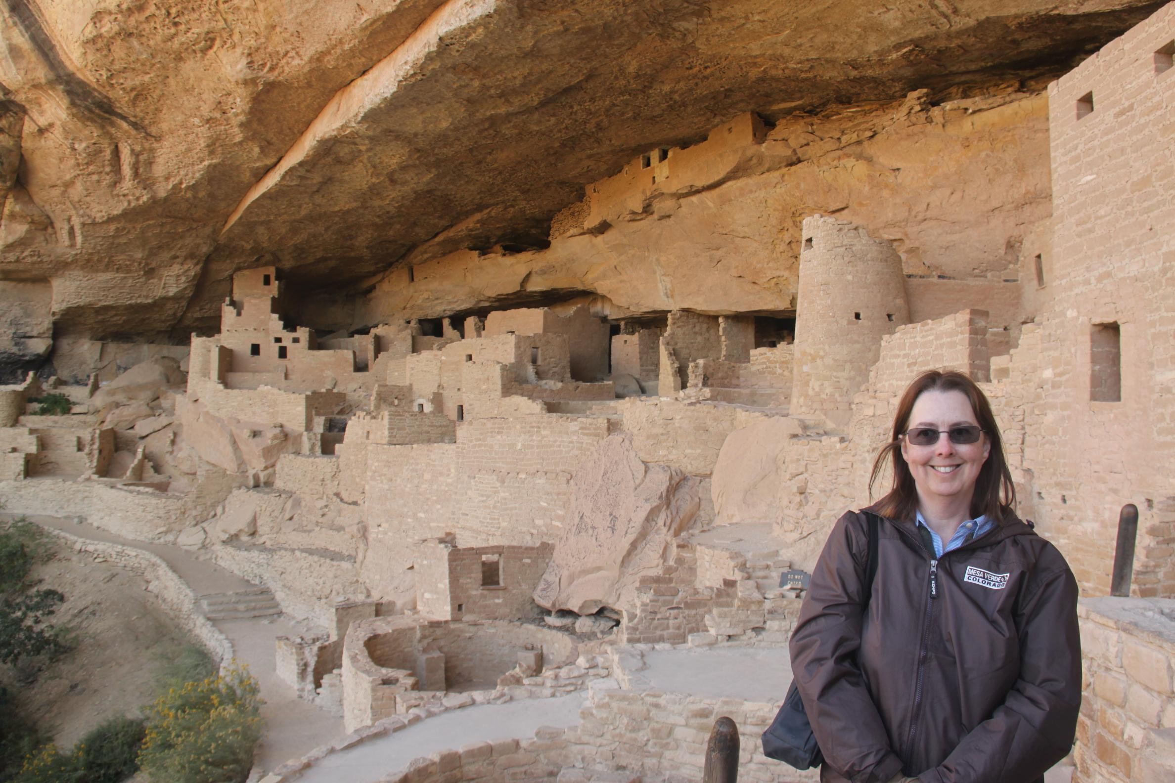
In the sixth century AD, the Anasazi, or "Ancient Ones," established villages on the high, flat land in southwestern Colorado. Mesa Verde contains the most complete record of Anazasi Indian culture in existence. Some 3,800 sites have been recorded, including one particular complex, today called the Cliff Palace, comprising more than 200 rooms.
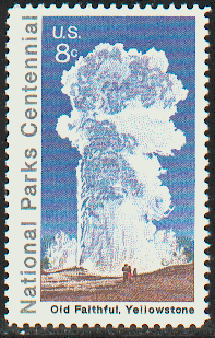
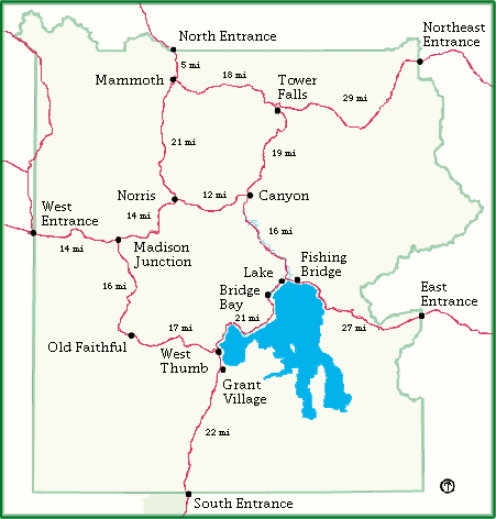
Yellowstone National Park, the world's first national park, contains 2.2 million acres packed with 10,000 thermal displays and an extensive array of wildlife, scenery and recreation opportunities. Mammoth Hot Springs and Old Faithful are two of the park's major attractions.
The everglades, or River of Grass as the Native Americans called it is formed by a river of fresh water 6 inches deep and 50 miles wide that flows slowly across the flat expanse of land at the southern tip of Florida. In 1947, the Everglades National Park was established and now covers 1.4 million acres. Being geographically at the meeting point of several climatic zones, a diverse variety of plants can be found from tropical palms and mangroves to temperate ash and oak, and even cacti and yucca. It is also home to several threatened species including the manatee.
The Declaration of Independence (1776) and the Constitution (1787) were signed in this Philadelphia building.
Redwood National Park contains the 3 tallest trees on earth. The giant redwoods, reaching 350 feet, now survive only in California and Oregon. Descendants of the giant evergreens that grew during the age of the dinosaurs, redwoods thrived in moist temperate regions of the world. They take 400 years to mature and some of the survivors are more than 2,000 years old.
Mammoth Cave National Park, with more than 345 miles of explored passageways, is the longest known cave system in the world.
Located 13 km north-east of St Louis, Missouri, Cahokia is the largest pre-Columbian settlement north of Mexico. It was occupied primarily during the Mississippian period (800-1400). It is an example of a complex agricultural chiefdom society, with many satellite mound centers and numerous outlying hamlets and villages. The site includes Monks Mound, the largest prehistoric earthwork in the Americas.
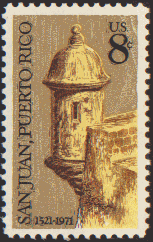
A series of defensive structures were built between the 15th and 19th centuries at this strategic point in the Caribbean Sea to protect the city and the Bay of San Juan.
Standing at the entrance to New York harbor, the statue was a gift of friendship from the people of France to the United States to commemorate the 100th anniversary of American independence. It was made in Paris by the French sculptor Frederic-Auguste Bartholdi, with help on the metalwork from Gustave Eiffel. It has welcomed millions of immigrants to the United States of America since it was inaugurated in 1866.
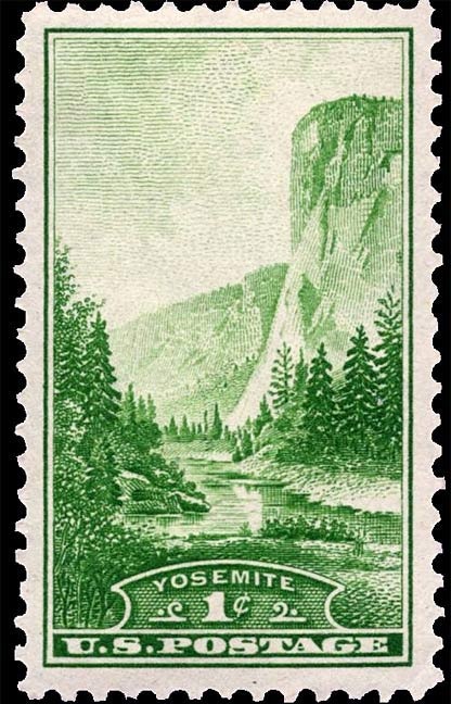
Yosemite is located in California's Sierra Nevada Mountains. Its hanging valleys, waterfalls, cirque lakes, polished domes, moraines, and u-shaped valleys offer a view of the many types of granite reliefs fashioned by glaciation. The alpine wilderness, groves of giant Sequoia trees and the specatcular valley landscape of Yosemite make it a pre-eminent natural marvel.

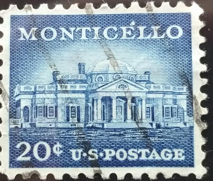
In addition to writing the American Declaration of Independence and being third president of the United States, Thomas Jefferson was also a talented architect of neoclassical buildings. He designed his plantation home, Monticello (1769-1809) and his ideal 'academical village' (1817-26) which is still the heart of the University of Virginia. Neoclassicism is seen in the relationship of the buildings with nature and the blending of functionalism and symbolism.
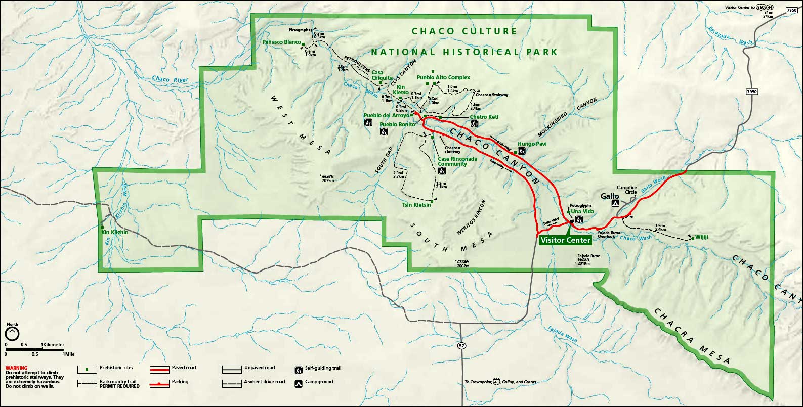
Nearly 1,000 years ago, Chaco Canyon was a center of Anasazi life. The Anasazi farmed the lowlands and built great masonry towns connected by a far-reaching network of roads.

This adobe settlement consisting of dwellings and ceremonial buildings represents the culture of the Pueblo Indians of Arizona and New Mexico.
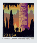
Southeastern New Mexico is famous for it's caverns and caves. Carlsbad Caverns National Park was established in 1930 and contains 46,766 acres of rugged mountain land and 80 caves. The park's most famous cave, Carlsbad Cavern, is one of the world's biggest underground caves. It has a mapped length of 27 miles. The cavern is decorated with stalagmites and stalactites, flow stones, columns and cave pearls, formations which began over 500,000 years ago. One of the largest chambers is called the Big Room. It is 1,800 feet long and 1,100 feet wide.
Papahanoumokuakea, in the north-central Pacific Ocean, is one of the largest marine protected areas in the world. It includes a linear cluster of islands, atolls, cays and pinnacles that lie to the northwest of the main Hawaiian archipelago. It covers an area similar in size to the US State of Montana. It is a mixed cultural and natural site that includes archaeological remains from the pre-European era, and embraces the living traditions of native Hawaiians who maintain shrines on some of the islands associated with the sacred realms of life and death.
A 19th century plantation gives its name to this site in the Lower Mississippi Valley. Earthen construction was created by a hunter-gatherer society between 3700 and 3100 BC.
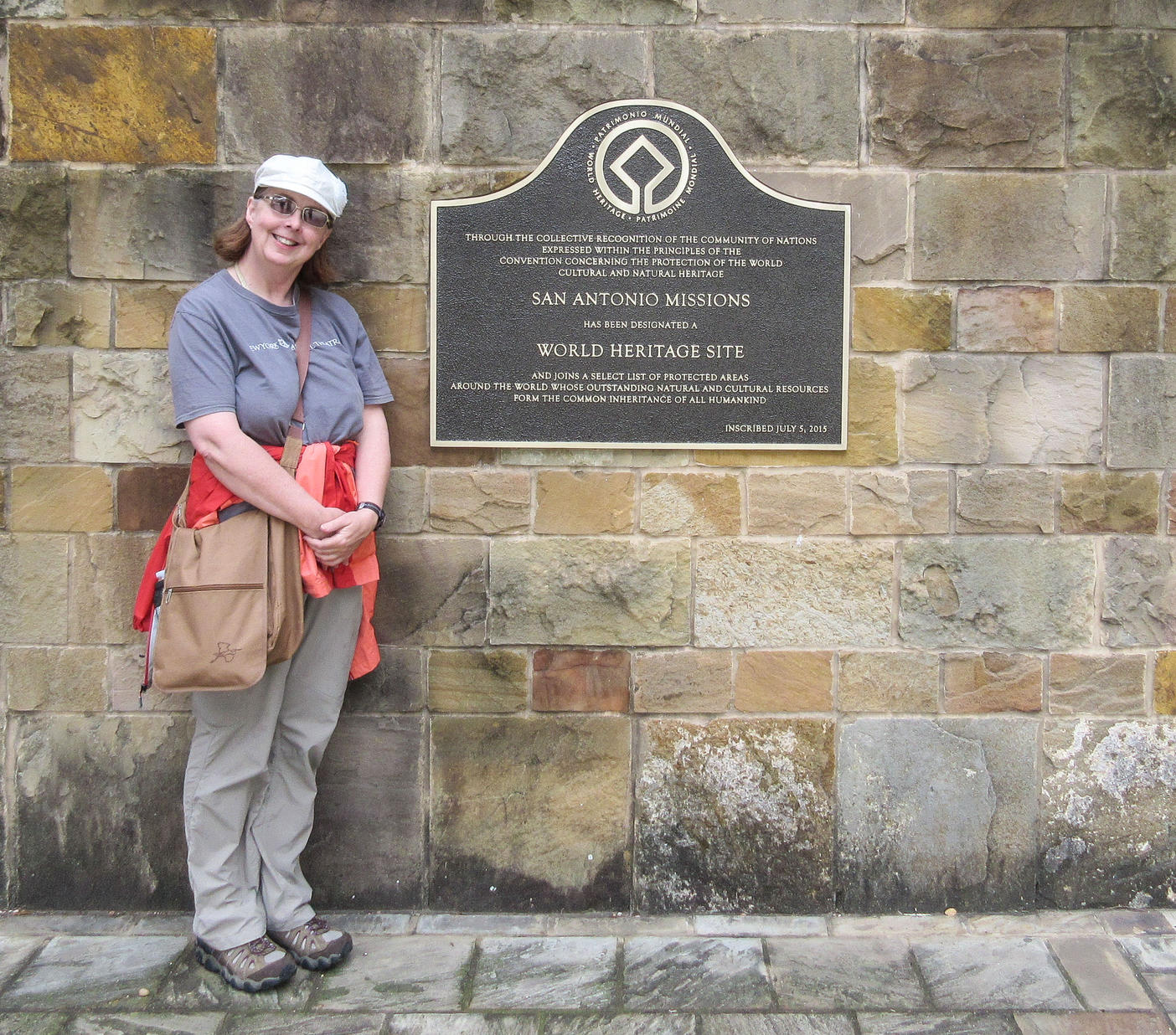
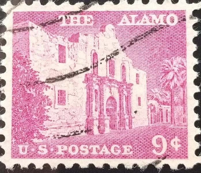
Five frontier missions situated along the San Antonio River basin in southern Texas built by Franciscan missionaires in the 18th century. The missions are: San Jose, Concepcion, San Juan, Espada and San Antonio de Valero, the latter is better known as the Alamo.
The property consists of eight buildings in the United States designed by the architect during the first half of the 20th century.
The earthworks are the largest set of geometric earthen enclosures in the world, many extending for hundreds of feet in the shape of circles, squares, or animals. Some are built in alignment with the movements of the sun and moon.
The eight sites include the Great Circle and Octagon Earthworks in Licking County, the Fort Ancient Earthworks in Warren County, and the Mound City Group, Hopewell Mound Group, Hopeton Earthworks, Seip Earthworks, and High Bank Works in Ross County.
(60.00 N 141.00 W) -- satellite image
UNESCO designated the following parks in the Yukon as a World Heritage Site. It is the largest internationally protected area in the world.
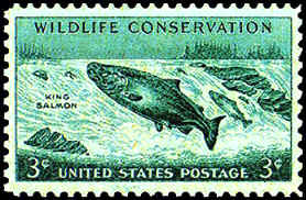
The Tatshenshini-Alsek river system contributes 95% of the chinook salmon, 90% of the sockeye salmon and 75% of the coho salmon for the multi-million dollar commercial fishing industry in the Dry Bay area of the Gulf of Alaska. This river system is one of only three major salmon-bearing rivers on the northern Pacific coast, with an important sustenance fishery for the people of the Champagne and Aishihik First Nations being found at Klukshu.
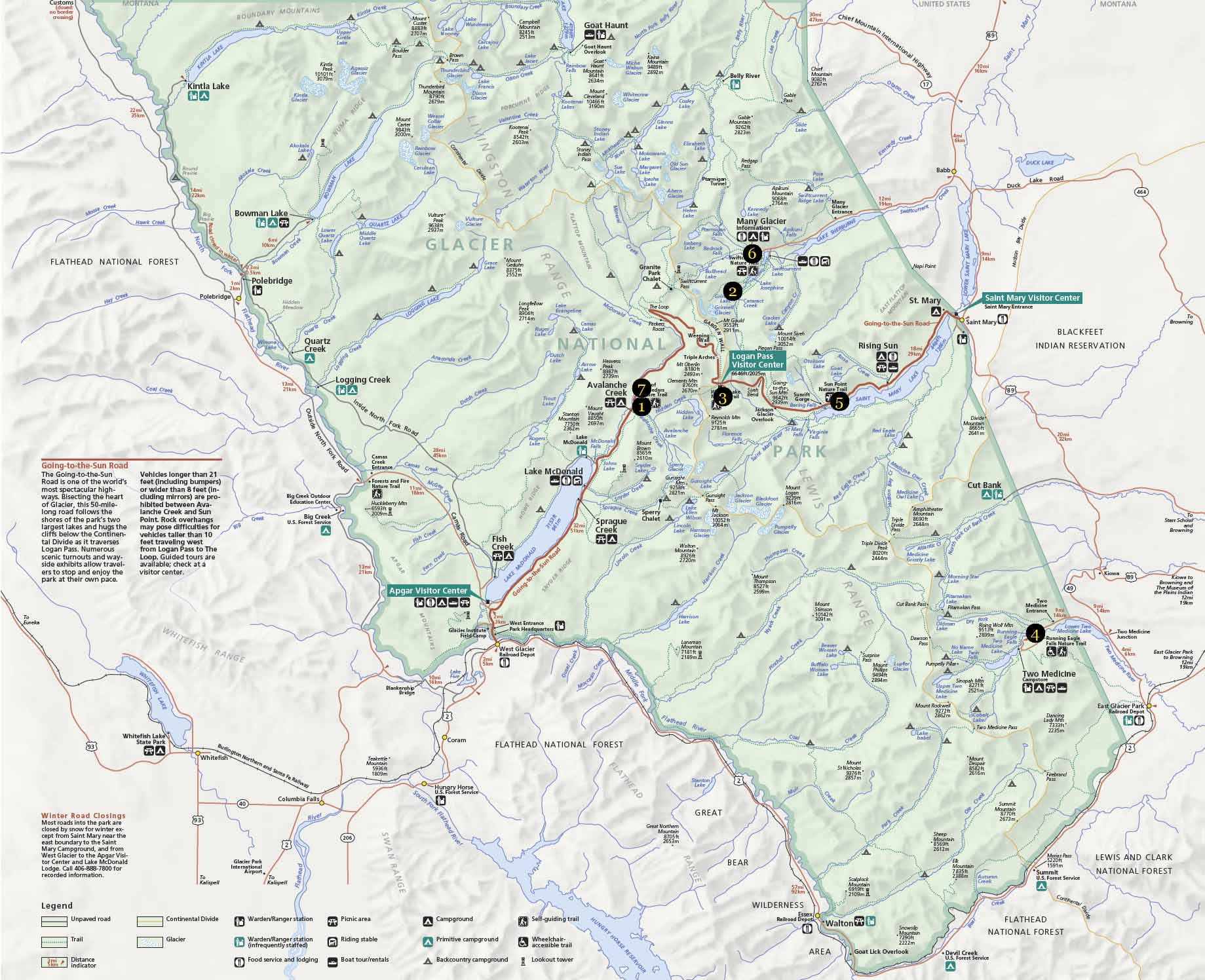
In 1932 Glacier National Park and Waterton Lakes National Park were designated by Canada and the United States as an "international peace park," the first such joint recognition in the world. With more than a million acres of forests, alpine meadows, lakes, and glacial-carved valleys in the Northern Rocky Mountains, the park is home an incredible variety of plants and animals. Over half of Alberta's plant species can be found in Waterton Lakes National Park, and Glacier National Park has a number of plant species that grow nowhere else.

Lynn Salmon <>{
Last updated: February 17, 2026