
One of Northern Ireland's greatest attractions is its spectacular landscape. Nicknamed onion-skins, the Giant's Causeway is an unusual mass of basalt columns packed tightly together. The sight has inspired legends of giants striding over the sea to Scotland.
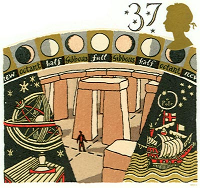
Stonehenge is a circular setting of large standing stones surrounded by an earthwork. It was built in stages during the Late Neolithic Period and Early Bronze Age (c. 3100-1500 BC) and located approximately 13km north of Salisbury, England.
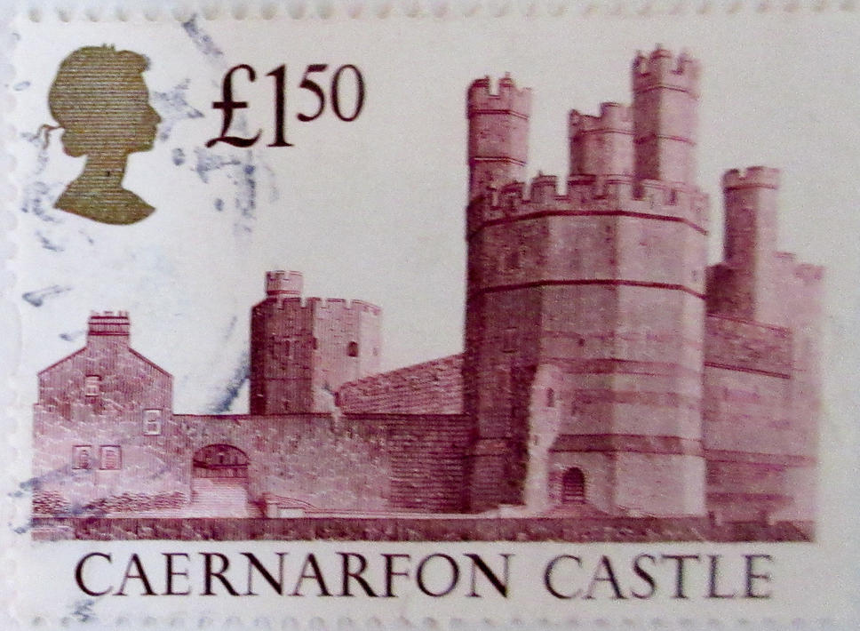
Several works carried out during the reign of Edward I, king of England (1272-1307) include the castles of Beaumaris and Harlech, and the fortified complexes of Caernarvon and Conway.
The archipelago of St. Kilda is situated in the North Atlantic 115 miles (185 kms) off the mainland of Scotland. The archipelago comprises the four islands of Hirta, Dun, Soay and Boreray and the sea stacs of Stac an Armin, Stac Lee and Levenish.
St. Kilda contains magnificent sea cliffs, teeming sea bird colonies, and remains of past human settlement. The largest colony of gannets in Europe breeds on Boreray and its stacs and there are large numbers of guillemots and kittiwakes. The most numerous bird is the puffin. Humans inhabited St. Kilda for more than 2000 years. The population was evacuated at their own request in 1930.
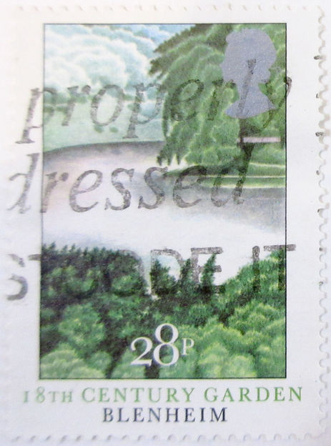
Blenheim Palace is in a romantic park near Oxford. It was created by the well-known landscape gardener "Capability" Brown and given by the English nation to John Churchill, first Duke of Marlborough, in recognition of his victory in 1704 over French and Bavarian troops. Built between 1705 and 1722, characterised by eclectic inspiration and a return to national roots, it is a perfect example of an 18th-century princely home.
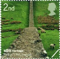
Built in about 122 A.D. under the orders of Roman Emperor Hadrian. The 118 km long wall is on the border between England and Scotland.
The listing was extended in 2005 and now includes two sections of the border line of the Roman Empire at its greatest extent in the 2nd century A.D., part of what is known as the Roman Limes. (see German Frontiers)
 [Henderson Island Page]
The Tower of London was begun in 1078 by William the Conqueror. Successive monarches added towers, walls and a huge moat over the centuries. It was here that traitors were brought to be executed, via the traitors gate by boat from the Thames, before being beheaded.
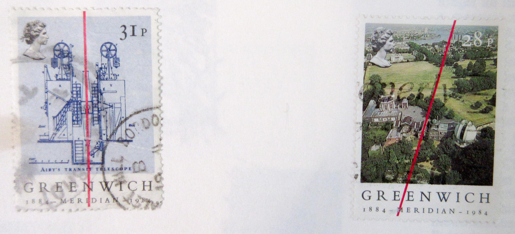
The collection of buildings at Greenwich, near London, are distinguished symbols of English artistic and scientific endeavour in the 17th and 18th centuries. The Queen's House of Inigo Jones was the first Palladian building in the British Isles, and the complex housing the Royal Naval College was designed by Christopher Wren. The Park contains the original Royal Observatory and the prime meridian line of longitude runs through it.
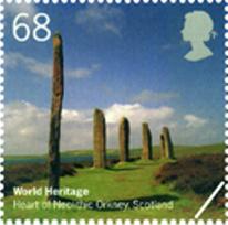
The group of Neolithic monuments on Orkney consists of a number of sites dating back five thousand years, including: Maes Howe, a large chambered tomb, the Stones of Stenness and the Ring of Brodgar, two ceremonial stone circles, and the settlement of Skara Brae.
Near Cromford, the modern factory owes its origins to the old mill (1771) where Richard Arkwright first used water power for a cotton mill.
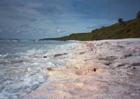
The cliff exposures along the Dorset and East Devon coast include rock formations spanning the Mesozoic Era, some 185 million years of the earth's history. The area's important fossil sites and classic coastal geomorphologic features have contributed to the study of earth sciences for over 300 years. satellite image
Founded as cotton-spinning center by David Dale & Sir Richard Arkwright, inventor of the spinning frame in the 18th century, the town became known for its advances in working conditions stimulated by socialist Robert Owen.
Originally listed in 2004, Liverpool was stripped of its World Heritage Site status in July, 2021. The UNESCO World Heritage Committee decided that the city should be removed from the list due to developments on the city's waterfront which had resulted in "irreversible loss of attributes". Developements at the Liverpool waterfront such as the construction of the Bramley-Moore Dock Stadium were said to be destroying the heritage value of the waterfront.
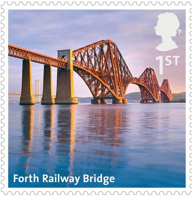
Openining in 1890, this railway bridge spanning the estuary of the Forth River in Scotland, was the world's earliest multispan cantilever bridge.
This site, located on the Mediterranean side of the Rock of Gibraltar, covers a landscape of cliffs and caves that show extensive evidence of the Neanderthal way of life.
The English Lake District, located in northwest England, is a mountainous area, whose valleys were molded by glaciers during the Ice Age and subsequently shaped by an agro-pastoral land-use system characterized by fields enclosed by walls. The combined work of nature and human activity has produced a harmonious landscape in which the mountains are mirrored in the lakes and has been celebrated in paintings, drawings and words.
Located in a rural area of northwest England, free from radio interference, Jodrell Bank is one of the world's leading radio astronomy observatories. At the beginning of its use, in 1945, the site housed research on cosmic rays detected by radar echoes. This observatory, which is still in operation, includes several radio telescopes and working buildings.
This joint listing comprises 11 towns, located in seven European countries. All of these towns developed around natural mineral water springs.
The most outstanding example of an actively accumulating blanket bog landscape. Located in the Highlands of Scotland.

Last updated: July 26, 2024