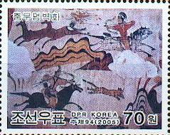


This listing includes 12 separate components from the Koryo Dynasty (10th to 14th centuries). The monuments inscribed include an astronomical and meteorological observatory, two schools, palaces, a tomb complex, defensive walls and gates and commemorative steles.

Built in the eighth century on the slopes of Mount T'oham, Sokkuram Grotto is one of Asia's finest Buddhist shrines. Sokkuram is an artificial structure built around a dome and comprised of stone structures of circular, triangular, hexagonal, and octagonal shapes, which required a high degree of mathematical and engineering knowledge. Today, to protect the treasures, a glass wall prevents visitors from entering the grotto and walking around the great Buddha.
The Temple of Haeinsa was originally built in the third year of King Aejang (800 - 809) of Shilla and has survived many fires and subsequent reconstructions. The temple is well known as the depository for the Tripitaka Koreana wood blocks. This is not only the oldest collection of Buddhist canons but it is also renowned for its accuracy and refined calligraphic style. The 80,000 wood blocks used to print the Tripitaka Koreana were carved in the thirteenth century to replace an earlier set which were lost in a fire during the Mongol invasion of Korea in 1232.
Located in Seoul, Chongmyo (Jongmyo) is a heavily wooded garden with buildings containing the royal ancestral tablets of the Choson Dynasty. On the first Sunday in May, the courtyards and shrines of Chongmyo are opened to the public for an annual Confucian ceremonial rite, one of the most interesting ceremonies in Korea.
Located around Suwon The Hwasong Fortress in Suwon is a 3.2 mile (5.4km) fortress made of stone reaching from Mt. P'aldalsan to the west.

Sometimes spelled Kyongju. The former capital of the Shilla Kingdom includes dozens of historical sites. One of Korea's most well known is the stone structure of Cheomsongdae, an ancient astronomical observatory. It was built during the reign of Queen Ssondeok in 634.
This shield volcano is about 1.2 million years old and rises to 1,950 meters with Mt. Hallasan, Korea's highest peak. The Geomunoreum lava tube system is very impressive and includes a spectacular array of stalactites and stalagmites.
This is a collection of 40 tombs built over five centuries from 1408 to 1966. In addition to the burial mounds, associated buildings that are an integral part of the tombs include a T-shaped wooden shrine, a shed for stele, a royal kitchen and a guards’ house, a red-spiked gate and the tomb keeper’s house. The grounds are adorned on the outside with a range of stone objects including figures of people and animals.
Located in a mountainous site 25 km south-east of Seoul, Namhansanseong was built by Buddhist monk-soldiers and served as capital for the Joseon dynasty (1392-1910).
Eight archaeological sites dating from 475 to 660 BC.
Seven temples comprise the site, established from the 7th to 9th centuries. These temples present common characteristics that are specific to Korea: the "madang" (open courtyard) flanked by four buildings (Buddha Hall, pavilion, lecture hall and dormitory).
This property includes archaeological cemetery sites with burial mounds attributed to the Gaya Confederacy, which developed in the southern part of the Korean Peninsula from the 1st to the 6th century.
Lynn Salmon <>{
Last Updated: July 24, 2025