Midnight Sun 2012: Warming the Arctic Chill


Midnight Sun 2012 Photos


by

John and Lynn Salmon -- July 2012

ARRIVAL in OSLO (Saturday, July 7)

It's smooth sailing - no traffic at all to the airport - plus an on time departure and we are off to a great start. At the gate while waiting to board, we see a two-year old standing on a window sill about 5 feet off the ground watching the planes. Mom is clearly aware and clearly unconcerned. This must be how Parkour runners grow up.

We arrive very tired in Oslo, but it's easy to head straight into the Centrum via the Flytoget train despite current construction that has shut down the Oslo central train station for a month. They've got it covered with shuttle bus service that efficiently fills in the gap and we walk a few blocks to our hotel, the Thon Panorama.

Our hotel is a "Thon Junior" and the guy at the front desk tells us that he's wearing a sombrero because they specialize in catering to young guests. We wonder whether we'll be sharing a floor with a Norwegian cub scout troop, but it turns out to be nothing like that. There's a second buffet table at breakfast at about half-height, and there's a ping pong table in the lobby. Otherwise it's a standard-issue Thon hotel. There are families with kids, but it's not Chuck-e-cheese. Ty Pennington was also name dropped during check-in. He had been on Norwegian Design Tour and may have even stayed at our hotel.

Our room has a kitchenette. This comes in handy for weary jet-lagged travellers who want to take a nap without fear of waking up and missing dinner. We stay awake long enough to make a trek to the super market, return to the room and go soundly to sleep. We wake up surprisingly refreshed, shower, and cook some pasta (after googling for the stove manual to figure out how to operate it).

It's 9pm. It's still daylight (gray and overcast, but daylight!). We head out to the opera house. It's a very cool 2008 building. Normally, the big attraction is the roof, but today there's a TV talk-show being recorded harbor-side in the front courtyard. One of the Jackson clan reminisces in English about The Michael. There's another guy on the couch with him. We watch for a few minutes and then go inside.

The "wave wall" is like an organic, wooden Guggenheim. Very cool. We even get a decent photo. Most of the posters are for a production that's coming in September, so we don't pay much attention. But we notice that there's a "dance inspired by ping pong" coming at the end of July which we just might be able to catch. We'll see.

The roof is very cool and probably couldn't exist in the USA with our liability laws. There are steep slopes randomly intersected with long diagonal, variable-height "steps". There is no bright yellow tape or "friction tape" to mar the aesthetics. If it makes you nervous, there's a marble stairway, deftly hidden below the deck level on one side. It's only dangerous if you don't pay attention (or if you are on a skateboard!). There are signs forbidding skateboarding. We do *not* see large numbers of surly teens on skateboards, but there is one kid with his parents. He never gets up to excessive speed, and he seems in less danger (and less a danger to others) than the photographers who are blindly stepping forward and back to perfectly frame their shot. There are some aluminum panels with random bumps and balls. It looks very much like Stephen Holl (as does the lobby opposite the "wave wall". All in all, we really enjoy our hour at the Opera House and find our first Norwegian geocache.

It's still light at 10:30pm. So we walk through the center of town. Lynn finds an earth cache near the cathedral. It involves finding the Nordmarkitt Lions and learning about the quartz content of granite. It's beginning to get dark. We walk a ways further, through a park, and alongside some fountains and ponds and head back to the hotel past the grounds of the Akershus Fortress. To bed around 1:30am. It's finally dark out!

OSLO (Sunday, July 8)

Sunday begins with a buffet spread that has everything one could want in a breakfast: 3 kinds of eggs, bacon, sausage, meatballs, and that's just the warm area. There are lots of cold meats, with pickled herring, cheeses, including a brown kind I didn't care for, some good dark bread, croissants, waffles, cereals, fruits, yogurts, juice, coffee, plenty.

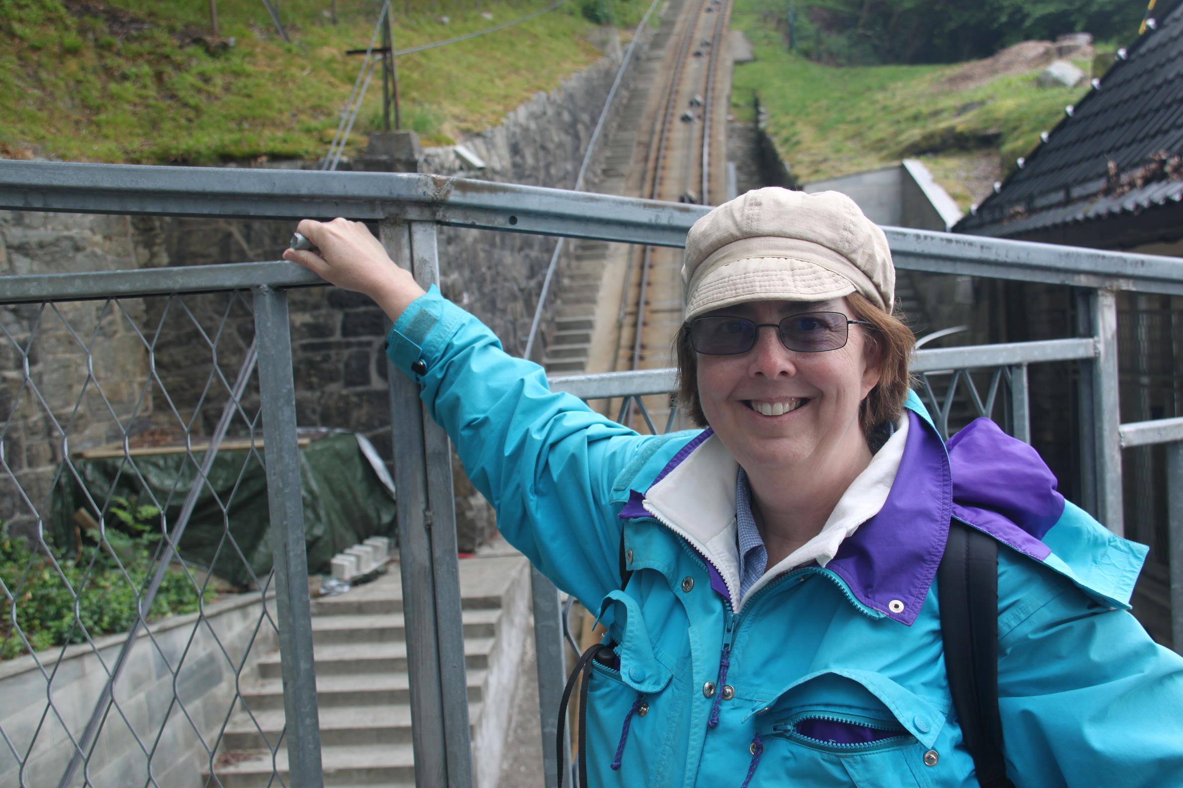
After breakfast we walked to the ferry for Bygdøy with a brief side trip to get money from an ATM and arrived just in time for a ferry departure. 
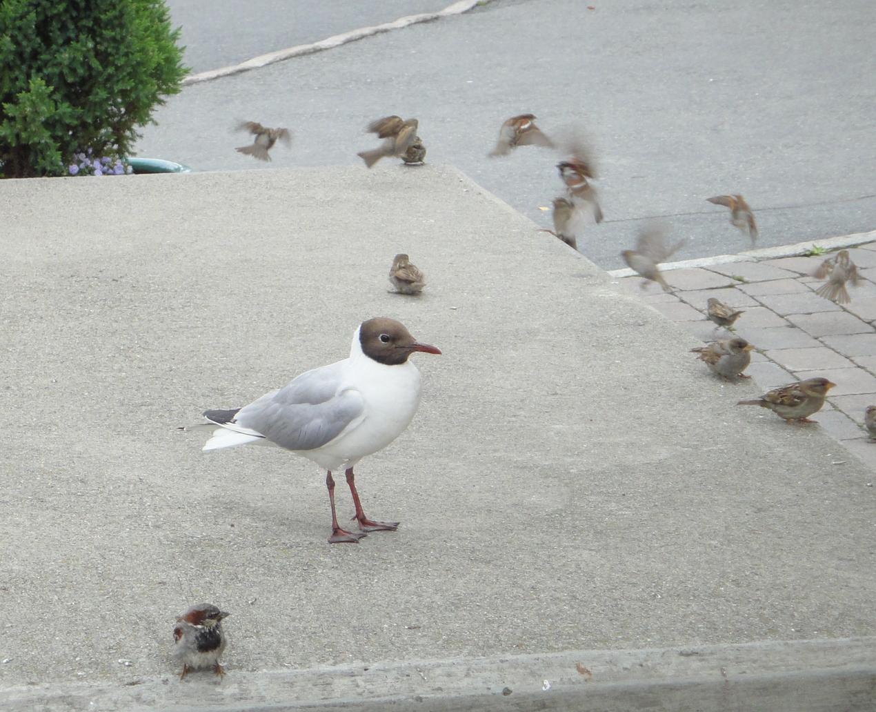
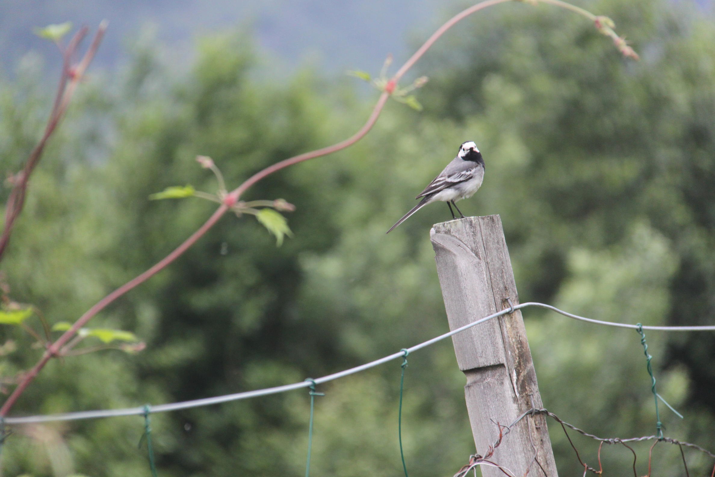
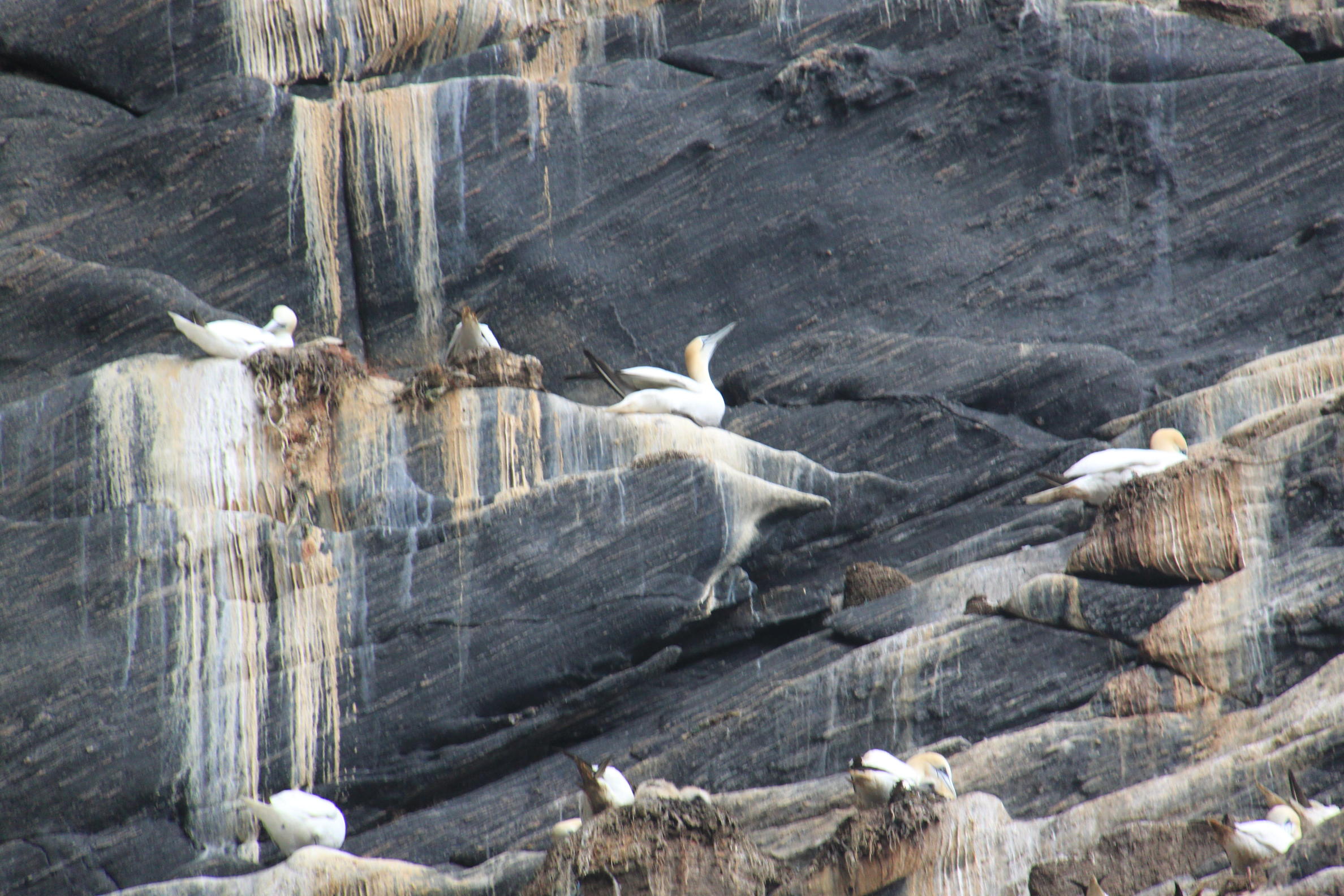
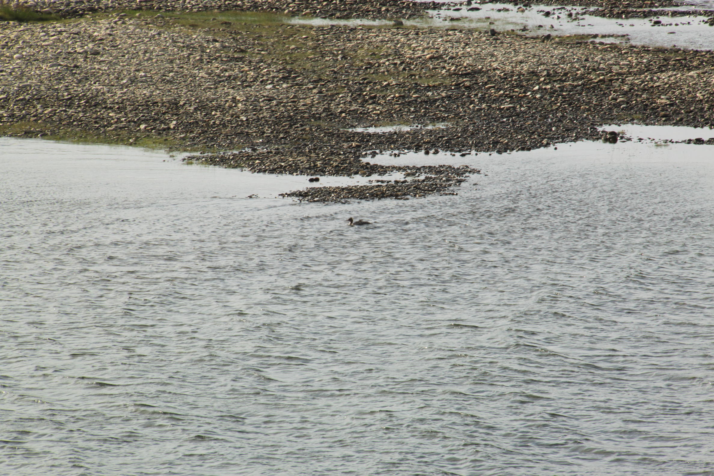
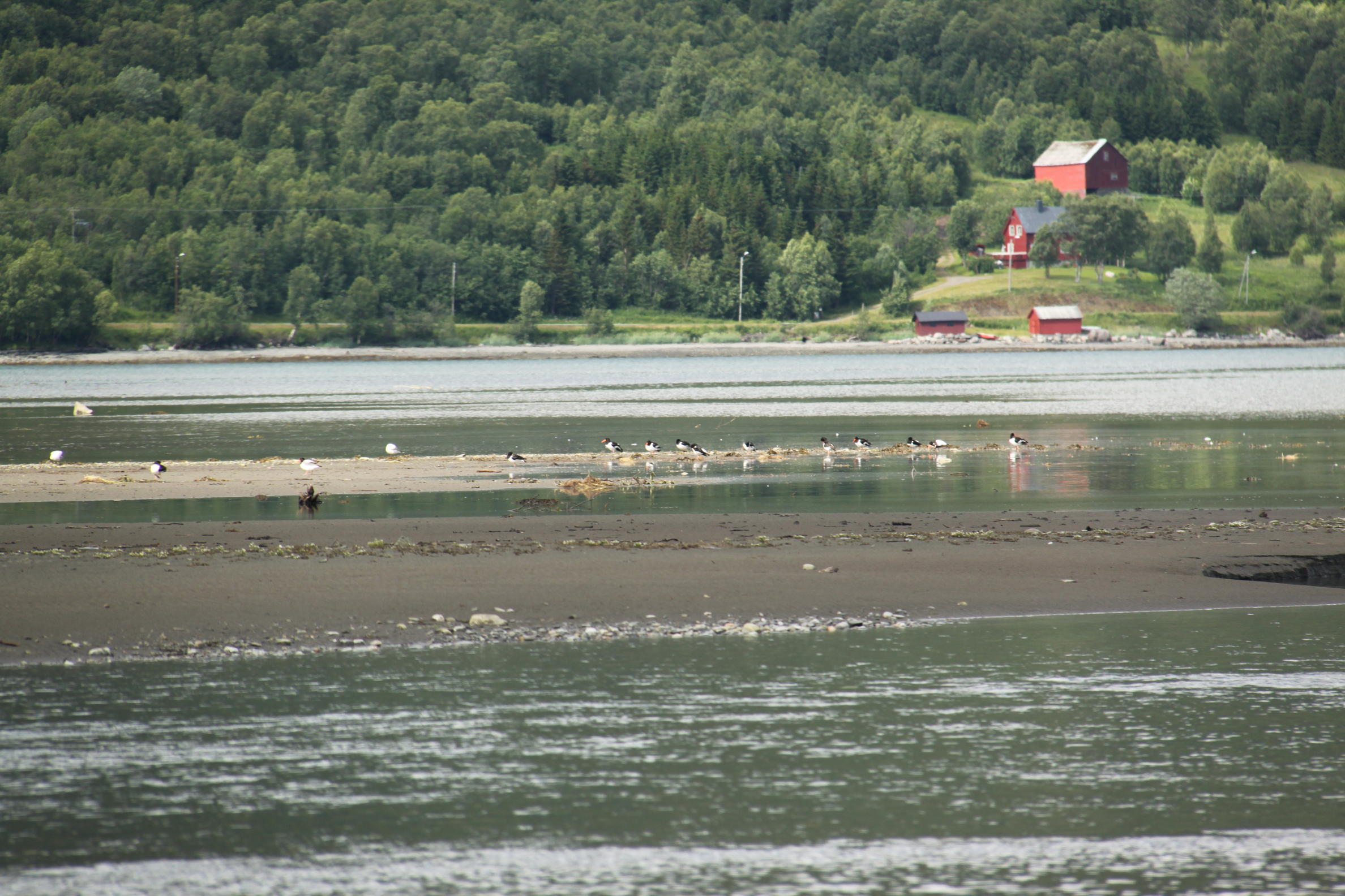
We see some ducks from the boat, but we can't identify them. They could be female mallards (boring). John sees a black-headed gull, which we later get a very close look at near the food cart outside Kon-Tiki museum. We ultimately add quite a few birds to the Salmon Bird List during this vacation. Pretty easy when the life list is as short as ours!

After a 15 min boat ride to the Bygdøy peninsula followed by a short walk, we get to the Viking Ship Museum early. The museum was pleasantly empty with just a handful of folks from the morning ferries. A couple of tour buses arrived as we were finishing up, and the place filled up fast. The Viking Ship Museum has three Viking ships recovered from burial mounds in the late 1800s and early 1900s. The oldest known Scandinavian ship, The Oseberg Ship built about 820 AD is front and center in the inviting museum space. The ships are in remarkably good condition. Why doesn't wood rot here? Were they in a peat bog? Anyway, they are very broad and shallow. They don't look at all like ocean-going vessels. Some signage by the Gokstad Ship indicates that the Oseberg wasn't really a robust sailing vessel, whereas the Gokstad which was a little deeper and had wooden covers for the oar-locks, was definitely used at sea before being buried with a chieftain. The Vikings used a lot of iron nails to hold everything together. We take plenty of pictures, including some shots of the "mast fish".

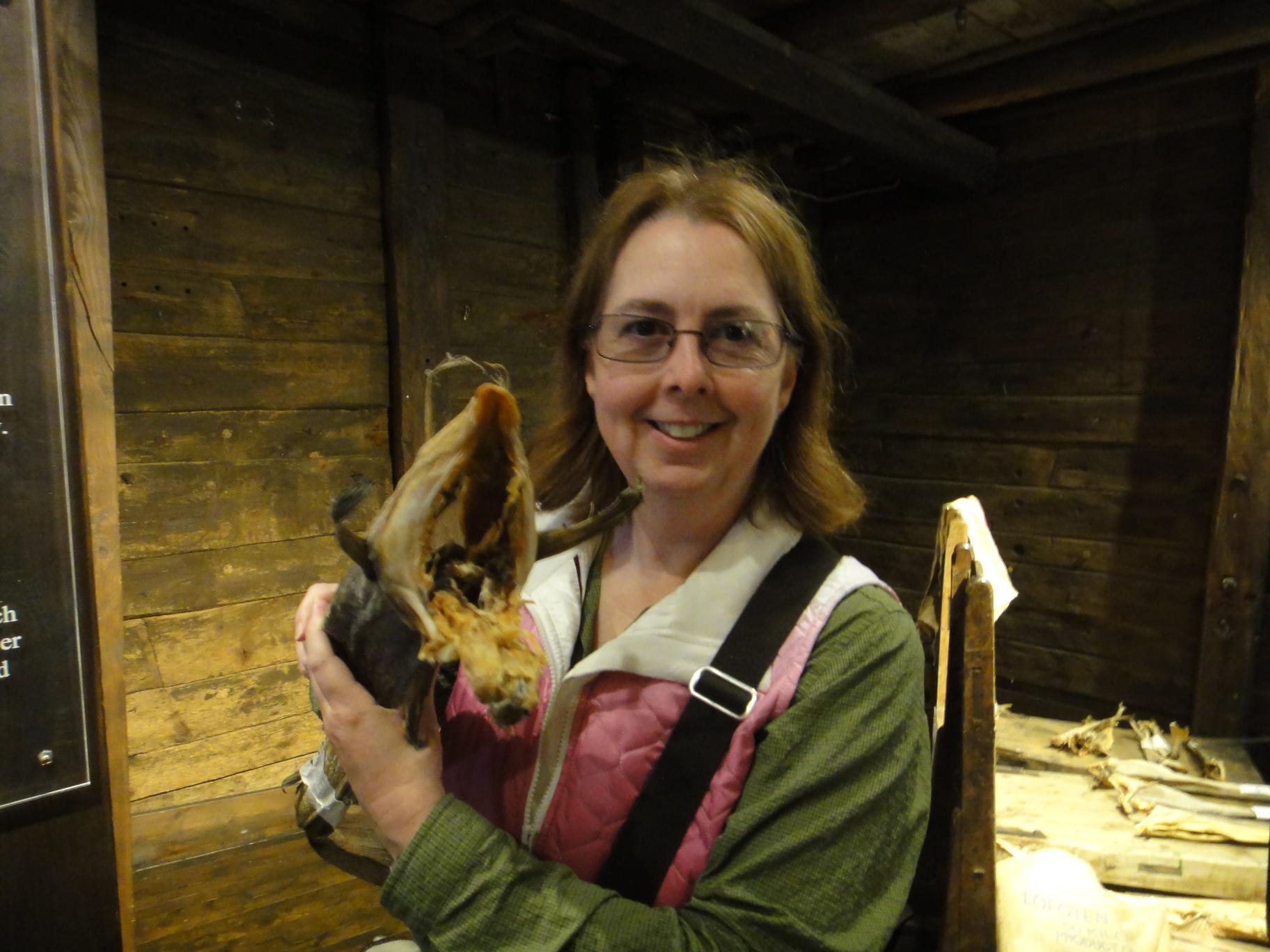
Next stop is the Kon-Tiki museum. We have some familiarity with Thor Heyerdahl's hi-jinks from reading we did before visiting Easter Island a couple of years ago. We begin with Ra II (Ra 1 sank off Barbados). Ra 1 was built by Chadian boat-builders using techniques that work on Lake Chad. Ra II was built by Aymara Indians from Bolivia (near Lake Titicaca) using South American techniques. For whatever reason (luck, a bit more experience) the second Ra reed boat was less prone to water-logging, and able to finish its journey. Photos show it in a bit of a shambles by the end of the voyage. It's been spruced up for display at the museum.

Thor Heyerdahl is quite the character. He must have been incredibly charismatic to successfully get funding and volunteers for such quixotic endeavors. While he certainly showed that Africans could have made the journey to the new world, and earlier showed that Americans could have made the journey to Polynesia, he never really came close to showing that they did. But so what? He went on an adventure! He brought cameras, and a gift for storytelling. He wove a story of international cooperation (during the height of the cold war) and of environmental degradation (when it was still a relatively new idea) into a classic man vs. nature and man vs. man (those stick-in-the-mud academics who said it was impossible). Those messages were worth getting out, even if the ostensible rationale for the trips was proved wrong.

Between the Ra II and Kon-Tiki exhibits there's a brief early biography of Thor, where we follow him and his wife to Fatu Hiva in the Marquesas. Here as a honeymoon trip, they lived off the land for a year in the 1930s. About 10 panels show them collecting specimens, meeting with local tribesmen, and seeming successful in idyllic surroundings. Toward the end of the display, we read something about beer and the couple being driven from their home, living in a cave, and sending out distress signals so they could be rescued by a passing ship. There's definitely a story there. I wonder if it's ever been told. Yes, there is a book.

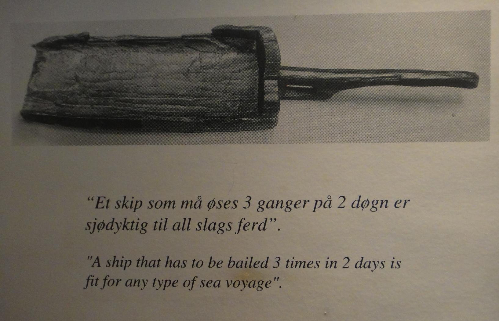
The Kon-Tiki looks way less sea-worthy than the Viking ships. I doubt that it satisfies the Viking motto: "A ship that has to be bailed 3 times in 2 days is fit for any type of sea voyage". We need to see the 1951 academy award winning documentary.

We just miss a ferry as we step out of the Kon-Tiki Museum, and decide 
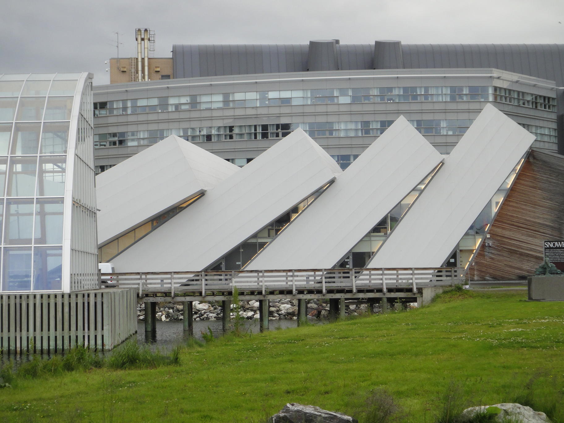
to pay a visit to the Polarship Fram Museum. In the end, this is probably the best museum visit of the morning. The museum is built around a big, BIG, ship, called, you guessed it, The Fram. The surrounding museum building is 3 levels and has walkways around all sides of the ship with exhibits lining the walls. One can also go in and wander inside the boat, also about 3 levels deep.

The organization of the museum was a bit confusing. The "start" seems to be in one corner up on the third floor. Though "start" is only relevant for looking at the displays in some sort of chronological order. We wandered around going backwards and forwards in time and exploring the internals of the boat before discovering the "start" and then viewing things in order from there on.

The first captain of the Fram was Fridtjof Nansen. Nansen was multi-talented, a scientist, explorer, champion skier and ice skater, and practical dresser when it came to cold climates. He had an inspiring motto, "The west coast or death" which is a bit more serious than the Salmon motto, no luden in scalas. It seemed to work for him. His back-story is much like Heyerdahl's. Nansen had a theory about how the arctic ice flowed west-to-east. The scientific community scoffed. So he had a super-strong ship built, plunged it into the ice north of the Bering strait, and sat it out for 3 years. Eventually, the ship made it out and returned to Tromsø. Nansen got bored half-way and struck out for the pole. His watch failed, so he couldn't get a latitude, and he turned back before making the pole. He set up camp on one of the Russian arctic islands, where he accidentally ran into an English explorer who gave him a lift home. It helps to be lucky!

Next, Roald Amundsen takes the helm of the Fram with plans to go to the North Pole. But Cook and Peary each get there first. So Amundsen secretly(!!) decides to go to the South pole instead. He brushes off questions like "Why are you taking dogs. You can get them in Russia" and "Why are you building this really sturdy hut?". He doesn't tell the crew they're going to the South pole until they leave from Spain. I guess they notice the ship hung a left instead of a right. Does anybody else know? It's not clear when the news gets back. Does Scott know that there's a race to the South pole? As we know, Amundsen wins the race. Scott reaches the pole second, dies on the return journey, and became an iconic British hero. A corner of the Fram Museum is devoted to the Robert Scott story.

This time when we left a museum, we were perfectly timed for the next ferry. We take the boat back and grab a small lunch at a harbor side cafe. Lynn orders cafe au lait, which comes in a soup bowl. We pass a street performer trying to drum up an audience and loiter for a bit as he desperately tries to get others to stop.

Next stop, the modern art museum, where there's an exhibition of the kind of geometric art that always appeals to us. It's called, The Space of Shape-Time. Perhaps this theme will be a successor to Not Quite as Big Bamboo. Lynn suggests doing it in the yard rather than indoors, which seems feasible. One of these days, we'll actually do that.

Other exhibits include a Spirograph-style crawling-men-with-guns, with plotting pens under them contraption which is pretty cool. We're also struck by the juxtaposition of the ornate old building and the modern white-box style of gallery. The hallways are a very textured brick with occasional marble flourishes. The galleries are all-white. One of the downstairs galleries has gold plated marble columns, paintings on the ceiling and general 19th century opulence, but holds geometric steel and enamel paint sculpture. I'm not really sure the juxtaposition "works". Was the building some kind of bank or mint in a previous life? The coat check room looked like a vault.

We eat dinner at Cafe Skansen. John orders classic Norwegian style shrimp with lemon, dill and mayonnaise. A ginormous plate of unshelled shrimp comes. He asks the waitress who demonstrates the traditional way to eat them. Spread mayo on bread. Remove head, tail and shell and pile shrimps on bread. Add lemon juice to taste. Eat. They're very tasty, but 
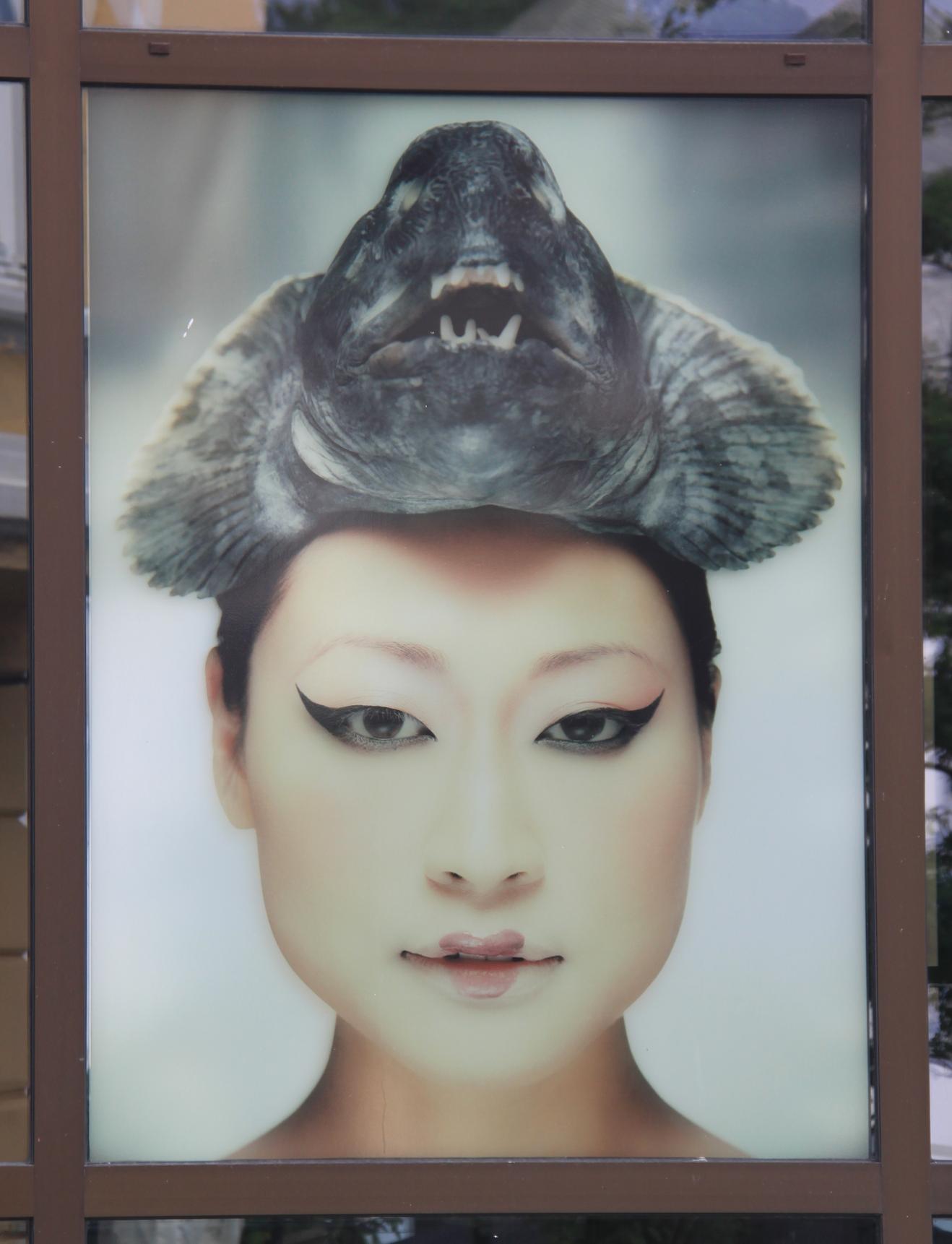
quite a bit of work. Lynn finishes her cat fish and sits patiently while John slowly works his way through the shrimp.

IN TRANSIT (Monday, July 9)

We get up at about 3:30am, partly from jet-lag, partly because the sun is up. It's very bright (gray, but bright).

We spend this day on various trains and buses as we make our way to Ålesund. It begins with a 7:37am departure from Oslo by train to Dombås. The train is spacious and comfortable and five hours slip by as we watch a very green landscape of rolling hills, pastoral scenes with farmhouses and cows, pine forests, and rushing rapids pass by. And this is not yet the "scenic" train. Trampolines seem to be a prominent fixture in people's yards, more common than swing sets or slides.

In Dombås, we disembark, cross to the opposite platform, and board the Rauma Railway for a scenic 1.5 hour journey. The Raumabanen is an engineering marvel with fancy into-the-rock switchback turnarounds. You go in one end of a tunnel and when you come out, the river is now on the other side of the train. Sheer mountain precipices and little waterfalls dot the landscape. In addition, we are passing by the River Rauma - a famous salmon river! The only downside is we're a bit too tired to fully appreciate how pretty it is.

We arrive in Andalsnes at 1:57pm and catch a 2:00pm bus that takes us to our final destination, Ålesund. Ålesund is a pretty sea side town and a good jumping off point for visiting fjord country. We have mixed feelings about our accommodation at the Hotel Quality Waterfront. It tries to be ultra-modern which translates to uncomfortable.

GEIRANGERFJORD (Tuesday, July 10)

We visit our first World Heritage Site of the trip - Geirangerfjord, which is listed with Naerøyford as part of the West Norwegian Fjords World Heritage Area. We board the Hurtigruten Ship, Richard With, for a 4 hour cruise and join the crowds scrambling for seats in the panorama lounge. See the route the ferry takes from Ålesund through the Storfjord and Synnylvsfjord before passing through World Heritage Geirangerfjord and stopping in the small village of Geiranger.

There are low clouds for the whole trip. We pass down increasingly narrow channels. The view out the windows is nice, but lacks grandeur. Some of the sights along the way include the pizza factory of the town of Stranda and a quarry that produces a lot of olivine which has a high specific weight and is used for insulation. Boredom sets in after a couple of hours, and we can't imagine taking a cruise that lasted for days.

Fortunately, John takes a walk outside and is immediately struck by the grandeur. We move to the rear deck without a roof to block the view. Now it is clear why this is a must see destination. Even with the low clouds it's very impressive. There are lots of shear cliffs and waterfalls, some tiny and some real cataracts, some are hundreds of meters high. It's all green (vegetation) gray (granite) and blue (water).

We arrive at the Geiranger Quay and take a LONG time to get off the ship. Passengers are loaded into a smaller tenders and ferried to the dock in small groups. Our planned 4.5 hour walk is cut to about 3 hours and we study the aerial map at the visitor center to figure out which walks are likely doable in that time frame and pick out a set of trails to follow that will lead to Mt. Vesterås.

We find a trail leading away from a bend in the road. This must be the start. We follow. It sure looks like it is going through people's back yards. There is a gate. Does it lead to someone's yard? Not quite. There's a wire fence separating the trail from the back yard. We come to a field. The aerial photo showed the trail following the outline of a field. We're in a field near a farmhouse with no sign of a trail. Lynn announces we are lost.

But we are not lost. We're following the map perfectly, even though it doesn't look like very many others have come this way. We lack the courage of our convictions, though, and leave the farmer's field for a road, which takes us past the very nice Union Hotel (think Falling Water), and the UNESCO information center. After a hundred yards or so, we finally see the kind of well-signed trail-markers that we were expecting. We head toward some that are marked as blue (easy), and range from 2.2 to 4km. We figure we can get to 2.2km, and still have an easy walk back in time for the bus that will return us to Ålesund.

We're now hiking a slightly muddy, occasionally steep uphill trail. We see a couple of birds (one we identify later as a European robin). We cross some streams/waterfalls including Mork and Mindy Falls. And we go up up up. Eventually, we pass through a gate ("Please close the gate behind you") and encounter some pretty deep mud. We can see a lookout point some distance above us, but it's pretty clear that we're going to slip and fall at least once on the way there and cover ourselves in mud for the rest of the day. We have terrific views from where we are - heading up another 50 vertical feet isn't going to make that much difference. So we take a few more photos and start back. The way back is easier than we feared (sometimes going down a slippery slope is slower than going up). We stop in at the UNESCO center, and thumb through a book on Geiranger's wildlife, where we identify the European robin and one of the wagtails.

We're back in town with a few minutes to spare. The bus is a few minutes late. The same Chinese threesome that we've been seeing since Dombås is on the bus with us. The bus trip back to Ålesund turns into a sequence of bus, ferry, bus, change bus for the final stretch into town. At some point, we lose the Chinese threesome -- we couldn't have left them back at the bus change point, could we??

We're very hungry, and it's getting late. Lynn has the bright idea to stop at the fish and chips kiosk at the head of the canal near the bus station and on the way to our hotel. We have a really excellent fish and chips. Food in Norway is expensive, but at least it has been uniformly excellent. $35 is a lot to pay for fish and chips (for 2), but at least it's really tasty!


ALESUND (Wednesday, July 11)

We plan for a very long day. After we check out of our hotel, we have no accommodation until after midnight when we get on the Hurtigruten Coastal Ferry to Bergen. Our first stop is the 62o Nord office, where we reserve the last two spots on the 2pm bird safari boat. We got very lucky here because if it had been full, or if the weather had been bad, we would have been disappointed.

Before the boat trip, we have time to hike up Aksla hill, a viewpoint overlooking the town. It's 418 steps to the top, so it's a nice little exercise for the legs. About half way up, we stop for a geocache at a landing where a family is sitting (man and woman, baby and dog). The woman unobtrusively wanders off about 10 steps up and then comes back. After they leave, Lynn unobtrusively wanders about 10 steps up and finds the cache. We think the family may have been geocaching, but we weren't certain at this point.

When we reach the top, we find another geocache at a great view point and sit near it. The man from the same family comes skulking along, checking each of the fence posts. No doubts remain that he is looking for the cache. We also spot the bright yellow GPS he is carrying. We decide not to cause him stress by sitting and playing dumb, so Lynn calls out "It's over here". He seems taken aback, but quickly figures out that we're also geocachers. They're from Frankfurt, and are on holiday in Norway. The dog has not learned how to sniff out caches.

We arrive 2 minutes before the instructed, "please arrive at 1:45 for a 2pm departure" and we're the last to arrive for the boat safari. Suiting up is complicated. First, we don a heavy duty, floatation suit. Then a life vest, gloves, hat and goggles. It seems like overkill, but then it's clear that we're riding in an open Rigid Inflatable Boat (RIB) which gets up to 38 knots, and careens along pretty violently. We have seats, but we're advised to stand to take the impact shocks in our legs rather than our backs and behinds. Hang on tight. The seas are pretty calm today, but it's not hard to imagine getting tossed out.

It becomes clear that this is an "adventure outing", with some birds, seals and lighthouses as secondary attractions. That's fine. It's definitely an E-ticket ride. The boat crashes along, occasionally taking long zero-G free falls, ending with a resounding crack as we hit the bottom of a swell. Using your legs to absorb the shock is hard work! The outbound trip is broken up by a couple of stops (at Alnes, to see the small, twee village and lighthouse) and at "Seal Island": to see two kinds of seals (one was a harbor seal. What was the other?), and a few birds. The way back is a straight shot, but to give everyone's legs a break, Christian (our driver) stops for a couple of breaks.

The bird island of Runde is very cool. The only disappointment is that we don't have any expert birders along to id the birds. Christian, our boat driver, does identify Northern Gannets, kittiwakes, puffins, razor bills, and shakes (aka shags). We also get good looks at a sea eagle, lots of guillemots and (we think) a couple of oyster catchers. We later identify a tern and common murre from our photographs.

We spend about 15 minutes drifting by the rocks. We also take a few minutes sitting over some buried treasure (island legend told the story of a shipwreck, but nobody knew if it was real until some treasure hunters pulled up millions of dollars in gold and silver in the 1970s. The rocks are covered in fog from about 50 meters up. Christian assures us that the rocks go up to about 300m above sea level. The sky and water are definitely full of birds. Different rock faces seem to be dominated by different types of birds. On one rock, though, there are several black birds with one white one. Apparently they're there every day. The white one thinks he's one of the others.

When we get back, the Ålesund Boat Festival is in full swing. There's a band playing in the square, and the place is crowded. We have the bright idea to make a reservation for dinner at 7:30pm at the same place we ate a couple of nights ago. It was very good, and surprisingly, Lynn orders the same thing again and a) it's very different from last time and b) even better. I have the lamb cutlets, which are excellent. The warm chocolate fondant is also excellent. Lynn wasn't going to have any, but I think I got only a tiny bit more than half!

We killed some time walking around town ( see map) before and again after dinner (it's light till very late!). We were very pleased to see the "ski jump" in action. We saw the platform being built when we arrived a couple of days ago, and it was finally getting some action tonight. Brrrrrr, one gets cold just watching the guys ski down and plunge into the cold water. We also walk to the other side of the canal and find a cache near the prison. The prison is decorated by a mural depicting the town before, during, and in ruins after the great fire of 1904. The fourth panel shows Ålesund as the current art nouveau town.

We head out to wait for our ship arriving at 11:45pm, which is the nominal arrival time. Surprisingly, there is absolutely nothing to make waiting pleasant. No waiting room. No TV monitor with an estimated arrival time. No benches. And very little cover from the weather which has become a light drizzle. Other people waiting have smart phones, and it's clear there are no apps or on-line info either. John gets the binoculars out and sees the ship coming when its about 15 minutes out. We begin the "hurry up and wait" mentality required for cruise travel.

The Hurtigruten ship, Kong Harald, pulls almost straight into the dock, and at the last minute takes a Blues Brothers style four-point turn and stops perfectly parallel, within inches of the dock. I doubt I could park a car more precisely.

We get on board around 12:45am. Organizing our cabin is very quick. We go upstairs and look out from the panorama deck for a little while (we had late coffee). We also learn, much to our disappointment, that we have to vacate our room tomorrow morning at 10am. We thought we'd have the room till 2pm (or close to it). We had been looking forward to catching up on some sleep after breakfast, but now we have to be out of the room after breakfast.

Around 2am there's a loud screeching noise as the ship docks somewhere en route. Apparently there's a fair amount of hydraulic machine activity at every port, and we visit several ports overnight between Ålesund and Bergen.

BERGEN arrival (Thursday, July 12)

After breakfast we begin the long/boring 4.5 hour portion of the trip after being kicked out of our cabin. We are not alone, since this is the final port of call for the Kong Harald, all passengers are ejected from the cabins so they can be cleaned. We find all of the "front row" seats taken on the observation deck. We grab some back-row seats but they are not very comfortable and it is too dim to read. Eventually, we move outside on deck 5, where there are outdoor seats that are protected from wind and rain and that have a nice view out the back. We're a bit too tired to appreciate the views, which tend toward stark, rocky desolation. Lots of glacier-scraped rocks, There's an occasional clutch of farm houses that look like they may be perfectly idyllic on a (rare) sunny day, but look like they'd be very lonely during the dark winter months.

Finally, we arrive in Bergen. Disembarkation is handled well - with decks called one at a time and larger bags delivered by the staff to an baggage carousel, rather than manhandled down the steps by overburdened passengers.

We choose to walk to our hotel - maybe 15 minutes away in the Old Hanseatic Quarter of Bergen, another World Heritage Site visit on this trip. We find a large, comfortable room awaiting us at the First Hotel Marin with heated floors in the bathroom. We take that long-awaited nap.

We dine at the Bryggeloftet og Stuene, one of the tourist restaurants in the Hanseatic quarter. We try whale carpaccio appetizer and reindeer steak, tastes of Norway that we like and repeat often throughout this trip. There is a large Japanese group at a nearby table that are a bit lost in translation -- they wanted reindeer, but ordered "bambi" and receive venison instead. It's sorted out after some amusing pantomimes of reindeer antlers done by the group.

It's light until midnight, a concept we are still adjusting to as we take an after dinner walk. Signage outside the Bergenhus Festning indicates it is open during daylight hours. It is 10pm and our first thought is we will need to come back tomorrow. However, it is daylight and the place IS open.

BERGEN (July 13-14)

We spend a couple of relaxing days taking in the sights of Bergen beginning with a 90 minute tour offered by the Bryggen Museum. While we wait for the walking tour to commence we visit the upper floors of the museum. The third floor has an odd exhibition tucked away in one corner. It's odd only in the sense that the style of modern art on display jars with the overall historical theme of the rest of the museum. The collection here includes the latest from 89-year old Laurie Grundt who evidently called up the museum and said, "I have some art for you guys to display". The museum responded with "we don't have much space now". Laurie replied, "I don't care I want it shown immediately". So here it is now, displayed off in a corner on the upper floor.

Much of the rest of the third floor was devoted to St. Sunniva, Norway's only female saint. Legend has it that Sunniva, in order to flee from a heathen king that wanted to marry her, set sail with no supplies, survived the sea voyage, and took refuge in a cave on the island of Selja during the 10th century. She and her followers then died in a rock slide that blocked the cave. Her pursuers could not find her, and thus she was saved from marriage. A happy ending, I guess. The story continues with her body being found undecomposed years later, and various miracles said to have happened for pilgrims praying on the island. Or maybe this whole story was made up. The museum texts looked positively on the written history of the time being "fluid" as copiers of books would add stuff to clarify a moral or delete text deemed too confusing.

The first floor displays were extensively about the tenements of old Bryggen and the Hanseatic League. Bryggen has been declared a World Heritage Site and includes the remains of the old wharfside buildings that have been the center of the city for centuries. The Hanseatic league of merchants opened an import/export office there in 1360 and dominated the area for the next 400 years. The Hansa come across as real whack jobs. If they were a religious order it would make more sense, but these guys seemed to setup something akin to a monastic order and undergo 400 years of all male celibacy strictly for economic purposes.

The foundations of the oldest buildings in Bergen, from the 12th century, are located on their original site and the museum is built up around and displays other findings from archaeological excavations. The Bryggen museum displays are very interesting and include some cute items from daily life like the runic carved message boards circa 1400. One of the messages read, "Gyda says you're to go home". Gyda sounds like a nagging spouse, but the Hansa had an all male hierarchy. Was Gyda a merchant, journeyman, or one of the apprentices. One wonders if someone got this message from Gyda on a daily basis. Our favorite thing in the museum was the big sign as you walk in that read, "Shiver My Timbers". Some translator just couldn't believe it should read "shiver me timbers" for the English audience.

Our tour commenced promptly at noon and we revisited part of the first floor of the Bryggen Museum and learned about the many fires that wiped out the timber construction of the city time and time again. The next stop on the tour is the medieval Hanseatic Assembly rooms. Our guide described the antics that went on reminiscent of fraternity boys with elaborate hazing rituals and a strict hierarchy all in service of the cod fish trade. The tour finished at the Hanseatic Museum.

After a meal break that included coffee and apple cake, we struck out with additional museum visits. The Leprosy Museum closed at 3pm (our guidebook listed it as open til 4pm) and the Contemporary Art Museum was closed for renovation until next February. The nearby Grieg Hall looked interesting, also closed. On to plan C and we walk to the Nordnes peninsula and stroll around the pleasant, narrow streets. An earthcache takes us by a really pretty layered wall near the old sardine factory that is now an arts center. No art appears to be happening today. Another geocache gets us to climb the hill to Fredriksberg Fortress which is not mentioned in any of our guidebooks.

Church bells go off for at least 5 mins around 5 o'clock. We head back toward our hotel. We head out again later in search of dinner, and after a long loop around town end up at a restaurant near our hotel. It's an excellent meal. Along the way we spotted the same street performer, Paul, we had seen a few days ago in Oslo. He has a much bigger audience today.

On our next day in Bergen, we visit the Leprosy Museum in the morning. There's not really much to see. We're surprised our guidebook gave the place rave reviews. Leprosy was apparently a big problem in Norway and between 1850 and 1900 Bergen had the largest concentraion of leprosy patients in Europe. The city's oldest leprosy hospital, St. George, has been turned into museum and does a fine job of telling the history of leprosy research in the area. A major figure was Norwegian physician Armauer Hansen who discovered the leprosy bacillus in Bergen in 1873. We learn the life history of Dr. Hansen who comes across as a bit of a crackpot who experimented on people, sometimes without their knowledge. The leprosy archives are part of UNESCO's Memory of the World Programme.

Our ticket for the Leprosy Museum offers us reduced admission to the Skole (School) Museum and we opt for a quick visit. We are the only visitors and have the place to ourselves. The exhibits in the museum largely fail to arouse much interest. The place consists primarily of large posters describing the history of education in Norway. While interesting, one could glean more from reading a book on the subject, and physical objects on display are few and far between. There is also a separate wing dedicated to the 18th century author Ludvig Holberg, the school's most famous alumnus. We found this section more interesting, and the highpoint was an animated exhibit made to look like a large book. A dancing "man" served as a mouse pointer on the touch sensitive pages. We were so enthralled with it that we took a movie ( see the movie).

We weren't expecting crowds when we saved the Fløibanen funicular railway trip for our last day in Bergen. No lines had been visible as we frequently walked past the station in the last two days, but this morning there were a million people in line. Saturday must draw out the crowds. The line moves quickly and we soon make our way into a funicular car and are whisked to the top of Fløyen Hill where we set off on trails through a pine forest seeking the peace and quiet of nature and leave the crowds behind. We spot some birds and take in the views. We find a couple of geocaches including one in a small hut on Torr Mountain and one at a Fløibanen station on the walk downhill. Do we go This way or That Way?

We have our best dinner yet at Spisekroken.

NORWAY IN A NUTSHELL (Sunday, July 15)

We had a long day (roughly 12 hours) in transit between Bergen and Oslo following the classic Norway in a Nutshell route: train to Voss, bus to Gudavang, ferry through the Naerøyford , Flåmsbana railway to Myrdal, then a final train to Oslo. There are quicker ways to get between Bergen and Oslo, but this is one of the more scenic routes.

The first segment is the local train from Bergen to Voss. It is not classified as scenic, but it's extremely scenic nonetheless. The train hugs the waterline around various lakes and rivers and then hugs the shoreline around some fjords.

Next up, is a bus journey down the steepest road in Norway, Stalheimskleiva. This comes as a pleasant surprise as we twist and make hairpin turns through spectacular scenery. Lots of stupid photos are taken out the bus windows, and I'm glad we sat near the front. The Norway in a Nutshell route is popular this time of year, and several buses form a conga line heading down the steep switchbacks. The turns are very tight. About an hour later we arrive in Gudvangen in time to catch the 11:30am ferry.

Next follows a 2 hour cruise through the Naerøyford , the narrowest fjord in the world and part of the West Norwegian Fjords World Heritage Site. At its narrowest point, just north of Gudvangen, the fjord is only about 800 feet (250 m) wide. The walls of the fjord range from about 3,000 feet (900 m) to nearly a mile high (1,500 m). We learn more by visiting this earthcache during the journey.

It was raining lightly as we boarded the boat, and we jostled for seats inside, but soon abandoned them for spots outside on what subsequently turned out to be a warm, sunny day. Seagulls followed the boat as we traverse terrain that looks like someone flooded Yosemite Valley, steep walls, deep blue water, waterfalls in every direction. There is an occasional herd of goats and a few farmhouses at impossible locations along the cliff side.

The fjord cruise ended in Flåm and we had a couple of hours to enjoy the town before embarking on the 12 mile train ride connecting Flåm and Myrdal. This is another e-ticket ride through magnificent mountain scenery as the trains spirals its way through tunnel after tunnel, 20 tunnels in all, three miles worth of tunnels. It is one of the world's steepest railway lines operating on normal gauge. It's not a cogwheel train and only being held to the tracks by steel wheels! What on earth possessed the engineers who designed this route. It's possible to rent bikes in Myrdal and ride downhill back to Flåm and really take in the scenery at a a slower pace, but we don't learn this until it's too late to alter our onward plans. Flåm also looked like a pleasant place to stop overnight to break up this journey.

From Myrdal onwards we're back to a regular train for a 5 hour trip back to Oslo. It's still scenic and we get above the tree line for a while and appear to be in Tibet. There's still plenty of snow and glaciers in the distance. When we arrive in Oslo, the sun is out! It's about 10pm and the sky is on fire with bright oranges and pinks.

TROMSØ (Monday, July 16)

Lynn's birthday. Did John forget? No. Would he have forgotten if he hadn't been reminded a day or two ago? Who knows!

We fly to Tromsø and are finally north of the Arctic circle. A sports team gets a big round of applause in the baggage claim area. They have interviews with the local newspaper, cheerleaders, etc. We have no idea who they are or what they play.

We rent a car and drive into town. Aha! That straight line on the map is a tunnel! And there's a traffic circle IN the tunnel underground! And, a second one! A far cry from "do not change lanes in tunnel" that we're used to back home.

The sky is bright, but the sun is hidden behind clouds. It stays that way through midnight. Thus, we have midnight sunshine rather than midnight sun. It's still cool to have it not get dark for over a week, and Lynn points out that it will continue to be her birthDAY until the sun sets.

We walk around town and visit the Polarmuseet. It has lots of "stuff" and much more room inside than we expected. There is a lot of detail about early adventurers. Most sound a bit crazy. Some were luckier than others. There is a sample polar bear trap with a large stuffed polar bear. It is brutally simple. Tie blubber to a string tied to the trigger of a shotgun. Wait for the bear to pull the trigger and shoot itself in the head.

We made a reservation and ate dinner at Emmas. Our second best meal so far in Norway. We both have the reindeer, which is excellent. We return to our room which has a great view out over the water facing the Arctic Cathedral. We see some arctic terns, and possibly a glaucus gull from our window.

ROAD to ALTA (Tuesday, July 17)

It's a long drive to Alta. We leave town across the bridge, rather than the tunnel with traffic circles. Tromsø is on an island, so now we're on the mainland. The road hugs the edges of the fjords, serpentine, and therefore takes a long time to go a short crow-flies distance.

Our first thought, as we leave the immediate city confines of Tromsø is that there are a lot of houses out here. A few of them look like summer homes (big decks are a giveaway), but many look like full-time residences. They also look remarkably "suburban". They don't look like they're built for severe weather. I was expecting stone barns and heavy timber A-frames with few windows and enormous chimneys. Instead, they're ranch houses with trampolines in the front yard (trampolines are as ubiquitous as basketball nets in the US). The cars are also not the winter-hardened Land cruiser with the "arctic package" (reindeer-bars, search lights, winch on the back for the tight spots). They're not even all Subarus and Volvos and other all-wheel drive vehicles. Our rental Toyota Diesel Auris is not out of place. As the brochures all say, "Alta has a mild climate, thanks to the effects of the gulf stream".

We quickly do our first geocache in the far north. It's at a waterfall and easy to find. There is a family there, also for the geocache.

Next we stop for a geocache along the Breivik River, the largest salmon river in Troms. We follow a dirt road by car all the way to the end. We assume that we are here all alone, but 5 minutes later another car drives up and a guy gets out, sorts out his fishing gear and heads down toward the river. We hear a lot of birds, but don't identify any of them.

Next on the itinerary: a car ferry to the Lyngen peninsula followed by a drive across the peninsula through the Lyngen Alps where we get on another ferry that deposits us in Olderdalen. We miss the first ferry by seconds, but it's only a 40 minute wait. We notice our car has more bird shit on it than all the others combined.

We get back on the E6 and head north from Olderdalen and detour to our favorite stop of the day, Spåkenes kystfort (another geocache find). This is the remains of a WWII era fortification at the top of a hill, overlooking the mouth of the Lyngen fjord and the Norwegian Sea. There are lots of old concrete bunkers and a little graffiti. Some of the large concrete blocks are in a big jumble. Were they just left this way after the last bombing raid? The guns have been removed, but everything else looks like it's been left alone. We watch some birds with a very characteristic flight pattern. Burst-of flapping, followed by a long parabolic glide... repeat. We try for some pictures, but don't manage a certain identification.

The drive continues up and over some headland/peninsulas, where we see our first reindeer, there will be many more of those in the next few days. We keep driving. There's not much traffic. The road feels a lot like US1 in California except there are more residences along the E6 than along Rt1. But otherwise, the up-and-down, follow the-contour of the coast, occasionally-up-over-a-headland, edge-of-the-world feel is very reminiscent of Rt1. California may have slightly better weather (though the last time we were on Rt1, I think it was gray and overcast just like it is now!).

We pass some glaciers on the other side of a fjord. And waterfalls are a dime-a-dozen. It's beautiful in a wild and forbidding kind of way. The clouds and fog make it seem dark and dangerous. It would be spectacular in good weather, but we're not that lucky. We also see a lot rings for farming salmon.

We pass through numerous little towns, none of them appeared on Google maps when we planned this trip in advance. They are all nicely sign-posted, with a reduced speed limit. We also pass a couple of construction sites (a major bridge work and a major tunnel). Norway is clearly spending their oil money on infrastructure. There's no way that the number of cars or the number of residents justifies this level of investment. Also, the road is in amazingly good shape. No potholes, or asphalt patches. Very few places where it appears that the sea may be "winning" (as it does on Rt1).

We arrive in Alta, hungry after a long drive at 10pm. "Luckily", Pepe's Pizza is open till 11. We order a medium, but when it comes, the waitress explains that they didn't have any mediums, so they made us a large. It's too much food, and we overeat.

ALTA and STRUVE WORLD HERITAGE (Wednesday, July 18)

Two World Heritage Sites on one day! Rock Drawings of Alta and Struve Geodetic Arc.

The rock art in Alta is between 6200 and 2000 years old, and it is one ofthe largest known collections of rock carvings made by hunter-gatherers in Europe. Somehow the carvings went unnoticed until they were discovered by accident in 1973. The first find, the "Pippi stone", was found by a farmer plowing a potato field (You say potato, I say potater). We joke about it being called the Pippi Longstocking stone, but later learn that it REALLY IS named after Pippi Longstocking because the figure's hair is sticking out just like Pippi's.

When we arrive at the Alta Museum, it's not raining, so we seize the moment and go outside to view the carvings, rather than getting context inside the museum first. This turns out to be a good choice because it began to sprinkle as we finished our walk. And, despite crowds from several tour buses inside, the walk through the carvings is sparsely attended.

Most of the carvings have been out-lined with a red ochre pigment. This definitely makes them easier to see, but there is some controversy about whether the painted figures give a less accurate representations of what the figures looked like "back in the day". In addition to animals, there's a fair amount of technology shown in the figures on display: skis, spears, fishing lines and hooks, and lots of boats. There are up to 30 people on one boat, and a party on another! A wooden boardwalk takes us to about 15 panels over about 2.8km of easy walking. An excellent printed guide provided by the museum gives plenty of background info.

The Alta Museum is a modern affair, very nicely presented. In addition to a lot of information about the Alta rock carvings, there are a number of other exhibits about the history of the area. There is a collection of material about one famous local, ski jumper Bjørn Wirkola, whose name is included in the Norwegian idiom "Jumping after Wirkola" meaning it's difficult to follow a gifted predecessor.

There's also a small display about the fight over the Alta river hydro project (JPEG1, JPEG2). It strikes me that many of the most successful protest movements, start with a failure. In this case, the dam was built, but at least according to the information presented, the movement to protect the environment got kick-started here, and has been a strong and effective force in Norwegian politics ever since. The two other examples that come to mind are the Sierra Club (which grew out of resistance to the Hetch Hetchy dam) and the NY Landmarks Preservation Commission, which grew out of the destruction of Penn Station.

We head back to the room and plan our next outing. We're going for two world heritages in one day. But first, to find dinner among slim pickings in Alta. A few Tripadvisor recommendations favor Alpha Omega, which is only a few blocks from our hotel. The recommendations range from, "Have the Ole Huetta! It's great" to "Whatever you do, avoid the Ole Huettta.". We decide to have one Ole Huetta and one reindeer soup. The soup is more like a reindeer chili than a soup. Edible, but nothing special. The Ole Huetta is a bunch of interesting tastes that don't really "work" together: reindeer, creamy Italian dressing, potatoes and garlic bread. It's trying for some kind of culinary fusion, but ends up more "assembled" than "fused". Nothing really blends. This is our first "bad" meal in Norway. It's not that bad, but compared to other meals, this is the first one that we felt was nowhere worth its cost.

After dinner we set out on a hike to the Struve triangulation marker a couple km south of town. We can actually see it from our room. The World Heritage Listing Struve Geodetic Arc is a chain of survey triangulations running through ten countries over 2820km (1752 miles) from Hammerfest in Norway to the Black Sea. The survey was carried out between 1816 and 1855 by the astronomer Friedrich Georg Wilhelm Struve, and represented the first accurate measuring of a long segment of a meridian. 34 of the original 265 station points are included in the WH listing.

It feels odd to begin a 4km walk at 8pm, but we figure that IT DOESN'T GET DARK. In fact, it perpetually looks like it's about 5-6pm in the afternoon. It looks like that at noon. It looks like that at 7:00pm, and it looks like that at 10pm and 2am.

The trail starts out lighted. For winter skiing? The light poles stop after 100 yards or so, so it doesn't seem like skiing. It's raining lightly, and it looks cloudy on top. Our goretex raincoats are basically useless. Do they work at all? We really need new rain gear!! At least it's not too cold or windy. On the other hand, the mozzies are pretty bad.

The walks ascends approximately 600 feet along a track that occasionally seemed more like a river bed than a trail. About half way up, we pass under some power lines and hear what sounds like a train engine chug-chugging below us. No idea what it is. About 2/3 of the way up we start to encounter bogs and swampy areas. There is also a lot of the spongy, arctic moss tundra vegetation. It's like walking on a wrestling mat. There is only one problem. MOZZIES!! Thousands and thousands of them. Lynn looks like Pigpen from the old Peanuts cartoons with a cloud of mozzies (instead of dirt/flies) surrounding her and following every move. We don our gloves. We pull shirts over our heads as scarves. We pull our hoods up. Many of our photos have streaks of mosquito in the frame. It's amazing, and makes it difficult to enjoy the view point. When we get there, we find a rock cairn (which is the actual Struve point), a marker post and log book, which marks the peak, and a UNESCO plaque about the struve line. We also find the remains of an old geocache. Lynn leaves a fish bead in the peak log.

STABBURSNES and TROLLHOLMSUND (Thursday, July 19)

Rather than carry on toward Kirkenes or Hammerfest or Nordkapp, we decide to diverge from the "standard" tourist route and head a couple hours east to the Stabbursnes Nature Reserve, home of the world's northernmost pinewood. We have a few more reindeer encounters along the road. They become commonplace and we stop getting out of the car for photo ops. The reindeer are not concerned by cars, and are perfectly happy to hold up traffic. There is a lot more up and over and hug-the-coast style driving.

We reach the nature reserve and visit the small, but thoroughly documented museum before taking the 2.8km (each way) bird walk along the mudflats. It's max high tide, and the mudflats are almost completely submerged. We see very few birds for most of the walk, until we find a natural bird-blind behind some birch trees at the edge of the bluff and watch some Sand Martins (aka Bank Swallows). Lots of pictures are taken of birds in very rapid flight. We also see a duck with a small "topknot" in the estuary on the way back, possibly a merganser.

Back at the car, we take another look at the area map and realize that we had been about 1km short of the park's bird blind cabin. There's a way to drive closer and approach from the other side, so we do that. By now, the tide isn't quite as high, and we look out over a much larger mud flat. This is where 12x binos or a 25x scope would really come in handy! We see something that might have been a rock. Or maybe an oyster catcher. Lynn is sure it's a rock. Especially after a gull lands on its head. A few minutes later it takes off and flies. It's definitely a rock-shaped oyster-catcher. We drive down to another access point to the park, but decide not to take the 5km hike to a waterfall.

We do decide to visit the Trolls at Trollholmsund further up the coast. The "Trolls" are a group of cool looking dolomite stone formations. There is a Lappish legend about a group of trolls who got caught out in the sun when they reached a headland and couldn't cross the fjord. Evidently trolls turn to stone when exposed to sunshine. Another theory suggests the Trolls were formed by the forces of the sea and weathering on the columns of stone.

The trolls are a 1km walk out along a windy headland. It's pretty nice despite the breeze. We leave the car "in town", and then head out on a well marked but very lonely trail along the headlands. When we get there, we're surprised to find a photographer with tripod and a bag full of gear. We take a bunch of pictures but they probably don't do justice to the windblown isolation of the place or the really cool wind-sculpted rock formations. This was the high-point of the day. Found by geocaching!

BORDERS - NORWAY - FINLAND - SWEDEN (July 20-21)

We review our options for onward travel and come across the web page for Kilpisjärvi Village. We are sold by the section that reads:

  • Kilpisjärvi is in the middle of nowhere, in a special location found only by a select few. Still it is easy to reach. First a flight to Helsinki. From there you will fly to Kittila or Enontekio, and then take line taxi to Kilpisjärvi. You have arrived.

For us it is even easier to reach, since we are already in the far north of Norway, and we simply have to hug the coast for a few hours and then take a left and cross the border into Finland. It's a cold, windy day and the drive is reminiscent of Big Sur. The last part of the drive just before the border crossing passes through a beautiful gorge that none of our guide books see fit to mention.

The border crossing is just a couple of signs and a rock cairn marking the spot. No formalities. We stop for a geocache. Otherwise, we would not have gotten out of the car and would have missed the motion sensor barking dog. What's up with that???? We investigated and took a classic Salmon home movie of the experience. There is a motion sensor and some speakers that play the sound of a barking dog as cars drive across the border, or when strange tourists jump around waving their hands in front of it while the spouse films them. See the "classic" Salmon home movie of this event. "Is this thing on ...."

We stay at the Kilpisjärvi Hotel. The accommodation is a bit basic, but has everything we need. The restaurant turns out to be very good featuring tastes of Lapland including smart vendace that stay in Finnish waters even though they are capable of swimming abroad without a visa.

The weather is absolutely beautiful when we wake up the next morning. After carefully considering our options, safety, health, fitness, equipment, etc. we decide to take the ferry across the lake and do the walk to the Treriksröset -- the point where Finland, Sweden, and Norway come together. We can take the ferry across the border into Sweden and then walk 3km to the meeting point. We think the ferry runs 3 times a day during the summer, but it is unclear how long it waits for passengers for the return trip. We plan to hike out through the Malla Strict Nature Reserve and make our way back to Finland on foot, approximately 14 km. We photograph a map of the route and mark some way points with the GPS to help with navigation.

Feeling confident and well prepared (we have some food and plenty of water) we arrive at the boat dock for the 10am ferry, but THERE IS NO BOAT! Ooops! Finland time is an hour later than Norway. Nothing we did since our arrival in the country had alerted us to this change.

We modify our plans and return early for the 2pm ferry. We're the first to arrive. The boat is at the dock unattended. We board and sit comfortably. Others subsequently arrive and the boat gradually fills up with passengers. The boatman arrived about 10 minutes before scheduled departure. Another person showed up a few minutes later to collect fares. We paid and departed 3 minutes early.

After a 30 minute ferry ride, we were deposited in Sweden at the start of a very well marked, flat trail through low birch forest to the Three Nations' Border Point. The landmark is marked by a plain concrete cylinder located in a shallow lake. It can be accessed by a boardwalk and circled for the full experience of being in three countries over the course of a few seconds. Google maps makes it look like the Treriksröset is on the border between Finland and Norway, with Sweden being a short distance to the east. There is also a geocache near the spot.

The weather cooperated fully, no rain, no mud, and no mosquitoes thanks to a bit of high wind, but we were well layered and kept warm. Due to our later than planned start on this journey, we decided to return by boat rather than make the long trek on foot. All but two of the dozen or so other passengers made the same choice. It turned out that each ferry waits a couple of hours for passengers to make the 6km round trip walk and return by boat. It also cost only a little bit more for the round trip fare (25 euro r/t vs 20 euro one-way).

After three-countries we take a walk to a geocache near lake Tsahkal on the other side of the highway near our hotel. The hike is about 1.5 km up a x-country ski trail behind the market. Everything here is well-signed, and the signs give directions to destinations 10, 20 and 50 km away. "Don't overestimate your ability" was item 2 on the outdoor-safety checklist at the information center. It doesn't get dark this time of year, but we still need to sleep some time. Our short walk takes us up a gentle hill to a waterfall at the outlet of a small lake. The cache is nicely placed with a view of the falls. Just the perfect activity level for an early evening stroll before dinner.

We visited one last geocache on our way out of town the next morning. It was near the WWII era plane crash of Junkers JU-88 which crash on October 20, 1942. Quite a bit of debris remains at the spot. The walks is through low birch forest and then out onto an above-the-treeline open plain. It's a wild and beautiful view. Another win for geocaching.


TROMSØ (July 22-24)

We bid farewell to Finland and drive back to Tromsø. We stop for a quick look at a waterfall. Then we stop again thinking that we have a lemming spotting. We jump out of the car, and get a couple of photos. Unfortunately, it's not a lemming. It's a squirrel. We have several fine photos of a dead squirrel!

On to Tromsø. It's a long drive. Especially the part behind a caravan on a narrow road that never quite has enough of a view to allow for passing. And it goes around a loooong thin fjord. Eventually, we get by, and make our way to Tromsø.

On the way into town we visit the Tromsø University Museum, which is much more extensive than we expected. It has lots of info about geology, stave churches, archaeology, northern lights, Sami culture, etc. There's some kind of treasure hunt involving QR codes, but we don't have a smart phone. Our favorite item was the 3,000-year old chewing gum from Melkoya, complete with tooth marks.

We have one of the best meals of the trip with dinner at Fiskekompaniet. We were seated at the "chefs table" which is by a window into the kitchen. Here we watch the very cheerful crew of three prepare meals for about 6 tables. The Japanese guy is in charge. The blond woman does the desserts. The younger guy shucks something. They are all seem to be having a remarkably good time at work. The food is delicious. Lynn has the whale, which is excellent. I have the menu of the day, which was wonderful. The Jerusalem artichokes steal the show, though. The crab soup is a close contender. Dessert (which doesn't even feature chocolate!) was also excellent.

The Arctic Cathedral, which we can see across the water from our hotel window advertises midnatsol concerts nightly at 11:30pm. This is our last night in town with a car, so we decide to drive over and arrive at 11:15pm. Much to our surprise the concert is already in progress. We are asked to be quiet, let in, and take seats near the back. The place is packed, and we seem to be the only people who thought the program would begin at 11:30pm. We do check all advertising we have encountered back at the hotel, in our guidebook, and on-line later and they all advertise the nightly at 11:30pm time. Subsequently, we learn that this was a special concert/memorial on the anniversary of the Breivik attacks in Norway, (Concert Program).

Monday morning we get up early to feed the parking meter at 8am, which gives us until 10am to eat a leisurely breakfast. John needs his morning dose of pickled herring. After breakfast, we drive to the Tromsø Arctic-Alpine Botanic Garden, the world's northernmost botanic garden. The garden has some astonishingly blue hybrids, the large blue poppy, Meconopsis lingholm. They've planted them in all the geographic areas, and they feature them on all their literature. Everyone working is also amazingly cheerful. Burning out weeds, or poisoning them, or cooking up waffles in the cafe -- it's a cheerful bunch. It's a beautiful day, and we explore the gardens and the gneiss rocks on the nearby geology walk.

We have one more day in Tromsø, but no need of a car in the city so we drive to the airport, return the car, and take the bus back to town. All very quick and easy. Much easier than finding parking for the rental car, had we chosen to keep it for another day.

We spend some of the afternoon looking for caches in Tromsø. John is not impressed with the caching scene in Tromsø. We search in filthy corners along the docks, under rocks in the crack between buildings. We also fail to find some, which just causes us to walk around more. Lynn decides that we're on a quest for a milestone, which means we can't just give up. We do stumble into an excellent cafe, Aunegarden, and see some interesting sculpture near one of the caches we can't find.

On Tuesday, after checking out of the hotel we take a longish walk trying to find a way out to a little spit of land to get a better look at the arctic tern resting place we have been looking at for days from our hotel window. We don't find a way to get there without walking through an operating industrial dry dock and instead take a hike up near a viewpoint over the city and then walk downhill to visit the Polstjerna.

The Polstjerna is an historic sealing ship in a glass house. We probably would not have visited had we not bought a combo museum ticket that included it in the price. We stopped in thinking we would spend a few minutes checking it out, and ended up spending a couple of hours. The excellent audio guide added a lot to the visit with interesting tid bits read aloud from the ship's logs as well as general background history of the sealing ship. It had just the right amount of "foley artist" work - coughing when talking about the close quarters of the men, clinking of pots and pans in the galley, etc.

Visitors were allowed to climb around extensively inside, but some of the passages were pretty narrow and difficult to navigate. Downstairs, under the boat were additional exhibits in a traditional museum environment. Included was film footage from Roald Amundsen's South Pole expedition (1910-1912). The film is included in UNESCO international register Memory of the World.

Now starving, we returned to the excellent cafe we discovered yesterday for lunch. We had 3 more hours to kill before our departure for the airport and opted to visit the Polaria, a much hyped Tromsø attraction, with an admission price double many of the other attractions in town.

The Polaria was a huge disappointment. It's not clear what it is trying to be - part science museum, part aquarium, part modern multimedia extravaganza. It fails at all. The "panoramic movies" aren't that impressive certainly a far cry from IMAX or Omnimax. There was one short film, an informational flick explaining the Northern lights. Everyone in the audience seemed to be talking at once through this, probably translating the English narration. The other film showed pretty pictures of Svalbard with no narration or explanation of what we were seeing. Yes, Svalbard looks worth visiting, but the film wasn't up to what I might expect from a National Geographic episode at home on TV.

Outside the theatre, the Polaria is mainly devoted to a small aquarium built around a large seal tank with a few bearded seals. The seal tank was nicely done and had viewing platforms on several levels including odd underwater bubble viewing domes. The rest of the museum had a few uninspired exhibits about global warming and environmental topics. There were some odds and ends tucked away in various corners including a strange vortex of water trying to be a science museum exhibit. There was also a cutesy permafrost simulation that had visitors walk across some bouncy pebbles.

We would have enjoyed spending some time in the upstairs cafe, but it closed around 4:30pm despite the place being open till 7pm. We were still able to sit at a table and put together some jigsaw puzzles intended for children. Amazingly all the pieces of the puzzle were present and accounted for! We were still killing time before our evening flight and it was rainy and cold outside.

We catch an 8:05pm plane to Trondheim. Living in the US we've forgotten what a pleasure airplane travel can be. You take a bus to the airport (10 min), go through security (5 minutes), let the cheerful guy at baggage check show you how to properly attach a baggage tag (1 minute), print boarding pass (1 minute). Buy a chocolate bar (1 minute). Voila! You're ready to board the plane. The small Wideroe propeller plane whisked us to Trondheim in less than 2 hours.

TRONDHEIM to RØROS (Wednesday, July 25)

We arrived late last night and spent the night at the VERY trendy Raddison Blu airport hotel. The on-TV advertisement actually makes us want to see the wine cellar at the UK airport hotel or the aquarium in the lobby of the Berlin hotel. The overnight stay at the airport made it convenient to pick up our rental car in the morning. We reserved a tiny economy car, but instead we were given a Nissan Qashqai with a sun roof, built in GPS and 6 gears. It kept insisting that we should up-shift, but otherwise was a comfortable car.

In Trondheim, we visited the Ringve Musical Museum and took the informative, well done tour. The guide would actually stop and play instruments for us as we toured the rooms. There were some hair samples framed on one wall. Is it the composer Liszt's own hair, or hair from his poodle, named Liszt? We may never know. The collection also included an interesting piano invented by Paul von Janko with six rows of keys.

We drove to Røros passing by the Gaula River, possibly the best salmon river in Norway. We stopped at a nice view of a waterfall and a guy standing there points out that there are salmon jumping. Wow! They sure are. We even get a few pictures.

Onward to the World Heritage City of Røros and a comfortable room at the Røros Hotel. We walk into town, have a nice dinner and take an evening stroll around town. Røros is a lovely, quaint old town and the light is wonderful tonight at 9:00 pm.

They're holding the dress rehearsal for the annual big historical rock opera, Elden, with cannons, horses, choirs, etc. It is staged on the slag heap on the edge of town and we almost walk onto the set from the back. We are stopped by a very friendly security woman. She directs us down to the most photographed historical street, and apologizes that we can't wander across the set tonight. We head back to the room, cross the cemetery and find a milestone geocache next to the church.

WORLD HERITAGE RØROS (Thursday, July 26)

Røros is an historic copper mining town with colorful wooden houses in a picturesque setting. The mining rights date back to a royal charter in the 1600's and the mining company that established its headquarters in Røros operated for 333 years before going bankrupt in 1977. Many 17th and 18th century wooden houses with pitch-log facades remain, giving the town a medieval appearance.

We begin the day with a tour of Olavsgruva, Olav's Mine, located 13 km outside of town. The last 5 km or so are on a narrow raised berm over a denuded landscape. Over the centuries, actually pretty early in its history, the mine's consumption of wood deforested the entire area and it still hasn't grown back. For the first hundred years or so, the mine was dug by building fires to make the rock brittle. Then the men could hammer and pick away a few centimeters before building another big fire and having at it again. There was also a lot of wood used to fire the smelter. Before long, there was no wood left.

The mine tours are organized very well. They stagger groups of people with different language guides. We choose the one in English led by Motts. On the way down, we're asked not to take pictures, and to stay with the guide. Then on the way back, we can go at our own pace and take as many pictures as we want. The mine has impressive huge caverns with slightly less huge columns holding up the ceiling. We go about 500 m in and 50 m down. It's slippery in places, and we get a bit muddy.

Later in the day we complete the mining educational experience with a visit to the Smelthytta (old smelting works). The smelter museum has some great scale models depicting the operation down in the mine. The audio guide is a definite must. At 3pm they do a smelting demo. Hot copper is poured into a mold in front of us where they cast some copper ingots. We later buy a small one to represent our WH visit.

We saw signs advertising a street fair along Sleggveien near the historic miners' cottages and we head over there at the advertised start time of 6pm. Spectators number in the 10s only slightly outnumbering participants in traditional garb. We are transfixed by a mysterious demonstration involving sticks and twigs placed in a frame and sewn with wire. The finished product is cut to a nice rectangular shape. We CANNOT figure out what it is. There's even audience participation with a member of the audience invited to do some of the sewing. One observer is taking notes and making drawings. We scratch our heads and look around the area trying to figure out what this could be. Not roofing material, not bedding, could it be wall insulation? We finally ask and discover it is a door mat. Lynn was closest - she was thinking maybe a seat cushion for a very uncomfortable seat. John thought it might be a window as a sort of a gag idea.

We also took a stroll up the slag heap, where we were prevented from going yesterday. It's earlier today, so we won't be in a scene of the opera. We really would be in the scene if the performance were happening! We're right behind and above the stage.

RØROS to DOMBÅS (Friday, July 27)

We had a good day even though it was mostly spent driving from Røros to Dombås. We stopped at a couple of easy caches along the way. One had a cool swaying suspension bridge to walk across. We also stopped at the Grinbu Station, an old BP station set aside as a "cultural" attraction. We saw a number of old cars near the mine yesterday from the same era. Unlike the petrol station, the cars were still in operation. They either don't salt the roads here or the cars stay indoors in winter.

On the way to Dombås we make a detour to Dovrefjell National park and hike a trail starting near the Kongsvold Fjeldstue and try to find a muskox by ourselves (trail map of Dovrefjell NP).

The muskox (Ovibos moschatus) is our main draw to the area. The muskoxen were contemporaries of the woolly mammoth that managed to survive the last ice age, but came close to extinction from hunting in the 19th and 20th centuries. 23 animals were reintroduced to the Dovrefjell area after WWII and the population has grown to 80 or more. They are big, shaggy creatures weighing between 225 and 450 kg. They should be easy to find, right. We walk up a hill through a pretty wildflower garden and scan the area with binoculars. No muskox.

It's a beautiful day, and knowing how the weather can change over night, we take advantage of the sunshine and take another hike. This time we walk to the Snøhetta Observatory House, though we were unaware that was our destination until we got there. Thanks go again to a geocache that led us on a walk, 1.5km each way.

At the top was a really cool looking wood, steel and glass building, the Snøhetta House. It is a very new building, designed by the same architects that did the Oslo Opera House. It is a spacious pavilion for hikers to get out of the wind or rain and still have fabulous views of the surrounding nature. It may be over-kill for that purpose, but it's truly a show-stopper.

We have a large comfy room at the Trolltun Gjestegard with a sofa and two chairs. Today is the start of the 2012 London Olympics and we are now sitting in our room in Dombås with 53 minutes until the opening ceremony. There are two channels on the TV here, and we keep switching back and forth between them with the remote. At least the Olympics are broadcast live in this time zone.

DOMBÅS (July 28-29)

We had to wait until 8am for breakfast to be served at the Trolltun. We arrived a few minutes early hoping to at least get a cup of coffee while they finished breakfast set-up, but the doors don't open until EXACTLY 8am. It seems like an awfully late start for a place that caters to guests doing nature and outdoor activities.

Having struck out finding muskoxen on our own, we plan to take one of the organized muskox safaris today. We are the first two to arrive and sign up for today's trip. We are subsequently joined by a family of four from Denmark and a young Belgian couple. Our guide arrives promptly at 10am. The weather is grey and wet, but we're looking forward to the hike anyway. The guide asks whether it's OK to stay out longer than the advertised 5 hours. This is a good sign. Our guide seems to really like his job. Despite the rain. Despite the mosquitoes. Despite lugging around a spotting scope, a heavyweight telephoto lens and a large pack full of (what all does he have in there? emergency supplies?) he couldn't be happier.

We start walking and the mosquitoes are pretty bad. John is a mosquito magnet, rivalled only by the young woman from from Denmark. Lynn might have had one land on her. There is a pause while everyone applies additional insect repellent.

We begin with a gentle uphill climb of a few hundred meters elevation gain. When we get to the top, we stop for a status check and some conversation, and then the mosquitoes REALLY DESCEND. With a hood, gloves, raincoat and long pants John can more-or-less tolerate standing still.

We walk for another hour or so. It's level, so it's not strenuous, but I don't think we'd describe it as "easy" as they do in the brochure. There's no shortage of rocks and mud and running water. We would give it moderate rating.

At one point somebody notices reindeer on a hilltop. We initially see their silhouettes against the sky, but with the binoculars the whole hillside is covered with wild reindeer. There are hundreds of them. Wild reindeer (known as caribou in North America) are generally a much rarer sight than muskox on this trip. We've seen lots of semi-domesticated reindeer up north, but these are truly wild. We take a few pictures with the guide's 200-400mm zoom. By a lucky coincidence, everyone has Canon bodies, so we all get a chance to use the lens.

Eventually, it is lunch time. Stopping for lunch again brings on the mosquitoes dive bombers. We haven't found the muskoxen yet, which is starting to be a concern. The guide jogs down to river, sending us ahead to a farm building. He jogs back with no sightings. Then he runs ahead to see if they're in one valley or another. When he comes back, he's spotted them another km ahead. They're on the other side (south) of a bona fide river that we really can't cross.

We ultimately get to within 0.5 km of group of muskoxen. The lighting and visibility is less-than-terrific. We're thrilled! A very successful 12 km walk. One muskox is keeping cool by laying in a small patch of snow on the ground. There is nice contrast between the light snow and dark animal that makes him our favorite.

The next morning we plan to take a quick stroll through the Fokstumyra Nature Reserve and then drive south. Our car is due back in Oslo where we have a return flight in a few days. We hope to pop into Sweden and see a world heritage site or two if time permits.

Fokstumyra has a 7km trail, much of it on boardwalks through connected areas of bog, moorland, birch trees, and swamp ( see trail map). The weather is beautiful, wildlife abundant, and before you know it we have spent a few hours in the reserve. At one point we had a close encounter with a Moose. When viewed through binoculars, things may seem closer than they really are, but Mr. Moose was clearly staring at us and flaring his nostrils. Evidently he didn't like our choice of soap and after a brief stare-down he bolted off in a different direction taking Mrs. Moose and baby Moose with him.

We finally hit the road south. We stopped briefly for dinner in Lillehammer. (No sign of Little Steven). Then pressed on as far as Lillestrøm before stopping for the night.

TANUM WORLD HERITAGE (Monday, July 30)

The Internet was broken at our hotel and we were unable to do any on-line research before setting out this morning. We feel like we're flying blind. We used to travel before the web and laptops and smart phones were ubiquitous. Maybe it was better that way with a few more unexpected detours and surprises along the way.

Our first goal is to head into Sweden and visit the world heritage Tanum Rock Carvings. We have the coordinates for a geocache at one of the rock art sites. We program it into the car GPS, and off we go.

The Tanum petroglyphs include thousands of images concentrated in small pockets along a 25km stretch in the area around the town of Tanumshede, Sweden. This was the coastline of a fjord during the Bronze Age, roughly 1800 to 500 BC. There are 450 different carving sites, the four most important being Vitlycke, Aspeberget, Litsleby and Fossum.

The Vitlycke Museum makes an excellent starting point for a visit, and it is free. In addition, the rock art sites themselves are well sign posted with informational boards and seem to be accessible when the museum is closed. (see map)

We gravitate toward a computer monitor showing the museums home web page on screen. A link to a geocache hidden by the museum catches our attention. We click the English translate button. Voila, the geocache link disappears! We return to the Swedish version and find the link - click through to the geocaching site and photograph the information necessary to find the multi-cache. It's a new cache listing that came out after we left home. The cache requires visiting several rock art panel sites and has the visitor find details at each one. We do that, and also tour around additional spots on our own.

The petroglyphs go on and on. Many of them depict boats, some carrying around a dozen passengers. There are humans with a bows, spears or axes, and hunting scenes. The rock carvings are endangered by erosion due to pollution, and a few have been covered by tarps for protection.

We spent a few hours wandering through the world heritage area taking pictures and had a picnic lunch in a shady spot. John tried his hand with a bit of archery practice using the "bronze age" weapons after a helpful docent moved the sheep out of target range. Now it was time to move on for the evening. Where shall we go to spend the night?

See more photos of Tanum World Heritage.

We head further south hoping to reach the next world heritage site in range near Varberg but find ourselves driving through Sweden's second largest city, Gothenburg (Swedish: Göteborg) at rush hours. We head for the "downtown" area hoping to find a hotel and John becomes stressed by the drive. I leave him circling in the rental car, we have seem to have come this far in Sweden without obtaining any local currency and can't pay a parking meter. By random chance I go into the Elite Plaza Hotel and get a deluxe room. It works out wonderfully. Not only is it one of the nicest hotel stays of our vacation, but they also have valet parking and we are able to unload the rental car and relax.

Our luck continues when we seek dinner later in the evening. Magnus and Magnus, the #1 rated (according to trip advisor) restaurant in the city is only a block away. We walk over and see if we can be seated around 8pm and get a table. We seem to have gotten a table from a no-show. Otherwise the place is booked and turning away everyone else who comes in the door after us. We both get the 4 course Chef Meny and it is an excellent meal.


GRIMETON WORLD HERITAGE (Tuesday, July 31)

We extend our hotel stay for another night and decided to squeeze in one more World Heritage site visit before heading back to Oslo and returning home. It took only an hour to drive to Grimeton. Speed limits in Sweden are 110, and the road is a four-lane divided highway so we can actually go at 110 around the trucks and camper vans.

Less than 100 years ago, wireless communication demanded gigantic technical equipment. The Grimeton Radio Station, built near Varberg in 1924, is the last remaining operational mechanical broadcasting station in the world. It functions completely without electronics - they had not yet been invented. Aerial towers transmitted radio waves with messages coded in Morse across the Atlantic to a receiving station in Long Island, NY. The Alexanderson alternator, the world's last transmitter of its kind, still operates for visitors on a few days a year.

We arrive at the visitor center just as the video is starting. They provide us with funky multi-lingual headsets that provide the audio in English. The video gives a nice introduction to the back-story of Grimeton. In 1920 or so, long-wave (about 20kHz) audio was the cool new technology for long-range communication. The network included stations in New York, New Jersey, Massachusetts, Wales, California, Hawaii, and Warsaw. After WWI the Swedish government decided that they needed their own station so as not to rely on foreign telegraph cables and to enable Swedish emigrants in America to communicate with home. There were a couple of transmitter designs, but the Alexanderson Alternator (made by GE, but invented by a Swede) was chosen. The fact that it was invented by a Swede probably played a role in the decision, but it was one of two workable designs. The key component is a 1.6M diameter flywheel with 600 conductors interleaved with insulator. You spin it at 2000 rpm to get a 20kHz signal. It's a big electric motor with a great big flywheel and a lot of copper winding. There are much better descriptions on line. It's too bad there are no videos. It's probably pretty cool to watch.

The antenna is an array of 6 vertical wires that run from ground to the top of 127m high towers in an East-West line. It's directional, so the signal goes mainly along the great circle toward the receiver in NY.

The machine room is half full of 1920-era equipment. Big inductors and giant AC-to-DC converters. Lots of heavy steel, gleaming brass and shiny copper conductors. The messages were typed in Göteborg, then (somehow) transmitted telegraphically (wired) to Grimeton, where they were electromechanically transduced onto the outbound signal. No record of the contents was ever made at Grimeton. The signal came in on a wire and went out over the ether without ever being written down.

Looking around the room, there is very little modern to be found (maybe some smoke detectors). The station is still operational, thanks to the efforts of volunteers, (many of whom are retirees), and they don't "cheat" by, say, using fancy new digital monitors to keep track of everything. All the old analog ammeters and voltmeters and RPM gauges and rheostats are still connected and there's nothing else seemingly in the works. The station is fired up about 3 times per year - on UN day, Christmas Eve and a third day which was most recently on the 100th anniversary of the sinking of the Titanic. Call sign SAQ can be received at the frequency 17.2 kHz.

It's a short walk to the base of Tower 1, where we find some cows, an "elevator" and a geocache attached to the bottom of the elevator's motor housing. The sky is blue with big puffy clouds. There's a light breeze. The museum is great, both inside and out. They also serve World Heritage Pastries which come with a large dollop of butter.

After visiting Grimeton, we drive to the coast to visit the Getteron nature reserve. We don't have much expectation here, and a squall is moving in just as we arrive. We go inside the visitor center to avoid the downpour and discover a very nice bird blind set up. There are even a few "house" spotting scopes set up to peer through. We mistakenly use one of the privately owned scopes, but the owner assures us that it's OK if we look.

We are puzzling over our bird book which breaks the ice and gets the attention of the long-haired Springsteen fan and very knowledgeable birder who very helpfully points us to the right page of our book. The juvenile plumage of a black-headed gull was what we were looking for. That's all we need to start chatting about what's out there now, what he's seen recently, etc. He shows us the cranes on the far shore, the gadwalls in the near estuary and a peregrine falcon about a km away. He's happy to let us look through his excellent spotting scope and tells us a bit about which birds breed here and which are migrants. It was a thoroughly enjoyable hour of birdwatching. The weather even cleared after the brief squall, so we got great sunlit views. We added 10 birds to our bird list today!

We return to Göteborg and walk around town before dinner. This morning, when we left the city it was amazingly quiet. Like a post-neutron bomb apocalyptic scene. No people or cars, but everything was perfectly clean, the traffic signals worked, etc. (It wasn't quite that deserted, but it felt that way). This was GREAT for us because we're still not entirely clear on all the driving rules. People driving straight really give way to the right? That's what we read. In practice, the "major" streets are designated to have priority (yellow diamond) which means the side streets give way. And traffic circles are marked with yield signs, so you always yield to the traffic in the circle, even though you're entering on the right and would otherwise have priority. We're still not sure what the red-and-black-car warning sign is about. Something about passing. But it's not clear what.

Later in the evening, the town is magically repopulated. The cafes are full of coffee drinkers. The streets are full of people. It looks like the shopping district of a prosperous city (which is exactly what it is). It's a big contrast to this morning. Even though we drive back in rush-hour, the traffic isn't that harrowing. In some places there are A LOT of road signs and lines on the streets, but there aren't that many lanes and we can follow the car in front and stay legal. We park opposite the hotel and hope that the valet gets our car within the 10 minute window.

Stone Ship and Ping Pong (Wednesday, August 1)

It's our last day of vacation. We make the 3 hour drive to Oslo with one stop at the stone ship geocache near the Sweden - Norway border. Although the stone ship is not a ship, while visiting we read some signage about a predecessor to Fitzcarraldo, who hauled ships overland through this area to fight a war with the Norwegians. More details in the photo.

The stone ship looks more like a "stone henge", or maybe a circle of gravestones. We chose to visit the spot solely because of the geocache and a chance to stretch our legs during the drive and did not know what to expect. The site turned out to be Bohuslan's biggest stone circle, more than 40m long with 49 stones. It is a grave form and meant to be reminiscent of a ship.

On to Oslo. We cruise past the gas station 35km from town. The plan is to stop at the first one closer than 30km, and then there are none for 25 more km, but finally there's one just outside of town, and a couple of km short of the Operatunnel. This is another tunnel with merging traffic, and mutli-lane on and off-ramps inside. No traffic circles this time, but clearly the Norwegians think that driving in tunnels is just like driving on the surface. I suppose that's not that weird an idea. It's just a little shocking after driving in NY Port Authority tunnels where even lane-changes are forbidden.

The GPS loses reception just before we emerge into traffic. So we're completely lost. Having just done a 540 degree loop, underground with no external queues, we don't even know what direction we're going. And of course, our printed google map doesn't bother to name most of the streets. We only know roughly where we're going anyway, so when we see both names of the known cross-streets, I dive for a temporary parking space and Lynn gets out to find the Europcar drop off on foot. We're only two blocks away, but it requires a u-turn and a left turn across heavy traffic which is made much easier by a sympathetic bus driver coming the opposite way. Whew! We return the car without mishap and walk about 1km to return to the Thon Panorama for the third time. No sombreros this time. Paying cash (which conveniently disposes of about 1200 of our last 2000 NOK) seems to take them by surprise, but it's not a problem.

On the very first day of the trip, we picked up a flyer at the Opera House for a Dance Tribute to Ping Pong, which was going to be running when we got back to Oslo. We check the web site and (after installing java!?) find that there are plenty of good seats left. We decide to walk over (it's only a couple of blocks away) rather than buy on-line. In fact, there are front-row-center seats left, and they're only 100 NOK. This has to be the least expensive thing we've done in Norway! We have a light meal at the Opera House's terrace restaurant which is a perfect end to the trip. John has a big bowl of peel-and-eat shrimp (not as big as last time, but this time, he knows how it's done) and Lynn has a "taste of Norway sampler", with pickled herring, whale, blue cheese, beets, potatoes and a couple of other things. All very good. All reminiscent of other Norwegian meals. Lynn hasn't had pickled herring until now. John has been having them every morning. She's sold, but not necessarily as a breakfast food.

The Dance Tribute to Ping Pong is a little disappointing. Why are they in their underwear? Do we really need a puppet playing a drunken faux-Chinese-philosophy-spouting master? It feels a bit like a student production. It feels like they had about 20 minutes of good material that they had to stretch into an hour. We liked the "illusions" accomplished with LED lights and balls on sticks and dancers in black. And the actual dancing was good. The "story" that tried to hold it together was, unfortunately, a failure.

Still, we're very happy that we were able to bookend our trip at the very beautiful opera house.


Lynn Salmon <>{